Approximate Location Map
Large Map »
This site is entirely user-supported. See how you can help.
Latitude: 54.4731 / 54°28'23"N
Longitude: -0.8376 / 0°50'15"W
OS Eastings: 475428.172735
OS Northings: 509260.624464
OS Grid: NZ754092
Mapcode National: GBR QJLQ.G8
Mapcode Global: WHF8Q.3TFQ
Entry Name: Rawland Howe round barrow on Lealholm Moor, 450m North of South View Farm
Scheduled Date: 9 January 1963
Last Amended: 2 December 1998
Source: Historic England
Source ID: 1018745
English Heritage Legacy ID: 30182
County: North Yorkshire
Civil Parish: Glaisdale
Traditional County: Yorkshire
Lieutenancy Area (Ceremonial County): North Yorkshire
Church of England Parish: Glaisdale St Thomas
Church of England Diocese: York
The monument includes the buried and earthwork remains of a prehistoric burial
mound on Lealholm Moor. Additional burial mounds, which are the subjects of
separate schedulings, lie 340m and 420m to the ENE, and 1140m and 1160m to
the ESE.
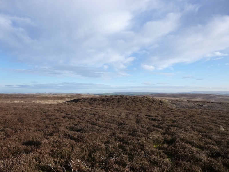
Rawland Howe is sited on the south side of the east-west ridge which links
Danby Beacon and Lealholm Rigg and which thus forms Lealholm Moor. It is a
large round barrow 16m in diameter standing up to 1.5m high. On the south side
of the centre there is a 1m deep hollow, 3m across at its base and 5m in
diameter at its top, left by an antiquarian excavation, the spoil from which
now forms a lobe on the south side of the mound. This lobe includes two large
stones both 1.5m across and at least 0.4m thick.
MAP EXTRACT
The site of the monument is shown on the attached map extract.
It includes a 2 metre boundary around the archaeological features,
considered to be essential for the monument's support and preservation.
Source: Historic England
Bowl barrows, the most numerous form of round barrow, are funerary monuments
dating from the Late Neolithic period to the Late Bronze Age, with most
examples belonging to the period 2400-1500 BC. They were constructed as
earthen or rubble mounds, sometimes ditched, which covered single or multiple
burials. They occur either in isolation or grouped as cemeteries and often
acted as a focus for burials in later periods. Often superficially similar,
although differing widely in size, they exhibit regional variations in form
and a diversity of burial practices. There are over 10,000 surviving bowl
barrows recorded nationally (many more have already been destroyed), occurring
across most of lowland Britain. Often occupying prominent locations, they are
a major historic element in the modern landscape and their considerable
variation of form and longevity as a monument type provide important
information on the diversity of beliefs and social organisations amongst early
prehistoric communities. They are particularly representative of their period
and a substantial proportion of surviving examples are considered worthy of
protection.
Excavations of round barrows in the region have shown that they demonstrate a
very wide range of burial rites from simple scatters of cremated material to
coffin inhumations and cremations contained in urns, typically dating to the
Bronze Age. A common factor is that barrows were normally used for more than
one burial and that the primary burial was frequently on or below the original
ground surface, often with secondary burials located within the body of the
mound. The majority of round barrows in the region were dug into by 19th
century antiquarians in search of burials and artefacts, leaving behind a
central depression as evidence of their work. However, excavations in the
latter half of the 20th century have shown that round barrows typically
contain archaeological information that survives earlier digging. Sometimes a
secondary burial was mistaken for the primary burial which was usually the
goal of the antiquarian. Even when the primary burial has been excavated,
further secondary burials often survive in the undisturbed surrounding part of
the mound. Additional valuable information about the mound's construction and
the local environment at the time will also survive antiquarian excavation.
Excavation has also shown that shallow ditches immediately encircling the
mounds are common, normally surviving as infilled features rather than as
earthworks. The infill of these ditches will also contain valuable information
about changes in the local environment from the Bronze Age onwards. Although
Rawland Howe has been disturbed by unrecorded excavation, over 75% of the
total volume of the original mound is considered to survive undisturbed, and
the monument is thus considered to be of national importance.
Source: Historic England
Books and journals
Smith, M J B, Excavated Bronze Age Burial Mounds of Durham and N' land., (1994)
Source: Historic England
Other nearby scheduled monuments