Approximate Location Map
Large Map »
This site is entirely user-supported. See how you can help.
Latitude: 54.5107 / 54°30'38"N
Longitude: -0.6762 / 0°40'34"W
OS Eastings: 485805.910401
OS Northings: 513630.345939
OS Grid: NZ858136
Mapcode National: GBR RJQ8.DT
Mapcode Global: WHG9Q.LW6C
Entry Name: Alum quarries and works 800m north of Sandsend Bridge
Scheduled Date: 29 April 1998
Source: Historic England
Source ID: 1018139
English Heritage Legacy ID: 29539
County: North Yorkshire
Civil Parish: Lythe
Traditional County: Yorkshire
Lieutenancy Area (Ceremonial County): North Yorkshire
Church of England Parish: Lythe with Sandsend
Church of England Diocese: York
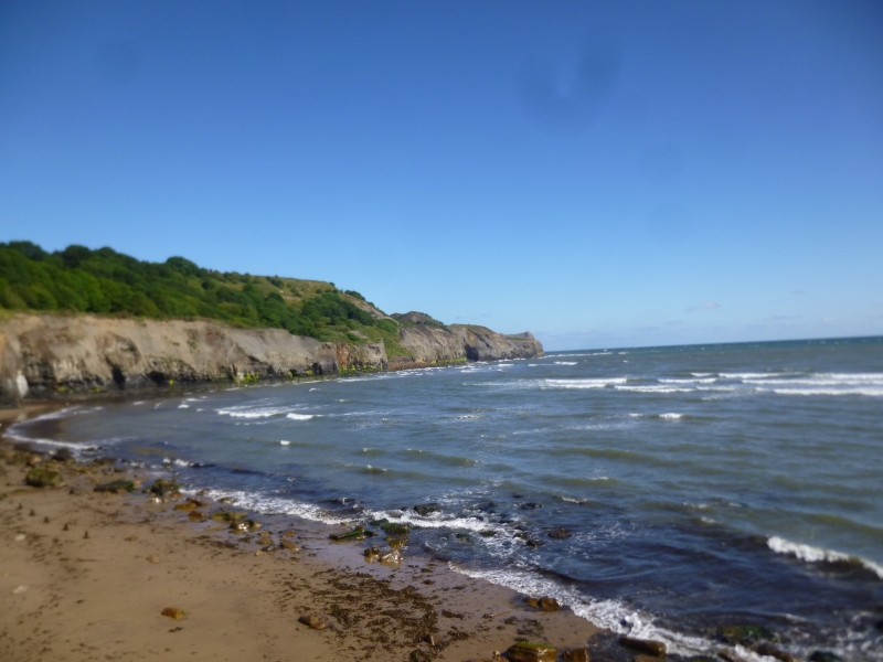
The monument includes remains of the alum quarries and associated features on
the coastal cliffs north of Sandsend. As well as the quarries, the monument
also includes structures used for initial processing and transport of the
alum. There are three discrete quarries within the monument, extending
northwards along the coast for 1km. The earliest quarry, which was working
from 1733, was the closest to Sandsend at Gaytrees. The other two, at Ness End
and Deep Grove, were excavated later as the extraction progressed along the
coast.
The quarries were cut into the east and north east-facing coastal cliffs where
alum bearing shales were exposed. Once the cliffs were cut back, processing of
the alum was carried out on the enlarging quarry floors. The first stage of
processing was calcination, remains of which survive as areas of burnt shale,
particularly on the sea edge of the central quarry. The next stage was
steeping which occurred in stone lined pits, some of which survive throughout
the quarry floor. A mid-19th century map shows steeping pits located in the
Deep Grove quarry. In the later use of the site the raw liquor thus produced
was stored and then sent to the nearby alum house by timber channels known as
liquor troughs, part of which survive within a stone tunnel. Remains of other
structures such as workshops, offices, stores and a laboratory survive on the
quarry floor. Remains of other structures are thought to survive below ground
level.
At the the northern quarry, Deep Grove, cement stone was also extracted from
mines and processed at a mill south of Sandsend. Cement stone was mined from
1811 to 1933 and overlapped the last 50 or so years of alum production.
A now disused railway line was built through the length of the monument after
the quarries went out of use. This was the Middlesborough to Whitby line which
was completed in 1883 and closed in 1958. Embankments, cuttings and supporting
walls associated with the railway still survive within the monument.
A number of features are excluded from the scheduling; these are the surface
of the old railway line and the trail markers; although the ground beneath
these features is included.
MAP EXTRACT
The site of the monument is shown on the attached map extract.
Source: Historic England
Alum is a chemical used principally in the textile industry for fixing dyes.
It is not found in a natural state in Britain but can be manufactured from
some types of shale. During the medieval period in Britain alum was imported,
mostly from Italy. Domestic production began in the north of England in the
early 17th century. The industry flourished in the north for 200 years until
the mid-19th century when it was overtaken by new techniques using shale from
coal mining, whilst after 1880 aluminium sulphate replaced alum for most
industrial purposes. The last English aluminium works (at Goole) closed in
1950. Approximately 50 alum sites have been identified in England. Most were
along the Cleveland and Yorkshire coast. Other early sites are known on the
south coast, particularly in Dorset and Hampshire.
Alum works comprise two main monument types: the quarry where extraction and
initial processing took place, and the alum house where final processing took
place. Alum shale was extracted from quarries sited on steep inland hillsides
or coastal cliffs. Initial processing on the quarry floor consisted of
calcination by burning shale in clamps, and the production in settling pits of
alum liquor. The liquor was transported to processing works in sealed casks or
through wooden channels known as liquor troughs. Larger quarries possessed
inclines and haulage gear and sometimes harbour facilities. Stores, workshops
and laboratories can also survive. Evidence of secondary industries such as
epsom salts and iron silicates production is also preserved at alum works.
The alum industry was the first chemical industry in Britain. Its quarries and
works illustrate the early stages of the industry and the technological
advances through the period known as the Industrial Revolution. The alum
industry also offers important information about wider changes in social and
economic conditions during this period. The large scale of the industry's
workings also mean that its remains are today a major component of coastal
landscapes. A sample of the better preserved sites, illustrating the regional,
chronological and technological range of this class of monument, is considered
to merit protection.
The alum site at Sandsend preserves important evidence of the quarrying and
processing activities. In addition to the 19th century workings, remains of
the early industry and its development will be preserved. The site offers
important scope for the study of the development of the alum industry.
Source: Historic England
Books and journals
Sandsend Trail, (1996)
Source: Historic England
Other nearby scheduled monuments