Approximate Location Map
Large Map »
This site is entirely user-supported. See how you can help.
Latitude: 51.6352 / 51°38'6"N
Longitude: -3.1249 / 3°7'29"W
OS Eastings: 322243
OS Northings: 193536
OS Grid: ST222935
Mapcode National: GBR J0.82PX
Mapcode Global: VH6DN.S5B8
Entry Name: Former Dam of Cwmcarn Canal Reservoir
Scheduled Date: 19 December 1996
Source: Cadw
Source ID: 3493
Cadw Legacy ID: MM259
Schedule Class: Water Supply and Drainage
Category: Dam
Period: Post Medieval/Modern
County: Caerphilly (Caerffili)
Community: Abercarn
Built-Up Area: Abercarn
Traditional County: Monmouthshire
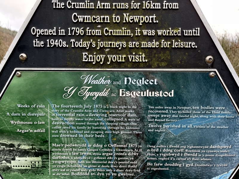
The monument consists of a dam, a barrier of concrete or earth built across a river to create a reservoir of water for industrial usage, dating to the 18th century. The Cwmcarn canal reservoir was built in around 1792 to provide water for the Monmouthshire Canal's Crumlin Arm. The earth dam was 128m long and 10.7m high. The dam burst catastrophically on 14 July 1875, resulting in devastation of the valley below and the loss of 13 lives.
The monument is of national importance for its potential to enhance our knowledge of 18th canal dam with well-preserved remains visible in section, and as the site of a major engineering disaster which informed future practice. It retains significant archaeological potential, with a strong probability of the presence of associated archaeological features and deposits. The structure itself may be expected to contain archaeological information concerning chronology and building techniques. A dam may be part of a larger cluster of monuments and their importance can further enhanced by their group value.
The scheduled area comprises the remains described and areas around them within which related evidence may be expected to survive.
Source: Cadw
Other nearby scheduled monuments