Approximate Location Map
Large Map »
This site is entirely user-supported. See how you can help.
Latitude: 51.6043 / 51°36'15"N
Longitude: -3.1249 / 3°7'29"W
OS Eastings: 322190
OS Northings: 190091
OS Grid: ST221900
Mapcode National: GBR J0.B2PN
Mapcode Global: VH6DN.SYB1
Entry Name: House Platforms to W of Mynydd Machen
Scheduled Date: 12 February 2008
Source: Cadw
Source ID: 1096
Cadw Legacy ID: MM337
Schedule Class: Agriculture and Subsistence
Category: House platform
Period: Medieval
County: Caerphilly (Caerffili)
Community: Crosskeys
Traditional County: Monmouthshire
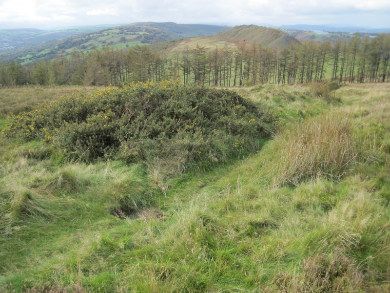
The monument comprises the remains of two house platforms, probably dating to the medieval or post-medieval periods and situated immediately adjacent to each other in open moorland on the sheltered W-facing upper slopes of Mynydd Machen. The larger, northernmost platform is subrectangular on plan and measures 16.5m from E to W by 9m transversely. It is terraced out on its W end, rising above the slope to a height of about 1m - and is terraced into the slope on its E end to a depth of about 1m. The southernmost platform is also subrectangular on plan and measures 12m from E to W by 6m transversely. It is terraced out on its W end, rising above the slope to a height of about 1m - and is terraced into the slope on its E end to a depth of about 1m.
The settlement presumably represents the remains of seasonal hafotai, the platforms once boasting buildings associated with summer grazing.
The monument is of national importance for its potential to enhance our knowledge of medieval and post medieval land use, settlement and economy. It is a relatively well preserved example of an upland settlement and retains great archaeological potential to enhance our knowledge of medieval and post medieval stock rearing practices in the upland zone, whether as permanent settlement, regular transhumance (such as the hafod system of summer pasture), or intermittent opportunistic expansion.
The area scheduled comprises the remains described and an area around them within which related evidence may be expected to survive. It is rectangular and measures up to 32m from NNE to SSW by up to 26m transversely.
Source: Cadw
Other nearby scheduled monuments