Approximate Location Map
Large Map »
This site is entirely user-supported. See how you can help.
Latitude: 54.3208 / 54°19'14"N
Longitude: -0.6479 / 0°38'52"W
OS Eastings: 488046.322635
OS Northings: 492533.565652
OS Grid: SE880925
Mapcode National: GBR RLXG.JW
Mapcode Global: WHGBQ.0NSG
Entry Name: Thompson's Rigg cairnfield, including a platform cairn, round burial cairns, hollow ways, a standing stone, associated round barrows and a ring cairn
Scheduled Date: 19 January 1968
Last Amended: 24 November 2000
Source: Historic England
Source ID: 1019629
English Heritage Legacy ID: 34547
County: North Yorkshire
Civil Parish: Allerston
Traditional County: Yorkshire
Lieutenancy Area (Ceremonial County): North Yorkshire
Church of England Parish: Allerston St John
Church of England Diocese: York
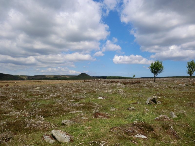
The monument includes a cairnfield situated across the southern end of the
ridge between Grain Slack and Crosscliff Beck, at the foot of the northern
scarp edge of the Tabular Hills. Included within the cairnfield there are two
round burial cairns, a platform cairn, three parallel hollow ways and a
standing stone. Also included are four round barrows, a ring cairn and a
cross-ridge boundary to the north of the cairnfield and associated with it.
The cairnfield consists of at least 133 well-defined cairns distributed on
gentle south and south east facing slopes, largely between the 160m and 180m
contours. They are predominantly in three concentrations, one at the northern
end of the cairnfield and two, one on either side of the ridge, at the
southern end. The cairns are sub-circular mounds constructed from medium-sized
stones and small boulders, although there are one or two which are more
elongated in shape. Some are built around large erratic boulders. Most are
between 3m and 5m in diameter, although there are a few smaller and larger.
They stand between 0.3m to 0.6m high. A few cairns have been robbed for stone
over the years and are less than 0.3m high. The majority are field clearance
cairns which are the result of clearing the ground to improve it for
agriculture, but some of the larger cairns were also used as burial mounds.
Interspersed between the cairns, especially within the southern two
concentrations, there are stretches of walling and field banks, totalling at
least 800m in length. These vary from lines of tumbled stone to banks of earth
and stone which are 1.5m-2m wide and up to 0.5m high. The longest is 70m in
length. These are interpreted as part of the field systems which were in use
with the clearance cairns.
In a prominent ridge-top position between the northern and southern cairn
concentrations there is a platform cairn (NGR SE88269262). This has a flat-
topped earth and stone mound which is sub-circular and measures 13m in
diameter. A large boulder is incorporated into the centre of the mound. On top
of the mound around its perimeter there is a well-defined bank of stone rubble
which is up to 3m wide and stands up to 0.6m high above the surrounding ground
surface. The southern cairn concentration on the east side of the ridge
includes the two round burial cairns, hollow ways and a standing stone. The
round burial cairns are at the northern edge of the cairn concentration. The
more northerly cairn measures 9m in diameter and the second measures 8m in
diameter. Both have stony mounds which stand up to 0.7m high. In the centre of
each there is a hollow from part excavation in the past. The spoil from this
excavation lies in an irregular heap on the north west side of the more
northerly cairn. The standing stone is situated towards the southern edge of
this cairn concentration (NGR SE88309221). It measures 0.3-0.9m by 0.4m in
section and stands 0.9m high. The three hollow ways are parallel and represent
successive use of the same route, which is considered to be later than the
cairnfield. One route passes to the immediate south of the southern burial
cairn. They run in a south west to north east direction down the steeper slope
on the east side of the ridge, towards Grain Beck. The hollow ways are visible
as rounded hollows 1m-2m wide and between 0.4m and 1.5m deep.
The four round barrows lie to the immediate north of the cairnfield, in a
prominent position at the top of the steeper slope down to the valley on the
east side of the ridge. One barrow is situated at the northern limit of the
cairnfield. This has an earth and stone mound which is 10m in diameter and
stands up to 0.6m high. The centre of the mound has been hollowed out by
partial excavation in the past. At the north west side three large boulders
are visible around the inner edge of the hollowed interior of the mound. These
would have formed an interior kerb to define and support the mound. The other
three barrows are clustered together about 65m to the north west. These
barrows have earth and stone mounds which have hollows and trenches across the
centre from partial excavation in the past. The largest mound is 10m in
diameter and stands up to 0.4m high. The second mound lies to the north west,
measures 8m in diameter and stands up to 0.5m high. The third mound lies to
the south west, measures 7m in diameter and stands up to 0.4m high.
North of the barrow group and running south west to north east across the
ridge there is a boundary. This is visible as an intermittent line of
orthostats (boulders set on end vertically in the ground) and tumbled stones
and boulders. In places, particularly on the east side of the ridge, a bank of
earth and stone has been constructed around the stones. This is up to 2m wide
and up to 0.5m high with a ditch on the north west side, up to 2m wide and
0.3m deep. Although this boundary forms part of the post-medieval field
boundary system in the area, it is considered to incorporate elements of an
earlier construction which had origins in the prehistoric period, contemporary
with the cairnfield.
The ring cairn is situated on the south eastern side of the cross-ridge
boundary on the eastern side of the ridge (NGR SE92919299). This has an
annular bank of earth and stone which has an external diameter of 10m. The
bank is constructed of earth and stone and is 2m wide and 0.25m high. Within
the central area there is a large boulder.
The monument is situated in an area where there are many prehistoric
monuments, including further cairnfields, burials and ritual sites.
The field boundary fences and walls on the east, south and west sides of the
monument are not included in the scheduling. The metalled surface of the farm
track which runs SSE to NNW through the monument is excluded from the
scheduling, although the ground beneath it is included.
MAP EXTRACT
The site of the monument is shown on the attached map extract.
Source: Historic England
Cairnfields are concentrations of cairns sited in close proximity to one
another. They often consist largely of clearance cairns, built with stone
cleared from the surrounding landsurface to improve its use for agriculture,
and on occasion their distribution pattern can be seen to define field plots.
However, funerary cairns are also frequently incorporated, although without
excavation it may be impossible to determine which cairns contain burials.
Clearance cairns were constructed from the Neolithic period (from c.3400 BC),
although the majority of examples appear to be the result of field clearance
which began during the earlier Bronze Age and continued into the later Bronze
Age (2000-700 BC). The considerable longevity and variation in the size,
content and associations of cairnfields provide important information on the
development of land use and agricultural practices. Cairnfields also retain
information on the diversity of beliefs and social organisation during the
prehistoric period.
Round barrows and round cairns,their stone equivalents found in upland areas,
are funerary monuments dating from the Late Neolithic period to the Late
Bronze Age, with most examples belonging to the period 2400-1500 BC. They were
constructed as earthen or rubble mounds, sometimes ditched, which covered
single or multiple burials. They occur either in isolation or grouped as
cemeteries and often acted as a focus for burials in later periods. Often
superficially similar, although differing widely in size, they exhibit
regional variations in form and a diversity of burial practices. There are
over 10,000 surviving examples recorded nationally (many more have already
been destroyed), occurring across most of Britain. Platform barrows and cairns
are the rarest of the recognised types of round barrow, with fewer than 50
examples recorded nationally. They occur widely across southern England with a
marked concentration in East and West Sussex and can occur either in barrow
cemeteries (closely-spaced groups of barrows) or singly. This example from the
North Yorkshire Moors lies well outside this main distribution and is thus
especially rare and unusual. They were constructed as low, flat-topped mounds
of earth, often surrounded by a shallow ditch and occasionally crossed by an
entrance causeway. None of the known examples stands higher than 1m above
ground level, and most are considerably lower than this. Due to their
comparative visual insignificance when compared to the larger types of round
barrow, few were explored by 19th century antiquarians. As a result, few
platform barrows are disturbed by excavation and consequently they remain a
poorly understood class of monument. Their importance lies in their potential
for illustrating the diversity of beliefs and burial practices in the Bronze
Age and, due to their extreme rarity and considerable fragility, all
identified platform barrows would normally be considered to be of national
importance.
Often occupying prominent locations, round barrows and round cairns are a
major historic element in the modern landscape and their considerable
variation of form and longevity as a monument type provide important
information on the diversity of beliefs and social organisation amongst early
prehistoric communities. They are particularly representative of their period
and a substantial proportion of surviving examples are considered worthy of
protection.
Standing stones are prehistoric ritual or ceremonial monuments with dates
ranging from the Late Neolithic to the end of the Bronze Age for the few
excavated examples. They comprise single or paired upright orthostatic slabs,
ranging from under 1m to over 6m high where still erect. They are often
conspicuously sited and close to other contemporary monument classes. They can
be accompanied by various features: many occur in or on the edges of round
barrows, and where excavated, associated sub surface features have included
stone cists, stone settings, and various pits and hollows filled in with earth
containing human bone, cremations, charcoal, flints and pottery. Similar
deposits have been found in excavated sockets for standing stones, which range
considerably in depth. Standing stones may have functioned as markers for
routeways, territories, graves or meeting points, but their accompanying
features show that they also had a ritual function and that they form one of
several ritual monument classes of their period which often contain deposits
of cremation and domestic debris as an integral part. No national survey of
standing stones has been undertaken, and estimates range from 50 to 250 extant
examples, widely distributed throughout England but with concentrations in
Cornwall, the North York Moors, Cumbria, Derbyshire and the Cotswolds.
Standing stones are important as nationally rare monuments, with a high
longevity and demonstrating the diversity of ritual practices in the Late
Neolithic and Bronze Age.
A ring cairn is a prehistoric ritual monument comprising a circular bank of
stones surrounding a hollow central area. The bank may be kerbed on the
inside, and sometimes on the outside as well, with small uprights or laid
boulders. Ring cairns are found mainly in upland areas of England and are
interpreted as ritual monuments of early and middle Bronze Age date. The exact
nature of the rituals concerned is not fully understood, but excavation has
revealed pits, some containing burials and others containing charcoal and
pottery, taken to indicate feasting activities associated with the burial
rituals. Ring cairns occasionally lie within round barrow cemeteries and in
northern England they are often associated with cairnfields.
The Thompson's Rigg cairnfield is in a very good state of preservation.
Significant information about its form and development will survive. Evidence
for the nature of Bronze Age agriculture will be preserved in the old ground
surface between the cairns and evidence for earlier land use will be preserved
beneath the cairns and field banks. The cairnfield is embedded in peat
deposits with some waterlogged areas which will preserve a wider range of
environmental evidence than can be found on drier sites.
Despite disturbance, evidence for the date and form of the round barrows and
round burial cairns and the burials placed within them will be preserved.
Significant information about the form of construction and the nature of the
rituals associated with the use of the ring cairn and platform cairn will
survive. The platform cairn is the only example of this monuments type to have
been identified in the area of the North York Moors.
The relationships between the cairnfield, the round barrows, round burial
cairns, ring cairn, platform cairn and standing stone will provide evidence
for the diversity and development of social and ritual practice in the
prehistoric period and will offer important scope for the study of the
association between agricultural and ritual activity.
Source: Historic England
Books and journals
Harding, A F, Ostoja-Zagorski, J, 'Archaeological Journal' in Prehistoric and Early Medieval Activity on Danby Rigg, N Yorks, , Vol. 151, (1994), 16-97
Hayes, R H, Rutter, J G, 'Transactions of the Scarborough Archaeological and Hist Soc' in The survey of two cairn groups on the North York Moors, , Vol. 3, 18, (1975), 17-19
Spratt, D A , 'Prehistoric and Roman Archaeology in North East Yorkshire' in Prehistoric and Roman Archaeology of North East Yorkshire, , Vol. 87, (1993)
Spratt, D A, 'Yorkshire Archaeological Journal' in Orthostatic Field Walls on the North York Moors, , Vol. 60, (1988), 149-157
Vyner, B E, 'CBA Research Report 101: Moorland Monuments' in The Brides Of Place: Cross-Ridge Boundaries Reviewed, , Vol. 101, (1995), 16-30
Other
Pacitto, A L, AM107, (1982)
Title: 1st Edition 6" Ordnance Survey sheet 76
Source Date: 1854
Author:
Publisher:
Surveyor:
Title: 2nd Edition 25" Ordnance Survey sheet 76/2
Source Date: 1912
Author:
Publisher:
Surveyor:
Title: 2nd Edition 25" Ordnance Survey sheet 76/2
Source Date: 1912
Author:
Publisher:
Surveyor:
Source: Historic England
Other nearby scheduled monuments