Approximate Location Map
Large Map »
This site is entirely user-supported. See how you can help.
Latitude: 54.497 / 54°29'49"N
Longitude: -0.8769 / 0°52'36"W
OS Eastings: 472837.978247
OS Northings: 511874.32634
OS Grid: NZ728118
Mapcode National: GBR QJ9F.YQ
Mapcode Global: WHF8P.H7ND
Entry Name: Three round barrows on Waupley Moor, 775m south west of Clay Hall Farm
Scheduled Date: 28 June 1971
Last Amended: 19 March 1999
Source: Historic England
Source ID: 1018799
English Heritage Legacy ID: 31993
County: Redcar and Cleveland
Civil Parish: Loftus
Traditional County: Yorkshire
Lieutenancy Area (Ceremonial County): North Yorkshire
Church of England Parish: Loftus-in-Cleveland St Leonard
Church of England Diocese: York
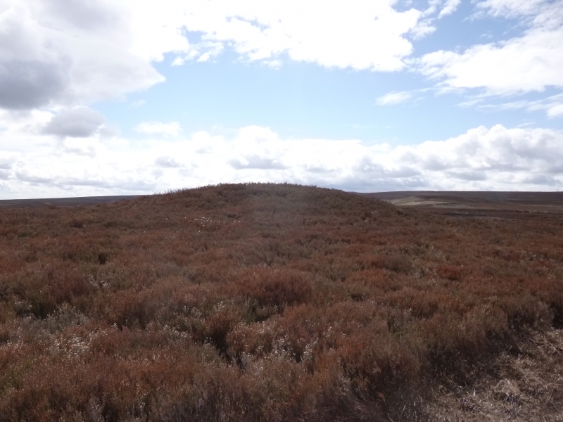
The monument includes three adjacent round barrows situated on a slight ridge.
The barrows are aligned south east to north west, with the barrow to the south
east offset by 20m to the south west. This most south easterly barrow is the
most prominent and has an earth and stone mound standing 1.5m high. It is
round in shape and 18m in diameter.
In the centre of the mound there is a hollow caused by the partial excavation
of the barrow in 1863 by J C Atkinson, which uncovered a cist burial. This was
found to consist of eight stone slabs in a hexagonal arrangment, set within a
platform of large stones and containing pieces of a cremation urn. The other
two barrows lie on slightly lower ground to the north west. Both have a well
defined flat-topped earthen mound and each was originally surrounded by a
ditch up to 3m wide which has become filled in over the years and is no longer
visible as an earthwork. The south eastern barrow stands 0.6m high and is 17m
in diameter. The north western barrow stands 0.4m high and is 20m in diameter.
Both the barrows are intact.
The barrows lie in an area rich in prehistoric monuments, including further
barrows, field systems and clearance cairns.
MAP EXTRACT
The site of the monument is shown on the attached map extract.
It includes a 2 metre boundary around the archaeological features,
considered to be essential for the monument's support and preservation.
Source: Historic England
Bowl barrows, the most numerous form of round barrow, are funerary monuments
dating from the Late Neolithic period to the Late Bronze Age, with most
examples belonging to the period 2400-1500 BC. They were constructed as
earthen or rubble mounds, sometimes ditched, which covered single or multiple
burials. They occur either in isolation or grouped as cemeteries and often
acted as a focus for burials in later periods. Often superficially similar,
although differing widely in size, they exhibit regional variations in form
and a diversity of burial practices. There are over 10,000 surviving bowl
barrows recorded nationally (many more have already been destroyed), occurring
across most of lowland Britain. Often occupying prominent locations, they are
a major historic element in the modern landscape and their considerable
variation of form and longevity as a monument type provide important
information on the diversity of beliefs and social organisations amongst early
prehistoric communities. They are particularly representative of their period
and a substantial proportion of surviving examples are considered worthy of
protection.
Despite limited disturbance to the south eastern barrow the three barrows 775m
south west of Clay Hall Farm survive well. Significant information about the
original form of the barrow and the burials placed within it will be
preserved. Evidence for earlier land use will also survive beneath the barrow
mound. Unlike many barrows in this area the other two within this group have
not been excavated and survive in a good state of preservation. The
archaeological deposits survive intact and evidence for the date and original
form of the barrows and the burials placed within them will be preserved.
Evidence for earlier land use will survive beneath the barrow mounds and
within the ditches.
Together with other barrows in the area, they are thought to represent a
territorial marker. Similar groups of monuments are also known across the west
and central areas of the North York Moors, providing important insight into
burial practice. Such groupings of monuments offer important scope for the
study of land division for social and ritual purposes in different
geographical areas during the prehistoric period.
Source: Historic England
Books and journals
Crawford, G M, Bronze Age Burial Mounds in Cleveland, (1980)
Smith, M J B, Excavated Bronze Age Burial Mounds of Durham and N' land., (1994)
Spratt, D A , 'Prehistoric and Roman Archaeology in North East Yorkshire' in Prehistoric and Roman Archaeology of North East Yorkshire, , Vol. 87, (1993)
Other
C 7211/3,
Source: Historic England
Other nearby scheduled monuments