Approximate Location Map
Large Map »
This site is entirely user-supported. See how you can help.
Latitude: 54.4334 / 54°26'0"N
Longitude: -0.9482 / 0°56'53"W
OS Eastings: 468324.985344
OS Northings: 504733.025427
OS Grid: NZ683047
Mapcode National: GBR PKT5.JH
Mapcode Global: WHF8V.DTQM
Entry Name: Northern of two cross dykes on Castleton Rigg, 600m north west of Stormy Hall
Scheduled Date: 25 October 1968
Last Amended: 21 January 1999
Source: Historic England
Source ID: 1018771
English Heritage Legacy ID: 30199
County: North Yorkshire
Civil Parish: Danby
Traditional County: Yorkshire
Lieutenancy Area (Ceremonial County): North Yorkshire
Church of England Parish: Danby with Castleton and Commondale
Church of England Diocese: York
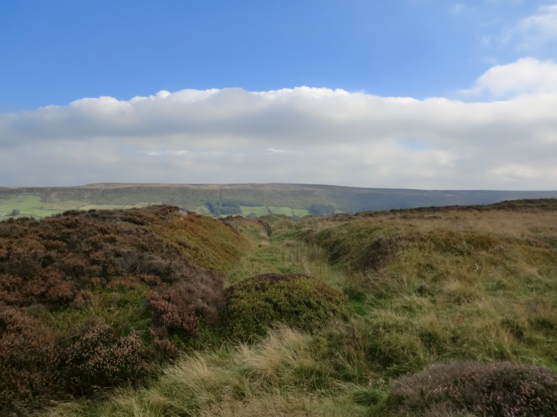
The monument includes the buried and earthwork remains of a prehistoric
boundary, a cross dyke, which runs across the spine of Castleton Rigg. It is
in two areas of protection. A second cross dyke, High Stone Dike which is the
subject of a separate scheduling, lies 750m to the south. The cross dyke is
just uphill and south of the lowest point of a saddle across the rigg, and is
sited on sloping ground.
The dyke is formed by a bank and ditch which runs in a broadly straight line
ESE to WNW with a slight curve to point due west at its western end. The bank
is not symmetrical in cross section, but is steeper on the side facing the
ditch which lies on the uphill, southern side of the bank. The eastern end of
the dyke has been truncated by a quarry and cut through by the road which runs
up the spine of the rigg. The section of dyke that survives to the east of the
road is 9m long. It has a 5m wide bank which stands 1m above the base of a 2m
wide, 0.8m deep ditch. To the west of the road the dyke continues, cut through
in places by old trackways until about 15m west of the road which runs down
into Westerdale. Here there is an approximately 20m wide gap in the bank and
ditch which is considered to be an original feature. This area, including the
part under the road, is considered to be archaeologically sensitive and is
thus included in the scheduling. Beyond the road the bank and ditch resumes as
a bank typically 5m-6m wide standing 1.3m above the base of a 4m wide, 1m deep
ditch. At its western end, where the dyke curves westwards, the bank and ditch
fade out into a slight terrace in the hillside which in turn fades out.
Excluded from the scheduling is the surface of the road that runs across the
western part of the dyke, although the ground beneath is included.
MAP EXTRACT
The site of the monument is shown on the attached map extract.
It includes a 2 metre boundary around the archaeological features,
considered to be essential for the monument's support and preservation.
Source: Historic England
Cross dykes are substantial linear earthworks typically between 0.2km and 1km
long and comprising one or more ditches arranged beside and parallel to one or
more banks. They generally occur in upland situations, running across ridges
and spurs. They are recognised as earthworks or as cropmarks on aerial
photographs, or as combinations of both. The evidence of excavation and
analogy with associated monuments demonstrates that their construction spans
the millennium from the Middle Bronze Age, although they may have been re-used
later. Current information favours the view that they were used as territorial
boundary markers, probably demarcating land allotment within communities,
although they may also have been used as trackways, cattle droveways or
defensive earthworks. Cross dykes are one of the few monument types which
illustrate how land was divided up in the prehistoric period. They are of
considerable importance for any analysis of settlement and land use in the
Bronze Age. Very few have survived to the present day and hence all well-
preserved examples are considered to be of national importance.
The northern of the two cross dykes on Castleton Rigg is a relatively well
preserved earthwork example of a Bronze Age boundary feature. The bank will
overlie and preserve prehistoric soil layers and the ditch will contain a
series of infilled sediments which will provide valuable information about the
local environment in the Bronze Age. Its importance is enhanced by survival of
a second cross dyke, High Stone Dike, 750m to the south.
Source: Historic England
Books and journals
Harding, A F, Ostoja-Zagorski, J, 'Archaeological Journal' in Prehistoric and Early Medieval Activity on Danby Rigg, N Yorks, , Vol. 151, (1994), 73-82
Vyner, B E, 'CBA Research Report 101: Moorland Monuments' in The Brides Of Place: Cross-Ridge Boundaries Reviewed, (1995), 16-30
Source: Historic England
Other nearby scheduled monuments