Approximate Location Map
Large Map »
This site is entirely user-supported. See how you can help.
Latitude: 54.5084 / 54°30'30"N
Longitude: -1.0901 / 1°5'24"W
OS Eastings: 459010.001257
OS Northings: 512946.497754
OS Grid: NZ590129
Mapcode National: GBR NJT9.SM
Mapcode Global: WHF8D.7Y45
Entry Name: Round cairn on Pinchinthorpe Moor, 530m south of Hanging Stone
Scheduled Date: 25 November 1969
Last Amended: 2 December 1998
Source: Historic England
Source ID: 1018662
English Heritage Legacy ID: 32009
County: Redcar and Cleveland
Civil Parish: Guisborough
Traditional County: Yorkshire
Lieutenancy Area (Ceremonial County): North Yorkshire
Church of England Parish: Guisborough St Nicholas
Church of England Diocese: York
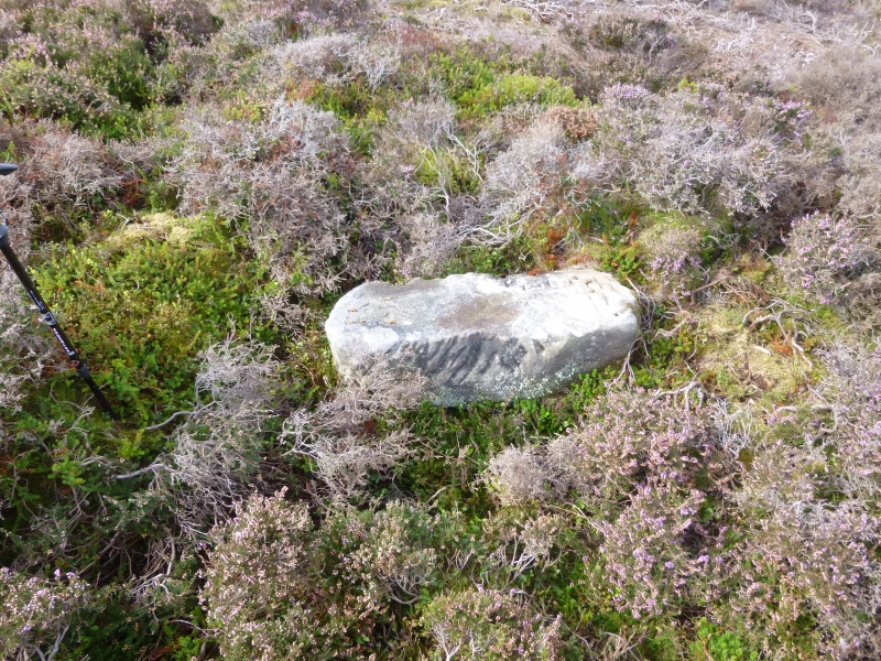
The monument includes a round cairn situated on level moorland at the north
edge of the North York Moors. The round cairn has a stone mound 7m in diameter
and standing up to 0.6m high. In the centre of the mound there is a hollow
caused by past excavations. Within the hollow there is a, Grade II listed,
recumbent boundary stone bearing the legend TKS 1815.
The cairn lies in an area rich in prehistoric monuments, including further
burial monuments, field systems and clearance cairns.
MAP EXTRACT
The site of the monument is shown on the attached map extract.
It includes a 2 metre boundary around the archaeological features,
considered to be essential for the monument's support and preservation.
Source: Historic England
Round cairns are prehistoric funerary monuments dating to the Bronze Age
(c.2000-700 BC). They were constructed as stone mounds covering single or
multiple burials. These burials may be placed within the mound in stone-lined
compartments called cists. In some cases the cairn was surrounded by a ditch.
Often occupying prominent locations, cairns are a major visual element in the
modern landscape. They are a relatively common feature of the uplands and are
the stone equivalent of the earthen round barrows of the lowlands. Their
considerable variation in form and longevity as a monument type provide
important information on the diversity of beliefs and social organisation
amongst early prehistoric communities. They are particularly representative of
their period and a substantial proportion of surviving examples are considered
worthy of protection.
The importance of the cairn 530m south of Hanging Stone is enhanced by its
spatial association with a group of burial monuments along Ryston Bank to the
west as such clusters provide valuable evidence for the development of ritual
and funerary practice during the Bronze Age. It is also situated within an
area which includes other groups of burial monuments as well as field systems,
enclosures and clearance cairns. Associated groups of monuments such as these
offer important scope for the study of the distribution of prehistoric
activity across the landscape.
Source: Historic England
Books and journals
Spratt, D A , 'Prehistoric and Roman Archaeology in North East Yorkshire' in Prehistoric and Roman Archaeology of North East Yorkshire, , Vol. 87, (1993)
Source: Historic England
Other nearby scheduled monuments