Approximate Location Map
Large Map »
This site is entirely user-supported. See how you can help.
Latitude: 51.605 / 51°36'17"N
Longitude: -3.3382 / 3°20'17"W
OS Eastings: 307420
OS Northings: 190421
OS Grid: ST074904
Mapcode National: GBR HQ.B31N
Mapcode Global: VH6DK.3X2H
Entry Name: Pontypridd Bridge
Scheduled Date:
Source: Cadw
Source ID: 2230
Cadw Legacy ID: GM015
Schedule Class: Transport
Category: Bridge
Period: Medieval
County: Rhondda, Cynon, Taff (Rhondda Cynon Taf)
Community: Pontypridd
Built-Up Area: Pontypridd
Traditional County: Glamorgan
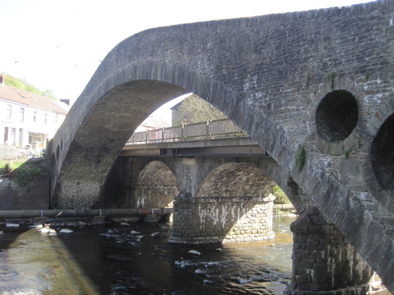
The monument consists of the remains of a bridge dating to the 18th century. Pontypridd Bridge was completed in 1756 and was the last of 4 bridges designed and built in the same place by William Edwards. The first bridge, of 3 arched bays, was begun in 1746 but was swept away two years later. The second bridge, of a single span, collapsed in 1751. Edwards solved the problem of the pressure on an unusually wide arch by piercing the spandrels. This has proved successful and together with its high arch has formed the distinct character of the bridge. For 40 years the bridge was the widest span bridge in Britain (until Sunderland Bridge of 1796) and the widest in stone until London Bridge of 1831.
A graceful high-arched bridge with a single span of 42.7m. Of rubble stone, it has stone parapets with plain copings, at the apex of which is a renewed tablet commemorating the efforts of William Edwards and the repair of bridge in 1798 by Edward David and Thomas Evan. The distinct character of the bridge is derived from the 3 circular holes pierced in the spandrels of 2.7m, 1.8m and 0.9m diameter respectively, in ascending order. The deck now has renewed concrete steps. The parapet on the south side is attached to the parapet of the adjacent Victoria Bridge.
The monument is of national importance for its potential to enhance our knowledge of post-medieval construction techniques and transportation systems. It retains significant archaeological potential, with a strong probability of the presence of associated archaeological features and deposits. The structure itself may be expected to contain archaeological information concerning chronology and building techniques.
The scheduled area comprises the remains described and areas around them within which related evidence may be expected to survive.
Source: Cadw
Other nearby scheduled monuments