Approximate Location Map
Large Map »
This site is entirely user-supported. See how you can help.
Latitude: 51.6647 / 51°39'52"N
Longitude: -3.813 / 3°48'46"W
OS Eastings: 274704
OS Northings: 197771
OS Grid: SS747977
Mapcode National: GBR H2.69MF
Mapcode Global: VH4K5.VFK5
Entry Name: Neath Roman Site
Scheduled Date:
Source: Cadw
Source ID: 2260
Cadw Legacy ID: GM215
Schedule Class: Defence
Category: Fort
Period: Roman
County: Neath Port Talbot (Castell-nedd Port Talbot)
Community: Blaenhonddan
Built-Up Area: Neath
Traditional County: Glamorgan
The monument is comprised of buried features and earthworks representing a Roman fort. The primary Roman fort network was designed and constructed by the Roman army for the purpose of military conquest and rule.
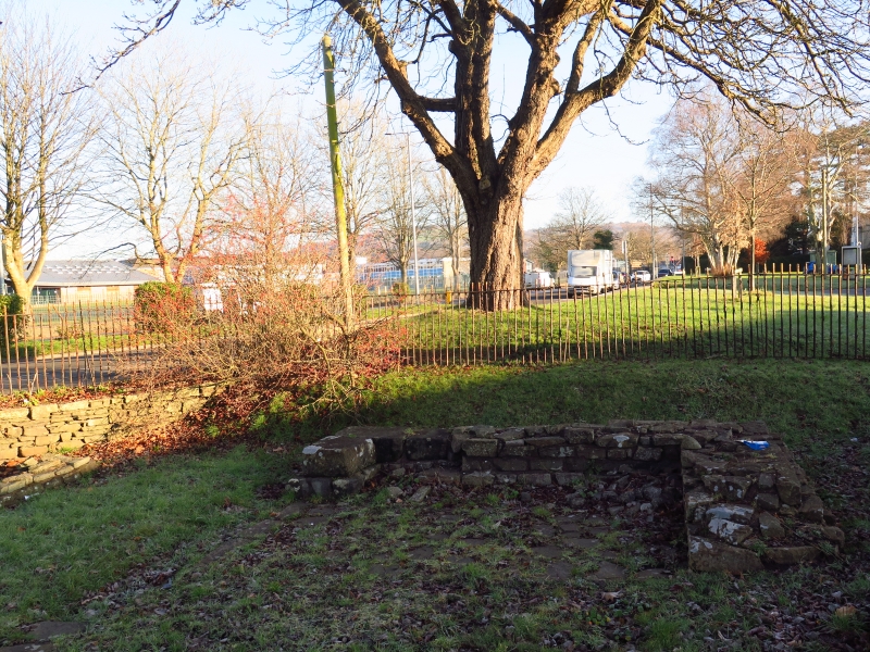
The roman fort of Nidum, now covered by modern roads, housing and playing fields, was discovered in 1949, when housing development took place in the area, and various parts have been excavated since then, revealing its extent, construction and two of its gateways. It was a medium sized (2.4ha), square auxiliary fort, situated in a strategic position on the road to Carmarthen, controlling the crossing of the river Nedd. Its history appears to be of several phases. First was a short-lived timber fort, builtin about AD 75, which was soon followed, in the early 2nd century, by an earth and clay rampart and ditch. In AD 120-5 the rampart was reconstructed in stone. Stone rampart walls have been found on the south-east, south-west and possibly the north-east sides. In the north corner part of a stone angle-tower was found. The stone footings visible in two places south of the modern road are all that remains of the south-west and south-east gateways. Of the south-west gateway, next to the main road, all that can be seen are the footings of a guard chamber at the back of the rampart on the south-east side, and a doorway in the north-west wall. The remains of the south-east gateway are more complete and reveal the typical plan of a double roadway between two square guard towers built on to the ends of the rampart. Outside the entrance is a section of ditch, which continues across it, implying a bridge of some sort, probably wooden.
The only other visible part of the fort is the north-west rampart, which can be made out as a low ridge crossing the playing fields on the other side of the modern road. No evidence was found for the internal layout of the fort. After its final construction in stone it was probably short-lived: most minor forts in the area were abandoned soon after the middle of the 2nd century.
The monument is of national importance for its potential to enhance our knowledge of Roman military organisation. The monument forms an important element within the wider context of the Roman occupation of Wales and the structures may contain well preserved archaeological evidence concerning chronology, layout and building techniques.
The scheduled area comprises the remains described and areas around them within which related evidence may be expected to survive.
Source: Cadw
Other nearby scheduled monuments