Approximate Location Map
Large Map »
This site is entirely user-supported. See how you can help.
Latitude: 51.6408 / 51°38'26"N
Longitude: -4.806 / 4°48'21"W
OS Eastings: 205935
OS Northings: 197287
OS Grid: SS059972
Mapcode National: GBR GC.CL8X
Mapcode Global: VH2PX.N03Z
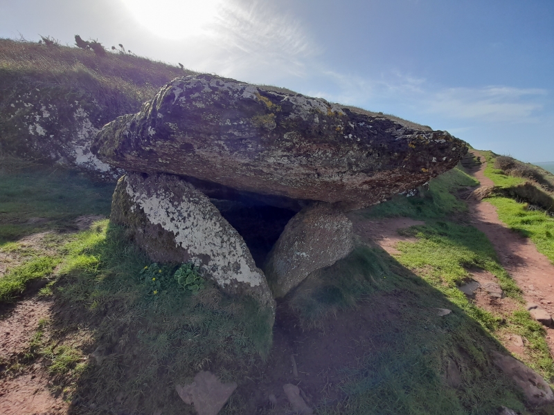
Entry Name: King's Quoit Burial Chamber
Scheduled Date:
Source: Cadw
Source ID: 355
Cadw Legacy ID: PE035
Schedule Class: Religious, Ritual and Funerary
Category: Chambered tomb
Period: Prehistoric
County: Pembrokeshire (Sir Benfro)
Community: Manorbier (Maenorbŷr)
Traditional County: Pembrokeshire
The monument comprises the remains of a chambered tomb, dating to the Neolithic period (c. 4,400 BC - 2,900 BC). Chambered tombs were built and used by local farming communities over long periods of time. There appear to be many regional traditions and variations in shape and construction.
King's Quoit” burial chamber lies on open moorland above the sea cliff to the west
Source: Cadw
Other nearby scheduled monuments