Ancient Monuments

History on the Ground

This site is entirely user-supported. See how you can help.

Pitcur,souterrain NNE of

A Scheduled Monument in Strathmore, Perth and Kinross

More Photos »
Approximate Location Map
Large Map »

If Google Street View is available, the image is from the best available vantage point looking, if possible, towards the location of the monument. Where it is not available, the satellite view is shown instead.

Coordinates

Latitude: 56.5225 / 56°31'20"N

Longitude: -3.2157 / 3°12'56"W

OS Eastings: 325302

OS Northings: 737378

OS Grid: NO253373

Mapcode National: GBR VD.10XT

Mapcode Global: WH6PW.KBX4

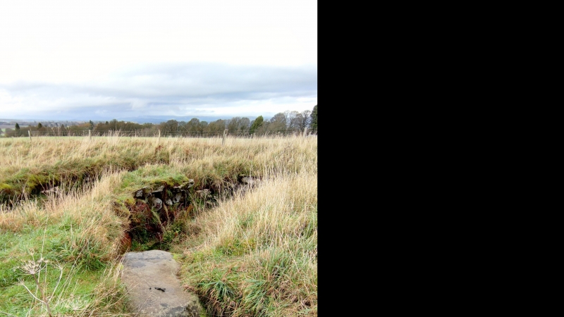
Entry Name: Pitcur,souterrain NNE of

Scheduled Date: 16 August 1957

Source: Historic Environment Scotland

Source ID: SM357

Schedule Class: Cultural

Category: Prehistoric domestic and defensive: souterrain, earth-house

Location: Kettins

County: Perth and Kinross

Electoral Ward: Strathmore

Traditional County: Angus

Sources

Bibliography
No Bibliography entries for this designation

Source: Historic Environment Scotland

Other nearby scheduled monuments

AncientMonuments.uk is an independent online resource and is not associated with any government department. All government data published here is used under licence. Please do not contact AncientMonuments.uk for any queries related to any individual ancient or schedued monument, planning permission related to scheduled monuments or the scheduling process itself.

AncientMonuments.uk is a Good Stuff website.