Approximate Location Map
Large Map »
This site is entirely user-supported. See how you can help.
Latitude: 54.3698 / 54°22'11"N
Longitude: -0.7494 / 0°44'57"W
OS Eastings: 481348.127822
OS Northings: 497861.108548
OS Grid: SE813978
Mapcode National: GBR RK6X.KB
Mapcode Global: WHF9B.GFDD
Entry Name: Cairnfield on Howl Moor 510m south of Wheeldale Lodge, including an unenclosed hut circle settlement, field system and round burial cairns
Scheduled Date: 15 April 2004
Source: Historic England
Source ID: 1021293
English Heritage Legacy ID: 35914
County: North Yorkshire
Civil Parish: Goathland
Traditional County: Yorkshire
Lieutenancy Area (Ceremonial County): North Yorkshire
Church of England Parish: Goathland St Mary
Church of England Diocese: York
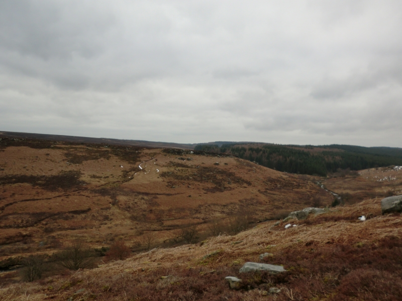
The monument includes the earthwork and buried remains of a cairnfield
which is situated on Middle Jurassic sandstone on the North York Moors. It
lies between Hunt House Crag and Howl Moor Dike, at the western edge of
Goathland Moor. Also included are an unenclosed hut circle settlement, a
regular aggregate field system, two parallel hollow ways, two round burial
cairns and a standing stone, all of which lie within or adjacent to the
cairnfield, and are associated with it.
The cairnfield consists of at least 63 cairns, distributed on a gentle
south west facing slope between the 180m and 190m contours, and on
approximately level ground above 190m. Most of the cairns are well-defined
sub-circular mounds constructed from small and medium sized stones,
although some are more elongated in shape, or are built around large
erratic boulders. They are generally 3m to 4m in diameter, with a few
varying examples, and they stand between 0.2m and 0.4m high. The majority
are field clearance cairns which are the result of clearing the ground to
prepare for agriculture, but some of the larger cairns are thought to have
been used as burial mounds. Interspersed between the cairns there are
fragments of walling and field banks, which are interpreted as part of the
field system which was in use with the clearance cairns. These are visible
as irregular lines of stone in the ground surface and stony banks which
are 1m-2m wide and 0.3m high. The field system extends to the south west
and south east beyond the main concentration of cairns, and has an
orientation along and perpendicular to the contours in an approximately
NNE to SSW direction. Some of the field boundaries are less fragmentary
here and survive as tumbled stone wall lines which include orthostats, or
earthfast stones, and as stony lynchets, which are the product of
cultivation within the small plots defined by the boundaries.
At the northern edge of the cairnfield there are two parallel hollow ways.
These are visible as rounded hollows, 3m-4m wide and up to 1m deep, which
run in a north westerly direction down the valley slope. They continue
beyond the monument, deepening as the slope increases, and would have
provided access between the cairnfield and field system and Wheeldale Beck
in the valley bottom.
The unenclosed hut circle settlement lies towards the centre of the
monument, between the main concentration of cairns and the better defined
part of the field system. The settlement is visible as a single hut
circle, defined by a penannular bank of earth and stone rubble, which is
1.5m-2m wide and stands up to 0.3m high. The interior of the circle is
slightly raised above the level of the exterior ground surface and
measures 6m in diameter. A break in the perimeter bank in the south east
sector of the circle would have been the entrance to the hut and this
opens into one of the enclosures within the field system. To the west of
the hut circle settlement there is a round burial cairn. This is the most
prominent cairn within the cairnfield and it has a stony mound measuring
7m in diameter and standing up to 0.5m high. Partial excavation in the
past has left a hollow in the centre of the mound. The second round burial
cairn is situated in a prominent position at the top of the rocky edge on
the north side of the monument. This has a stony mound which measures 8m
in diameter and stands up to 0.5m high. Partial excavation in the 19th
century uncovered a cist, consisting of vertical stone slabs set into the
ground beneath the mound. These formed a square chamber, which had sides
1.1m long. The chamber would originally have contained a burial and been
covered by a further stone slab. The northern and eastern sides of the
chamber are still visible, but the other sides have become buried by
tumbled stone at the edges of the excavation, and the covering slab has
been removed.
The standing stone is located at NGR SE81469780, to the south east of the
cairnfield and field system and on the opposite side of Howl Dike. It is a
block of sandstone which measures 0.7m by 0.3m in section and is oriented
NNE to SSW. The stone is 1.3m high, although it is leaning to the west.
During the post-medieval period, the standing stone was used as a marker
for a crossing point over the nearby stream, which was traversed by means
of a sandstone slab laid across it.
Over the years the cairnfield and field system have become embedded in
blanket peat. This has partly masked some of the earthworks, making them
less pronounced, and has buried other features which will survive between
the visible remains.
The monument is surrounded by many other remains from the prehistoric
period, which include further cairnfields as well as ritual and funerary
monuments.
MAP EXTRACT
The site of the monument is shown on the attached map extract.
Source: Historic England
Cairnfields are concentrations of cairns sited in close proximity to one
another. They often consist largely of clearance cairns, built with stone
cleared from the surrounding landsurface to improve its use for agriculture,
and on occasion their distribution pattern can be seen to define field plots.
However, funerary cairns are also frequently incorporated, although without
excavation it may be impossible to determine which cairns contain burials.
Clearance cairns were constructed from the Neolithic period (from c.3400 BC),
although the majority of examples appear to be the result of field clearance
which began during the earlier Bronze Age and continued into the later Bronze
Age (2000-700 BC). The considerable longevity and variation in the size,
content and associations of cairnfields provide important information on the
development of land use and agricultural practices. Cairnfields also retain
information on the diversity of beliefs and social organisation during the
prehistoric period.
Regular aggregate field systems date from the Bronze Age (2000-700 BC) to
the end of the fifth century AD. They usually cover areas of up to 100ha
and comprise a discrete block of fields orientated in roughly the same
direction, with the field boundaries laid out along two axes set at right
angles to one another. Individual fields generally fall within the
0.1ha-3.2ha range and can be square, rectangular, long and narrow,
triangular or polygonal in shape. The field boundaries can take various
forms (including drystone walls or reaves, orthostats, earth and rubble
banks, pit alignments, ditches, fences and lynchets) and follow straight
or sinuous courses. Component features common to most systems include
entrances and trackways, and the settlements or farmsteads from which
people utilised the fields over the years have been identified in some
cases. These are usually situated close to or within the field system.
The development of field systems is seen as a response to the competition
for land which began during the later prehistoric period. The majority are
thought to have been used mainly for crop production, evidenced by the
common occurrence of lynchets resulting from frequent ploughing, although
rotation may also have been practised in a mixed farming economy. Regular
aggregate field systems occur widely and have been recorded in south
western and south eastern England, East Anglia, Cheshire, Cumbria,
Nottinghamshire, North and South Yorkshire and Durham. They represent a
coherent economic unit often utilised for long periods of time and can
thus provide important information about developments in agricultural
practices in a particular location and broader patterns of social,
cultural and environmental change over several centuries. Those which
survive well and/or which can be positively linked to associated
settlements are considered to merit protection.
Hut circle settlements were the dwelling places of prehistoric farmers.
The hut circles take a variety of forms. Some are stone based and are
visible as low walls or banks enclosing a circular floor area. Others were
timber constructions and only the shallow groove in which the timber
uprights used in the wall construction stood can now be identified; this
may survive as a slight earthwork feature or may be visible on aerial
photographs. Some can only be identified by the artificial earthwork
platforms created as level stances for the houses. The number of houses in
a settlement varies between one and twelve. In areas where they were
constructed on hillslopes the platforms on which the houses stood are
commonly arrayed in tiers along the contour of the slope. Several
settlements have been shown to be associated with organised field plots,
the fields being defined by low stony banks or indicated by groups of
clearance cairns. Some unenclosed settlements are thought to date from the
Bronze Age, but excavation of others suggests that they were also occupied
during the Iron Age to the Romano-British period (c.700 BC-AD 400). These
settlements provide an important complement to the various types of
enclosed and defended settlements which were being constructed and used
around the same time. The longevity of use of hut circle settlements and
their relationship with other monument types provides important
information on the diversity of social organisation and farming practices
amongst prehistoric communities. They are particularly representative of
their period and a substantial proportion of surviving examples are
considered worthy of protection.
Round cairns are prehistoric funerary monuments dating to the Bronze Age
(c.2000-700 BC). They were constructed as stone mounds covering single or
multiple burials. These burials may be placed within the mound in
stone-lined compartments called cists. In some cases the cairn was
surrounded by a ditch. Often occupying prominent locations, cairns are a
major visual element in the modern landscape. They are a relatively common
feature of the uplands and are the stone equivalent of the earthen round
barrows of the lowlands. Their considerable variation in form and
longevity as a monument type provide important information on the
diversity of beliefs and social organisation amongst early prehistoric
communities. They are particularly representative of their period and a
substantial proportion of surviving examples are considered worthy of
protection.
Standing stones are prehistoric ritual or ceremonial monuments with dates
ranging from the Late Neolithic to the end of the Bronze Age for the few
excavated examples. They comprise single or paired upright orthostatic
slabs, ranging from under 1m to over 6m high where still erect. They are
often conspicuously sited and close to other contemporary monument
classes. They can be accompanied by various features: many occur in or on
the edges of round barrows, and where excavated, associated sub-surface
features have included stone cists, stone settings, and various pits and
hollows filled in with earth containing human bone, cremations, charcoal,
flints and pottery. Similar deposits have been found in excavated sockets
for standing stones, which range considerably in depth. Standing stones
may have functioned as markers for routeways, territories, graves or
meeting points, but their accompanying features show that they also had a
ritual function and that they form one of several ritual monument classes
of their period which often contain deposits of cremation and domestic
debris as an integral part. No national survey of standing stones has been
undertaken, and estimates range from 50 to 250 extant examples, widely
distributed throughout England but with concentrations in Cornwall, the
North York Moors, Cumbria, Derbyshire and the Cotswolds. Standing stones
are important as nationally rare monuments, with a high longevity and
demonstrating the diversity of ritual practices in the Late Neolithic and
Bronze Age.
The cairnfield on Howl Moor, 510m south of Wheeldale Lodge, is in an
excellent state of preservation. Significant and varied information about
the date and form of the different components will survive. Valuable
evidence for the nature of Bronze and Iron Age agriculture, the
contemporary environment and earlier land use will be preserved between
and beneath the cairns and field banks. Important evidence for the nature
and duration of the occupation will survive within the hut circle
settlement. The association with the hut circle settlement, burial cairns
and standing stone will provide evidence for the relationships between
agricultural, social and ritual practice. The relationships between
features of different date will add greatly to our understanding of the
sequence of development and change, and continuity of land use during the
prehistoric period.
The monument is situated within a landscape where there are many other
prehistoric monuments. Associations such as this contribute to our
understanding of the distribution of prehistoric activity across the
landscape.
Source: Historic England
Books and journals
Spratt, D A , 'Prehistoric and Roman Archaeology in North East Yorkshire' in Prehistoric and Roman Archaeology of North East Yorkshire, (1993)
Other
7785.0002,
Source: Historic England
Other nearby scheduled monuments