Approximate Location Map
Large Map »
This site is entirely user-supported. See how you can help.
Latitude: 54.2977 / 54°17'51"N
Longitude: -2.7774 / 2°46'38"W
OS Eastings: 349504.559539
OS Northings: 489393.834962
OS Grid: SD495893
Mapcode National: GBR 9L1R.H5
Mapcode Global: WH832.97PP
Entry Name: Part of Helsington medieval village immediately west of Briggs House Farm
Scheduled Date: 12 November 2003
Source: Historic England
Source ID: 1021146
English Heritage Legacy ID: 35019
County: Cumbria
Civil Parish: Helsington
Traditional County: Westmorland
Lieutenancy Area (Ceremonial County): Cumbria
Church of England Parish: Underbarrow with Helsington
Church of England Diocese: Carlisle
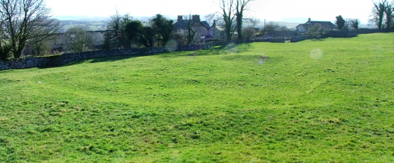
The monument includes the earthworks and buried remains of part of
Helsington medieval village located immediately west of Briggs House Farm.
Although the date of the first settlement at Helsington is unknown the
village is unlikely to have pre-dated the Norman Conquest of the region.
The site of an apparently abandoned structure is shown on the Corn Rent
Map of 1835 in the field to the west of what is now Briggs House Farm. The
village of Helsington remains in occupation today and the protected area
includes part of the village which was abandoned but is still identifiable
as having formed part of the medieval village.
In the irregularly-shaped field centred at SD49518939 there are a series
of earthworks visible both as surface features and on aerial photographs.
These include the well-defined earthworks of a two-roomed building
measuring 18m north-south by 6m east-west. There are entrances into each
of the two rooms from the east and traces of a doorway between the two
rooms. A doorway in the south wall of the building's south room gives
access into a well-defined enclosure measuring about 18 sq m which has
been terraced into the hillside on its western side and has an entrance at
its south western corner. On the eastern side of the building and its
attached enclosure there are the faint earthworks of a posible garden wall
running east from close to the north east corner of the building then
returning to the south east corner of the square enclosure. There appears
to be an entrance at the north east corner of this garden wall. Traces of
another wall or bank can be seen running north for a short distance from
the northern wall of the building. On rising ground a short distance to
the south west are traces of two more rectangular enclosures and south of
this there are traces of what appears to be either one large
irregularly-shaped enclosure or two adjacent sub-rectangular enclosures.
All modern walls, gateposts, fences, fenceposts, telegraph poles and an
obsolete water tank are excluded from the scheduling, although the ground
beneath all these features is included.
MAP EXTRACT
The site of the monument is shown on the attached map extract.
Source: Historic England
Medieval rural settlements in England were marked by great regional
diversity in form, size and type, and the protection of their
archaeological remains needs to take these differences into account. To do
this, England has been divided into three broad Provinces on the basis of
each area's distinctive mixture of nucleated and dispersed settlements.
These can be further divided into sub-Provinces and local regions,
possessing characteristics which have gradually evolved during the past
1500 years or more. This monument lies in the Lancashire Lowlands
sub-Province of the Northern and Western Province, an area extending from
the moorlands of the western Pennines to the coastal plain with its
villages and hamlets. The southern part of the sub-Province supports high
densities of dispersed settlements, but there are much lower densities
further north, in the Craven Lowlands, the Ribble Valley and the areas
around Morecambe Bay. In the Middle Ages the larger, lowland settlements
were supported by `core' arable lands, communally cultivated, with
enclosed fields around them. The uplands contained sheep and cattle farms
and seasonally occupied `shieling' settlements.
Extending beyond the boundaries of Lancashire, this southern sector of
Cumbria lacks the high mountains of the Lake District. Framed by a series
of strong ridges, trending north to south, the valleys of Duddon, Crake,
Leven and Kent result in rolling valley and flatter landscapes, with more
wood than further north. These give way, often abruptly, to the rough
pastures of silted estuaries and the marginal sands of the shallow seas.
The scatter of towns and villages is probably largely post-Norman,
imposed by conquerors over earlier levels of scattered farmsteads and
hamlets. As late as the year 685 it was possible for the monks of
Lindisfarne to receive a grant of `Cartmel, with all the Britons belonging
to it', emphasising the Celtic roots of the cultural landscapes of this
region.
Medieval villages were organised agricultural communities, sited at the
centre of a parish or township, that shared resources such as arable land,
meadow and woodland. Village plans varied enormously, but where they
survive as earthworks their most distinguishing features include roads and
minor tracks, platforms on which stood houses and other buildings such as
barns, enclosed crofts and small enclosed paddocks. They frequently
included the parish church within their boundaries, and as part of the
manorial system most villages include one or more manorial centres which
may also survive as visible remains as well as below ground deposits. In
the northern and western province of England medieval villages occurred
infrequently amid areas of otherwise dispersed medieval settlement and
good examples are therefore proportionally infrequent. Thus their
archaeological remains are one of the most important sources for
understanding rural life in the five centuries or more following the
Norman Conquest.
Despite being partly overlain by post-medieval building, a substantial
part of Helsington medieval village survives well. It is a good example of
this class of monument in the Lancashire Lowlands sub-province and will
add greatly to our understanding of the wider settlement and economy
during the medieval period.
Source: Historic England
Other
In Cumbria SMR No. 4790, Corn Rent, (1835)
Source: Historic England
Other nearby scheduled monuments