Approximate Location Map
Large Map »
This site is entirely user-supported. See how you can help.
Latitude: 53.963 / 53°57'46"N
Longitude: -1.0818 / 1°4'54"W
OS Eastings: 460335.706746
OS Northings: 452267.132205
OS Grid: SE603522
Mapcode National: GBR NQWM.L4
Mapcode Global: WHFC3.CN28
Entry Name: York Minster cathedral precinct: including Bootham Bar and the length of City Walls extending round the precinct up to Monk Bar
Scheduled Date: 8 October 1937
Last Amended: 20 May 1993
Source: Historic England
Source ID: 1017777
English Heritage Legacy ID: 13280
County: York
Electoral Ward/Division: Guildhall
Built-Up Area: York
Traditional County: Yorkshire
Lieutenancy Area (Ceremonial County): North Yorkshire
Church of England Parish: York St Michael-le-Belfrey
Church of England Diocese: York
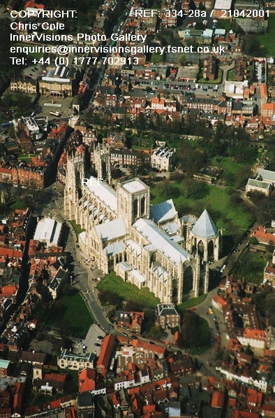
York Minster cathedral precinct is a multi-period site comprising a single
area containing a number of nationally important archaeological features which
also extend beyond the area of the scheduling. These include part of the Roman
legionary fortress at Eboracum, the site of the Anglian and early Norman
minsters, the sites of the Anglian and medieval churches of the Alma Sophia,
St Sepulchre and St Mary ad Valvas, the sites of the medieval archbishops'
palace and deanery, St William's College, the precinct boundary, gates and
gatehouses, part of the City Wall including Bootham Bar, cemeteries dating
from the ninth to fifteenth centuries, the site of the Ingram Mansion and the
sites of the cathedral prebendal houses.
The boundary of the scheduling has been drawn to identify the main area of the
cathedral precinct.
The legionary fortress, founded in AD71 by Petilius Cerialis, occupied a
roughly square site on the north-east bank of the River Ouse above its
confluence with the Foss. The cathedral precinct lies largely within the north
quarter and includes the remains of barracks, the commandant's house, the
principia or headquarters, sections of the road known as the Via Decumana and
parts of the north-west and north-east walls. In the seventh and eighth
centuries AD the Roman fortress was taken over as a royal centre by the
Anglian Kingdom of Northumbria. The principia survived in use as a palace down
to c.AD800 and the commandant's house is thought to have been reused as the
Anglian archbishop's residence. The fortress walls were maintained throughout
the Anglian period and refortified with a new rampart and palisade during the
Viking era. After the Norman Conquest the Viking defences were added to and,
during the twelfth century, the four main city gateways, or Bars, were built.
Of these, Bootham Bar lies adjacent to the Minster precinct at the junction of
Bootham and High Petergate. The walls form the northern part of the cathedral
precinct boundary while the southern part correlated with the boundaries of
adjacent parishes. Four cathedral precinct gates were still extant in 1736:
Peter Gate, the main gate at Minster Gates, a gate `in Ogleforth' and a gate
at the junction of College Street and Goodramgate. The latter allowed access
from the main precinct to the Bedern, a cluster of buildings which housed the
Vicars Choral who supported the medieval cathedral canons in services in the
Minster.
Although a Bishop of York is known to have existed in AD314, no Roman church
has so far been identified. The present see was founded in 625 when Paulinus,
arriving from Kent to convert the Northumbrians to Christianity, built a small
wooden church dedicated to St Peter within the Anglian royal centre. This
church was restored and repaired several times in the succeeding centuries
until, in 1069, work began on the first Norman minster. The remains of
Paulinus's church and its Anglian and Viking successors have not yet been
located, but fragments of sculpture have been recovered from the cemeteries of
both periods and include seventh and eighth century grave-slabs, and Viking
grave-markers have been excavated from beneath the south transept of the
present Minster. Excavation has shown that the pre-Conquest cathedral does not
underlie the Norman foundation and therefore it is presumed to lie either
south of the south transept or north of the present church beneath Dean's
Park. The latter is considered the most likely since it would explain the
alignment of the medieval archbishops' palace which does not match that of the
medieval church. The substantial stone foundations of the first Norman minster
have, however, been found beneath the present church, overlying the north
corner of the Roman principia and adjacent barrack blocks. Begun by Archbishop
Thomas of Bayeux in 1069, this church was extended by Archbishop Roger of Pont
l'Eveque in the mid-twelfth century. The present Minster dates from the second
quarter of the thirteenth century and is not included in the scheduling, being
in current ecclesiastical use.
The remains of a number of churches dating to the Anglian and medieval periods
are also known to survive within the cathedral precinct. These are the Alma
Sophia, or church of the Holy Wisdom, built between 767 and 780 and so far not
precisely located, the church of St Mary and the Holy Angels, also known as
St Sepulchre, founded in the late twelfth century, and the church of St Mary
ad Valvas, demolished in the 1380s. One wall of the latter was uncovered in
the late 1960s, close to the east end of the Minster, and remains relating to
St Sepulchre were found near the gate of the archbishops' palace, partially
built over by the fourteenth century extension of the cathedral nave. The
post-Conquest palace of Archbishop Thomas and his successors lay to the north
of the Minster and comprised an open court surrounded by buildings. Its
visible remains consist of six bays of a late twelfth century blind arcade,
known as the `Cloister', and an L-shaped block to the north which housed the
thirteenth century chapel and is now the Minster Library. Documentary sources
refer to an aisled medieval hall, a south-west range and a buttressed building
to the south-east of the chapel. During the fourteenth and fifteenth
centuries, the palace fell out of use and, by 1600, had become ruinous. In
1618 the site was leased to Sir Arthur Ingram who incorporated the south-west
range into a mansion known as York Palace. Plans and surveys show the layout
of the mansion but, by the eighteenth century, this too was in ruins and was
demolished and the site cleared in 1814.
Other features of the cathedral precinct include the site of the medieval
deanery, originally constructed in the reign of William II at the junction of
Minster Yard and Deangate, St William's College, built in 1465 to provide
accommodation for the chantry priests, and numerous prebendal houses, some of
which, like St William's College and some of the service buildings of the
deanery, are still extant or incorporated into current buildings. The remains
of the medieval Treasurer's House survive beneath the extant seventeenth
century building and adjacent Gray's Court while a late medieval cemetery lies
around the east end of the current Minster. The current seventeenth century
Treasurer's House is considered adequately protected by its Grade I Listed
status and is not included in the scheduling, although the ground beneath is
incorporated. This also applies to St Williams College, the Minster Library,
Gray's Court and the present Minster, which are protected by Grade I Listed
status.
In addition other buildings, considered adequately protected by Listed status
are excluded from the scheduling, although the ground beneath them is
included: York College for Girls (Grade II*), the Minster Song School and the
Purey-Cust Chambers (both Grade II), together with other buildings including
private houses and premises Listed Grade I, II* and II).
Also excluded from the scheduling are the present Deanery, the Purey-Cust
Nursing Home, all buildings, the surfaces of all paths, roads and driveways,
all modern walling and railings; all fixtures such as lamp-posts, bins,
benches and signs, although the ground beneath all these exclusions is
included.
MAP EXTRACT
The site of the monument is shown on the attached map extract.
Source: Historic England
The present cathedral church known as York Minster is at least the fourth
major church to have stood on this site. The earliest ecclesiastical use of
the site can be traced back to the early seventh century when Paulinus
baptised King Edwin of Northumbria in a wooden oratory considered to have been
located in the vicinity of the present Minster. This event was of particular
importance as it marked the post-Roman rebirth of Christianity in northern
Britain. As a result of the adoption of Christianity by the Northumbrian
kings, a bishopric was established in York, this being one of the earliest
such foundations in post-Roman England. Pre-Conquest cathedrals are a rare and
poorly understood monument class, there having been only twenty-four known
examples. York is of particular note because its chief incumbents were
archbishops second in ecclesiastical authority only to the archbishops of
Canterbury.
Evidence for the ecclesiastical importance of York in the pre-Conquest period
is provided by contemporary references to its library, the episcopal see and,
in particular, its monastic school whose most famous pupil, Alcuin, became
Charlemagne's adviser. This importance has been maintained down to the present
day. Even during the Viking period, when York was conquered and became part of
an independent Viking kingdom that lasted from 866 to 954, there was an
unbroken succession of archbishops suggesting that the pagan Vikings quickly
converted to Christianity. After the Norman Conquest, the see rose in power
and prosperity when its Norman archbishops began a series of major building
works which culminated in the construction of the present Minster in the
thirteenth century and after. During the medieval period, the cathedral gained
considerably from its position within a thriving and wealthy town; one of the
most flourishing urban centres in England and the major town of the North. The
wealth of York was reflected in the magnificent, extensive and costly building
programme which characterised much of the cathedral precinct throughout the
medieval period. These works were funded in part by pious donations and
endowments to the church made by leading secular individuals.
With the exception of the present Minster many of the buildings and features
of the pre- and post-Conquest cathedral precinct are no longer visible.
However, extensive below-ground deposits are known to survive across the
majority of the precinct area. This is due in part to the fact that the area
has remained largely in ecclesiastical hands since earliest times. This has
limited development within the precinct; hence, below-ground archaeology
survives here in much better condition than in other more intensively
developed areas of the city. In some areas of the precinct, up to 4m of
archaeological deposits are preserved. Because of this depth of stratigraphy,
extensive remains will survive well beneath the present ground surface and
will include not only those of the pre- and post-Conquest cathedrals and their
ancillary buildings but also the Roman legionary fortress which formerly
occupied the site and the remains of the seventeenth century Ingram Mansion.
The survival of the Roman fortress is of particular note as it was one of the
earliest military foundations in the north of England and also one of the most
long-lived. It led to York being granted the status of colonia and also, in
the fourth century, to it becoming, for a time, the Imperial capital of the
Emperor Constantine. This and the degree to which its remains are preserved
make it a monument of national importance in its own right.
Source: Historic England
Books and journals
The Victoria History of the City of York, (1961)
Addyman, P V (ed), The Archaeology of York, (1972)
Aylmer, G E, Cant, R (eds), A History of York Minster, (1977)
Benson, G, Later Medieval York, (1919)
Drake, , Eboracum, (1736)
Butler, R M, 'York Historian' in York Palace: A Vanished Jacobean Mansion, , Vol. VIII, (1988), 25-45
Morris, R K, 'The Anglo Saxon Church' in Alcuin, York and the alma sophia, , Vol. 60, (1986), 80-89
Phillips, D, 'Excavations at York Minster' in The Cathedral of Archbishop Thomas of Bayeux, , Vol. Vol II, (1985)
Other
RCHM, Eburacum, Roman York, York, (1962)
RCHM, The Central Area, York, (1981)
RCHME, City of York Volume II: The City Walls, (1972)
Ryder, P, Cathedral Close Reports: York, 1990, Unpublished
Title: Roman and Anglian York
Source Date: 1989
Author:
Publisher:
Surveyor:
With descriptive text
Title: Viking and Medieval York
Source Date: 1989
Author:
Publisher:
Surveyor:
With descriptive text
Source: Historic England
Other nearby scheduled monuments