Approximate Location Map
Large Map »
This site is entirely user-supported. See how you can help.
Latitude: 51.7224 / 51°43'20"N
Longitude: -3.4495 / 3°26'58"W
OS Eastings: 299970
OS Northings: 203625
OS Grid: SN999036
Mapcode National: GBR HK.2R1Q
Mapcode Global: VH6CX.5Y7Z
Entry Name: Tramroad East of Robert's Town Bridge, Aberdare
Scheduled Date: 24 September 2008
Source: Cadw
Source ID: 1055
Cadw Legacy ID: GM527
Schedule Class: Transport
Category: Tramway
Period: Post Medieval/Modern
County: Rhondda, Cynon, Taff (Rhondda Cynon Taf)
Community: Aberdare (Aberdâr)
Traditional County: Glamorgan
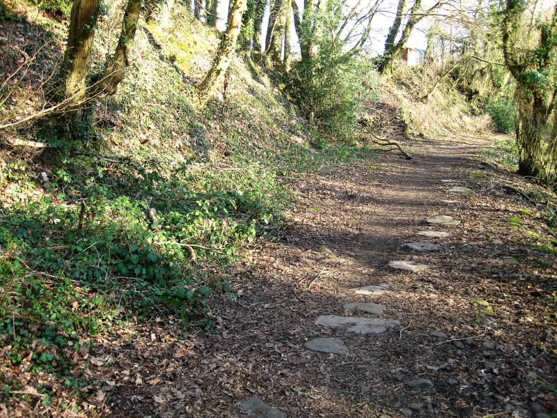
The monument consists of the remains of a tramroad, embankment and stone sleeper blocks, dating to the 19th century. The sleeper blocks have between one and three holes and many show wear marks from shoes and plates. The tramroad was opened in 1811 as a plateway of 4 feet 2 inch gauge, designed by the leading tramroad engineer George Overton. The tramroad was owned by the Aberdare Canal Company, and was 2 miles long, connecting the canal terminus at Aberdare with the Hirwaun to Abernant Tramroad, which served mines and ironworks further up the Cynon Valley. The Llwydcoed Tramroad crossed the River Cynon on Robert's Town iron bridge. It continued in use until 1900. The monument is of national importance for its potential to enhance our knowledge of the development of industrial transportation in the 18th and 19th century. The track bed, bridges, drainage systems, embankments and revetments may all be expected to contain archaeological information in regard to construction techniques and functional detail. The scheduled area comprises the remains described and areas around them within which related evidence may be expected to survive.
Source: Cadw
Other nearby scheduled monuments