Approximate Location Map
Large Map »
This site is entirely user-supported. See how you can help.
Latitude: 52.9602 / 52°57'36"N
Longitude: -3.4115 / 3°24'41"W
OS Eastings: 305282
OS Northings: 341252
OS Grid: SJ052412
Mapcode National: GBR 6M.KKT0
Mapcode Global: WH780.KVPG
Entry Name: Pont Dyfrdwy
Scheduled Date:
Source: Cadw
Source ID: 3204
Cadw Legacy ID: ME033
Schedule Class: Transport
Category: Bridge
Period: Post Medieval/Modern
County: Denbighshire (Sir Ddinbych)
Community: Cynwyd
Built-Up Area: Cynwyd
Traditional County: Merionethshire
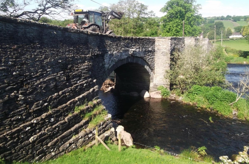
The monument consists of an imposing stone-built bridge, probably dating to the eighteenth century. It contains four spans with segmental arches, cutwaters on both sides, and plain parapets.
The monument is of national importance as a fine example of eighteenth century road bridge technology and design, and incorporates a number of interesting regional vernacular details such as opposing pedestrian recesses above the cutwaters. Spanning a fast-flowing and often flooded section of the River Dee, the bridge contributes to our knowledge of post-Medieval engineering and bridge building technology. It is one of a group of well-preserved late and early post-Medieval bridges in the middle Dee valley.
The scheduled area comprises the remains described and an area around them within which related evidence may be expected to survive.
Source: Cadw
Other nearby scheduled monuments