Approximate Location Map
Large Map »
This site is entirely user-supported. See how you can help.
Latitude: 52.0807 / 52°4'50"N
Longitude: -4.6607 / 4°39'38"W
OS Eastings: 217779
OS Northings: 245818
OS Grid: SN177458
Mapcode National: GBR CZ.C4M1
Mapcode Global: VH2MP.5YGV
Entry Name: Cardigan Bridge
Scheduled Date:
Source: Cadw
Source ID: 1825
Cadw Legacy ID: CD003
Schedule Class: Transport
Category: Bridge
Period: Post Medieval/Modern
County: Ceredigion
Community: Cardigan (Aberteifi)
Built-Up Area: Cardigan
Traditional County: Pembrokeshire
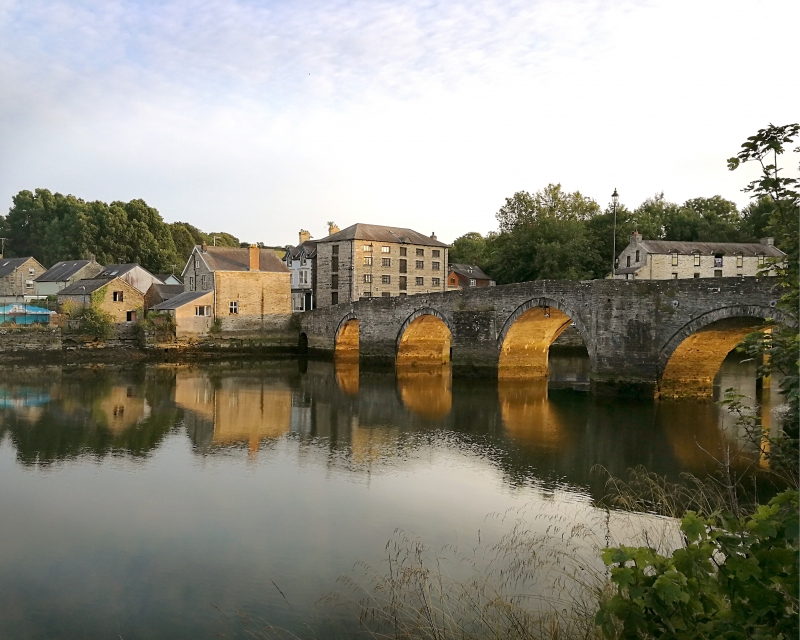
The monument consists of a bridge, dating to the medieval and post-medieval period. Cardigan Bridge, carrying a road across the river Teifi, is thought to have been initially constructed in the 13th century; it was partly rebuilt in 1726 and widened in 1872-3. The bridge is built of blue lias rubble stone, and has five main arches, graduated in size, and a much smaller flood arch at the south end, which is now visible only on the east face. It has recessed cut-stone voussoirs to the arches and cutwaters on both sides, those on west obscured by the widening in 1872-3. On the east side the cutwaters are carried up to full height to form pedestrian refuges, except for one to south of centre which is capped off at the level of the arch top, with a plaque above which reads ‘This arch was built in the year 1726 W Jones’. On the west side the original arches can clearly be seen behind the more elliptical arches of the 1872-3 widening. A separate modern pedestrian bridge has been provided alongside the west face of the structure.
The monument is of national importance for its potential to enhance our knowledge of medieval and post-medieval construction techniques and transportation systems. It retains significant archaeological potential, with a strong probability of the presence of associated archaeological features and deposits. The structure itself may be expected to contain archaeological information concerning chronology and building techniques.
The scheduled area comprises the remains described and areas around them within which related evidence may be expected to survive.
Source: Cadw
Other nearby scheduled monuments