Approximate Location Map
Large Map »
This site is entirely user-supported. See how you can help.
Latitude: 52.406 / 52°24'21"N
Longitude: -4.089 / 4°5'20"W
OS Eastings: 257990
OS Northings: 280724
OS Grid: SN579807
Mapcode National: GBR 8R.PHW4
Mapcode Global: VH4FC.2SND
Entry Name: Aberystwyth Harbour Defences
Scheduled Date: 13 December 2007
Source: Cadw
Source ID: 1227
Cadw Legacy ID: CD248
Schedule Class: Defence
Category: Pillbox
Period: Post Medieval/Modern
County: Ceredigion
Community: Aberystwyth
Built-Up Area: Aberystwyth
Traditional County: Cardiganshire
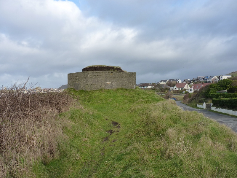
The monument consists of a reinforced concrete pillbox, dating to the early period of World War II (AD 1940-41). The pillbox is located on top of a small knoll overlooking the entrance to Aberystwyth Harbour and the bridge from Trefechan over the Afon Ystwyth to the Bar. The pillbox is built to standard War Office FW3/24 specifications, possessing seven embrasures, and was originally one of at least three known structures defending the harbour. It is an irregular hexagon in shape on plan and measures c. 4.85m in length N-S by 3.8m transversely and a maximum of 2.3m in height externally. The walls measure 0.39m in thickness. The pillbox entrance is shielded by a porch and two protective walls, which measure c. 2.7m in length and 1.7m in width. A grass and turf covering protects the roof and provides camouflage through concealment.
The monument is of national importance for its potential to enhance our knowledge of World War II anti-invasion practices. The monument is well preserved. It is an important relic of actions taken against the perceived threat of a German invasion from Ireland. It retains significant archaeological potential, with a strong probability of the presence of associated archaeological features and deposits.
The scheduled area comprises the remains described and an area around within which related evidence may be expected to survive. The scheduled area is circular and measures 12m in diameter.
Source: Cadw
Other nearby scheduled monuments