Approximate Location Map
Large Map »
This site is entirely user-supported. See how you can help.
Latitude: 56.6504 / 56°39'1"N
Longitude: -3.1338 / 3°8'1"W
OS Eastings: 330574
OS Northings: 751529
OS Grid: NO305515
Mapcode National: GBR VF.M1YZ
Mapcode Global: WH6PB.T3WK
Entry Name: Barns of Airlie, souterrain 495m WSW of
Scheduled Date: 25 March 1954
Last Amended: 28 July 2015
Source: Historic Environment Scotland
Source ID: SM136
Schedule Class: Cultural
Category: Prehistoric domestic and defensive: souterrain, earth-house
Location: Airlie
County: Angus
Electoral Ward: Kirriemuir and Dean
Traditional County: Angus
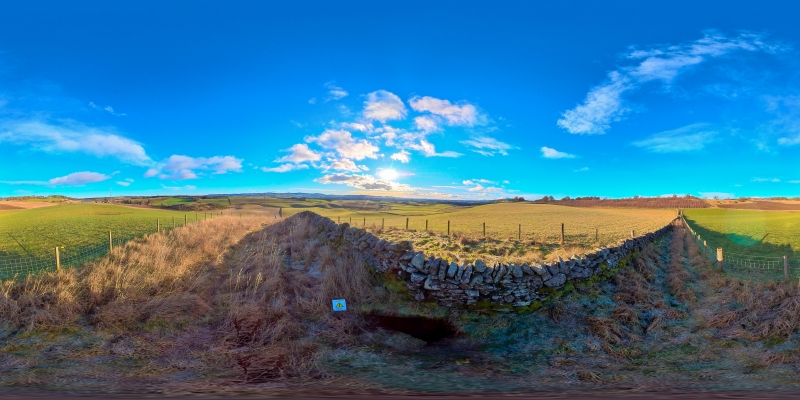
The monument is a stone-built souterrain, a type of prehistoric underground structure dating probably to the Roman Iron Age (sometime in the first two centuries AD). The souterrain is visible as an underground curving passage, with rubble-built side-walls and a roof of large stone slabs. It is about 20m long, aligned roughly NW-SE, with an entrance at the NW end. Internally it measures about 1.5m wide and stands 1.6m high. One of the roof slabs bears incised decoration of cup-marks and serpent-like motifs. The original entrance is flanked by two upright slabs and has been neatly blocked. Immediately N of the entrance, two roof slabs have been removed to provide modern access. The passage interior was investigated when it was discovered in 1794, and again in 1864. Quern stones have been found in the immediate vicinity of the souterrain, indicating that the remains of an associated house or settlement probably lie nearby. The structure lies below an arable field and is crossed by a stone dyke. It is located on the crest of a rise at around 130m OD, to the W of the farm at Barns of Airlie. The monument was first scheduled in 1954, but the documents did not meet modern standards: the present amendment rectifies this.
The area to be scheduled is irregular on plan to include the remains described above and an area around them within which evidence relating to the monument's construction, use and abandonment may survive, as shown in red on the accompanying map. The scheduling specifically excludes the above-ground remains of the stone dyke and post-and-wire fences.
Source: Historic Environment Scotland
The monument is of national importance because it has the potential to make a significant addition to our understanding of souterrains and their role in late Iron Age economy and society. It is a fine example of its type, retaining intact side-walls and roof slabs, one of which bears incised serpent-like figures on the lower face. Although most of the monument lies below ground level, the structure would have been an important component of the prehistoric landscape, and was probably associated with an above-ground house or settlement. It may have acted as a focal point in the community as a place where agricultural surpluses were collected and stored. Its importance is enhanced because the souterrains of eastern central Scotland form an important concentration of evidence for social and economic change in the early first millennium AD, especially in the Roman Iron Age. Our understanding of the distribution and character of Iron Age souterrains would be diminished if this monument was to be lost or damaged.
Source: Historic Environment Scotland
Bibliography
Other Information
RCAHMS records the monument as NO35SW 19. The Angus SMR reference is NO35SW0019.
References
Bryson, S 1990, 'Airlie (Airlie parish), survey of souterrain', Discovery Excav Scot, 39-40.
Childe and Graham, V G and A 1943, 'Some notable prehistoric and medieval monuments recently examined by The Royal Commission on Ancient and Historical Monuments of Scotland', Proc Soc Antiq Scot 77, 37-8.
Jervise, A 1865, 'Notice of antiquities in the parish of Airlie, Forfarshire', Proc Soc Antiq Scot 5, 352-4.
RCAHMS 1942-3, Emergency Survey. 2v typescripts.
RCAHMS 1983, The Royal Commission on the Ancient and Historical Monuments of Scotland. The archaeological sites and monuments of Central Angus, Angus District, Tayside Region, The archaeological sites and monuments of Scotland series no 18, Edinburgh, 29, no 235.
Wainwright, F T 1963, The souterrains of southern Pictland, London, 154-6.
Williamson, S 2013, An investigation into the re-use of cup-and-ring marked stones in Iron Age souterrain settlements of south-east Scotland, MA dissertation (School of History, Classics and Archaeology, University of Edinburgh).
Wood, J S and Bryson, S (eds) 2005, An archaeological survey of a souterrain at the Barns of Airlie, ACFA Occasional Paper.
trove.scot
https://www.trove.scot/place/32358/
https://www.trove.scot/place/32358/
Source: Historic Environment Scotland
Other nearby scheduled monuments