Approximate Location Map
Large Map »
This site is entirely user-supported. See how you can help.
Latitude: 55.7432 / 55°44'35"N
Longitude: -2.9083 / 2°54'29"W
OS Eastings: 343073
OS Northings: 650358
OS Grid: NT430503
Mapcode National: GBR 8241.EK
Mapcode Global: WH7VV.9XB1
Entry Name: Cortleferry, scooped settlement 400m NW of
Scheduled Date: 28 February 1924
Last Amended: 10 October 1995
Source: Historic Environment Scotland
Source ID: SM1167
Schedule Class: Cultural
Category: Prehistoric domestic and defensive: scooped settlement
Location: Stow
County: Scottish Borders
Electoral Ward: Galashiels and District
Traditional County: Midlothian
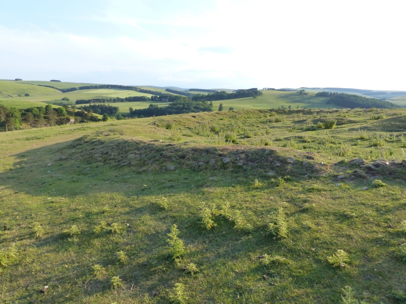
The monument comprises a later prehistoric scooped settlement, situated on the S flank of Hoppringle Hill.
A turf-covered stone (3m wide and 1m high) encloses an area measuring about 40m by 30m within which are the remains of a hut circle (now badly damaged by modern agricultural activity). There is a bi-partite rectangular structure in the lower (SE) part of the interior.
The area to be scheduled is egg-shaped on plan and measures 90m from N-S by 60m transversely, to include the scooped settlement and an area around in which traces of activities associated with its construction and use may survive, as marked in red on the attached map extract.
Source: Historic Environment Scotland
The monument is of national importance because it has the potential to provide information about the life-style and economy of later prehistoric farming communities in southern Scotland.
Source: Historic Environment Scotland
Bibliography
RCAHMS records the monument as NT 45 SW 8.
Reference:
RCAHMS (1929) The Royal Commission on the Ancient and Historical Monuments and Constructions of Scotland. Tenth report with inventory of monuments and constructions in the counties of Midlothian and West Lothian, Edinburgh, 172-3, No. 241, Fig. 206.
Source: Historic Environment Scotland
Other nearby scheduled monuments