Approximate Location Map
Large Map »
This site is entirely user-supported. See how you can help.
Latitude: 56.1641 / 56°9'50"N
Longitude: -3.9925 / 3°59'32"W
OS Eastings: 276363
OS Northings: 698608
OS Grid: NS763986
Mapcode National: GBR 19.HP1D
Mapcode Global: WH4NZ.NB0D
Entry Name: Arnhall Castle
Scheduled Date: 26 October 1992
Source: Historic Environment Scotland
Source ID: SM5424
Schedule Class: Cultural
Category: Secular: castle
Location: Dunblane and Lecropt
County: Stirling
Electoral Ward: Trossachs and Teith
Traditional County: Perthshire
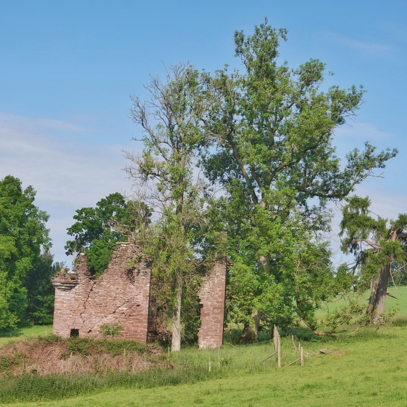
The monument consists of the remains of the castle of Arnhall, a compact L-shaped mansion of seventeenth century date.
The building is situated in parkland SW of Keir House. Arnhall is known to have been the dowager-house of the Duchess of Athole. The surviving walls of the castle are intact and stand to wall-head level (c.10m) except for the re-entrant angle which has gone. The building measures 10m E-W by 9.6m N-S overall within walls 0.8m thick. The arm aligned E-W which contains the entrance extends for a distance of 5.4m (int) beyond the original position of the re-entrant angle. The masonry is of coursed sandstone rubble with dressed quoins and mouldings. At the NW and SE angles are the remains of corbelled turrets. The unvaulted building has had three stories, the ground floor contains several square mural cupboards and there is a fireplace in the N wall which indicates that this portion contained
The kitchen. There are the remains of fireplaces in the N and W walls at first floor level. Traces of an interior flight of steps leading to the first floor can be seen on the E wall. The square-headed entrance has a badly worn inscription above it. There may have been a porch or pediment above the door. The windows of the house are all square-headed. Both in the first floor S facade have segmental rear arches with an arched wall recess separating them. There are three gun-loops on the W wall. To the E of the house are a row of dilapidated contemporary out-buildings running N-S.
The area to be scheduled is square with sides measuring a maximum of 50m to be centred on the castle, as shown in red on the accompanying map.
Source: Historic Environment Scotland
The monument is of national importance as it is a good example of a residence of seventeenth century date that retains features of interest to those researching the development of defensive and domestic architecture and in particular how building design relates to changing social and domestic needs. In addition it may preserve information retrievable through excavation which may increase our understanding of the society, economy and material culture of the Scottish Nobility in the late medieval and early modern period.
Source: Historic Environment Scotland
Bibliography
RCAHMS records the monument as NS79NE 12.
Source: Historic Environment Scotland
Other nearby scheduled monuments