Approximate Location Map
Large Map »
This site is entirely user-supported. See how you can help.
Latitude: 54.5125 / 54°30'45"N
Longitude: -0.8165 / 0°48'59"W
OS Eastings: 476718.196848
OS Northings: 513666.64367
OS Grid: NZ767136
Mapcode National: GBR QJR8.05
Mapcode Global: WHF8J.FVD0
Entry Name: Round barrow on Newton Mulgrave Moor, 360m south east of Stang Howe
Scheduled Date: 7 March 1969
Last Amended: 2 July 1999
Source: Historic England
Source ID: 1016578
English Heritage Legacy ID: 32027
County: North Yorkshire
Civil Parish: Roxby
Traditional County: Yorkshire
Lieutenancy Area (Ceremonial County): North Yorkshire
Church of England Parish: Ugthorpe Christ Church
Church of England Diocese: York
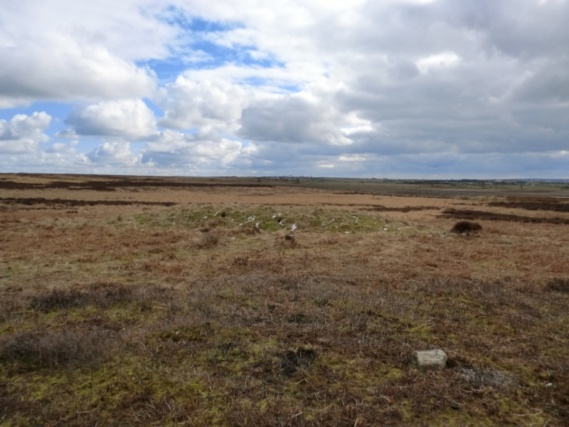
The monument includes a round barrow which lies on a gentle south west facing
moorland slope at the north edge of the North York Moors.
The barrow has an earth and stone mound which measures 17m in diameter and
stands up to 1.2m high. It was originally surrounded by a ditch up to 3m wide
which has become filled in over the years and is no longer visible as an
earthwork, although a slight depression can still be seen around the base of
the mound on the north side. In the centre of the mound there is a hollow
caused by excavations in the past. Investigations by S Anderson in 1852-3
uncovered a cist burial in the centre of the mound, consisting of vertical
stone slabs surrounding a cremation.
The barrow is one of a group of six spread across the west side of Newton
Mulgrave Moor and lies in an area rich in prehistoric monuments, including
further barrows, field systems and settlements.
MAP EXTRACT
The site of the monument is shown on the attached map extract.
It includes a 2 metre boundary around the archaeological features,
considered to be essential for the monument's support and preservation.
Source: Historic England
Bowl barrows, the most numerous form of round barrow, are funerary monuments
dating from the Late Neolithic period to the Late Bronze Age, with most
examples belonging to the period 2400-1500 BC. They were constructed as
earthen or rubble mounds, sometimes ditched, which covered single or multiple
burials. They occur either in isolation or grouped as cemeteries and often
acted as a focus for burials in later periods. Often superficially similar,
although differing widely in size, they exhibit regional variations in form
and a diversity of burial practices. There are over 10,000 surviving bowl
barrows recorded nationally (many more have already been destroyed), occurring
across most of lowland Britain. Often occupying prominent locations, they are
a major historic element in the modern landscape and their considerable
variation of form and longevity as a monument type provide important
information on the diversity of beliefs and social organisations amongst early
prehistoric communities. They are particularly representative of their period
and a substantial proportion of surviving examples are considered worthy of
protection.
Despite limited disturbance, the barrow 360m south east of Stang Howe survives
well. Significant information about the original form of the barrow and the
burials placed within it will be preserved. Evidence for earlier land use and
the contemporary environment will also survive beneath the barrow mound and in
the buried ditch.
The barrow is one of a group of six burial monuments and such clusters
provide important insight into the development of ritual and funerary
practice during the Bronze Age. It is situated within an area which includes
other monuments dating from the Neolithic to the Iron Age. Associated groups
of monuments such as these demonstrate a continuity of occupation throughout
the prehistoric period and offer important scope for the study of the
distribution and development of prehistoric activity across the landscape.
Source: Historic England
Books and journals
Nichol, R J, Newton Mulgrave Damaged Barrow. Recording and Reinstatement, (1993)
Smith, M J B, Excavated Bronze Age Burial Mounds of Durham and N' land., (1994), 83
Spratt, D A , 'Prehistoric and Roman Archaeology in North East Yorkshire' in Prehistoric and Roman Archaeology of North East Yorkshire, , Vol. 87, (1993)
Source: Historic England
Other nearby scheduled monuments