Approximate Location Map
Large Map »
This site is entirely user-supported. See how you can help.
Latitude: 53.1648 / 53°9'53"N
Longitude: -1.6309 / 1°37'51"W
OS Eastings: 424776.099337
OS Northings: 363133.334139
OS Grid: SK247631
Mapcode National: GBR 58F.NHF
Mapcode Global: WHCDF.XQK6
Entry Name: Bronze Age burial, ceremonial and settlement remains on Stanton Moor, and evidence for medieval, post-medieval and 19th to early 20th century activity
Scheduled Date: 18 August 1882
Last Amended: 24 March 1995
Source: Historic England
Source ID: 1009300
English Heritage Legacy ID: 23315
County: Derbyshire
Civil Parish: Stanton
Traditional County: Derbyshire
Lieutenancy Area (Ceremonial County): Derbyshire
Church of England Parish: Stanton-in-Peak Holy Trinity
Church of England Diocese: Derby
Stanton Moor is a discrete area of moorland lying at 280m-322m OD on the south
west edge of the eastern gritstone moors of the Peak District. The most
important remains on the moor are those of prehistoric date. However, the
monument also includes a variety of features from several other periods.
Broadly the remains can be categorised as Bronze Age burial, ceremonial and
settlement remains, medieval, post-medieval and early 19th century fields,
numerous hollow ways and other tracks which date from the medieval to the
modern period, widespread evidence of stone-working and stone and sand
extraction, and, lastly, earthworks relating to 19th century afforestation and
early 20th century woodland clearance. None of these features exists in
isolation. Together they reflect a continuing and changing pattern of land use
in which the later phases are superimposed on the earlier. Further evidence of
prehistoric and later land use is likely to have been destroyed by extensive
modern quarrying of the west and south edges of the moor and it is also
believed that Bronze Age activity would have extended onto the lower shelves
of the moor on its north and east sides. These areas have been enclosed and
under pasture since c.1800 and, although prehistoric remains may survive here
as buried features, they have not been included in the scheduling as the
extent and state of preservation of the remains is not sufficiently
understood. The monument is therefore currently defined on its east side by
the natural edge of the precipitous east-facing slope of the moor, on its
west side by the quarry edge, and elsewhere by a combination of modern field
walls, quarried and natural edges, topographical features and trackways. At
its south west corner the monument extends as far as the Birchover Road and
includes the sites of the early 20th century sawmill and part of the
light railway which served it.
Numerous investigations of the archaeological monuments on Stanton Moor have
been carried out, all except the most recent concentrating largely on the
prehistoric remains. The most notable include the late 18th century delves and
commentaries of such antiquarians as the Reverend Pegge and Major Hayman
Rooke, the excavations of prehistoric cairns and other features by J P and J C
Heathcote in the 1930s and 1940s, the surveys of L Butcher in the 1960s and C
R Hart and J Barnatt in the 1980s, and, latterly, the full measured survey
carried out in 1986 and 1987 by the Royal Commission on the Historical
Monuments of England (RCHME). This was the first investigation to make full
note of the effects of later land use on the Bronze Age remains and also the
effects of the Heathcotes' methods of excavation and reconstruction on the
physical form of the monuments they investigated.
The latter is important to the understanding of the Bronze Age remains on
Stanton Moor and requires explanation. The Heathcotes believed that all
prehistoric monuments on the moor would be constructed along the same lines as
the burial cairn T2, which was the first cairn excavated by them. That is,
they expected each monument to be defined by a kerb of large stones and filled
in by a heap of smaller loose stones which would cover any burial deposits.
Consequently, they would begin their excavation by digging a narrow trench
round the presumed edge of the monument in order to locate a kerb. Next they
removed the cairn material from within the supposed kerb, placed it in a ring
outside their delineation trench and searched the exposed land surface for
burial and other remains. Then they reused some of the original cairn material
to rebuild the monument, leaving the remainder as a bank of spoil round the
outside. RCHME has noted 56 examples of cairns excavated this way.
Characteristically, their remains comprise a central mound, partially or
wholly circumscribed by a narrow trench which is flanked on the outside by low
bands of spoil. Before it was recognised that the current form of these
monuments was a direct result of Heathcote interference, it was thought that a
variety of exotic forms of prehistoric burial monument existed on Stanton
Moor, descriptions of which appear in the archaeological literature. Now it is
generally accepted that there is little evidence for exotic cairn forms on the
moor and that the predominant type of prehistoric burial monument was probably
the hemispherical round cairn together with a number of variants on that basic
shape, including oval, egg-shaped and sub-rectangular. However,
notwithstanding the above, it should not be automatically assumed that every
Heathcote reconstruction is entirely fanciful. It is likely that at least some
of their rebuilt structures were intended to illustrate features uncovered
during excavation. However, due to a lack of excavation records, this cannot
now be verified.
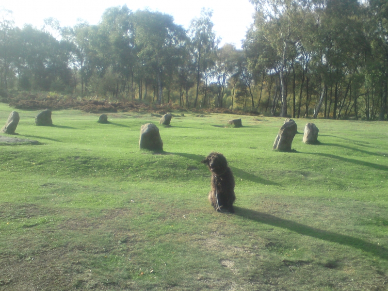
The Bronze Age burial and ceremonial monuments on the moor include three
embanked stone circles, two ringcairns and a possible third ringcairn, a
standing stone and over 120 cairns varying between c.2m and c.20m in diameter.
In addition to a number of proven or probable burial cairns, the latter group
includes many cairns which, at this time, cannot be classed with certainty as
funerary monuments because they have not been excavated. Some of these lie
close to, or are incorporated within, areas which were cleared of stone in the
Bronze Age to create fields and may be thought of as clearance cairns.
However, this does not preclude a burial function since several proven burial
cairns have also been found within cairnfields and banks of linear stone
clearance.
In addition to both inhumed and cremated human bone, finds which date the
burial cairns to the Bronze Age include bronze and flint implements, quartz
pebbles, personal ornaments and Bronze Age ceramics such as collared urns and
pygmy cups. Two of the largest cairns, referred to as T2 and T57 after the
numbering system devised by J P Heathcote, have yielded fragments of pottery
food vessels. Together with the cairn T55, these cairns are of a similar size,
substantial form and topographically prominent location, suggesting that they
may be broadly contemporary. T2 and T55, together with the ring cairn T56 and
the embanked stone circles T43, T61 and Nine Ladies, are thought by Barnatt to
form a deliberate, if somewhat ragged, SSW-NNE alignment along the spine of
the moor and, prior to its afforestation, may have been intervisible. This
probable alignment may also have extended southwards to incorporate the cairn
cemetery on the south edge of the moor which includes a line of three small
cairns which also share a SSW-NNE alignment. Close to Nine Ladies stone circle
is the standing stone called the King Stone which is now known to stand inside
a previously unrecognised ring cairn which may also have formed part of the
alignment. Other cairns scattered throughout the moor, sometimes singly and
sometimes in pairs, groups and lines, indicate that the area was in use over a
long period during the Bronze Age and some examples display evidence of
multi-phase construction. These include conjoined cairns in which two or more
individual but closely spaced cairns have, at some later date, been covered
over to create an apparently single long cairn. The most notable of these is
the so-called `triple cairn' comprising cairns T44, T45 and T46. This unusual
type of funerary monument has also been noted on Beeley Moor, which is also
part of the East Moors of the Peak District.
Until recently, Stanton Moor was sometimes referred to by archaeologists as a
Bronze Age `necropolis' because, despite the many burial and ceremonial
monuments, there seemed to be no evidence of settlement. This is now
contradicted by new evidence brought to light by the RCHME survey. The survey
notes the existence of scooped floors which, on Dartmoor and in the northern
border counties, have been identified as platforms associated with Bronze Age
timber houses. Between two and three such house stances have been recorded on
Stanton Moor and their locations, near the north west and eastern edges of the
moor, suggest that further examples may have existed on the lower shelves
where, in some instances, they may have been quarried away. In both cases,
the house sites are located close to areas of Bronze Age stone clearance.
These areas, identified by groups of strings of cairns and stony banks laid
out in rough grids, represent the remains of Bronze Age coaxial field
systems.
Another cairnfield on the north east edge of the moor, together with several
isolated examples of linear clearance throughout the moor, indicate that, in
the Bronze Age, the Stanton Moor area was extensively farmed. It is possible
that it was occupied by a single large coaxial field system. However, much
of the visible evidence for this has been disturbed by later land use leaving
only the isolated portions discernible today.
The field system in the north west area of the moor includes evidence of two
phases of Bronze Age stone clearance. The earlier is represented by clearance
cairns and the later by lines of linear clearance which, together, form a
group of at least five small rectilinear fields. These Bronze Age fields are,
in turn, overlain by a second phase of rubble banking which is different in
form from the first, being deliberately revetted and consolidated. This
banking is probably medieval though it may, alternatively, be pre-medieval or
early post-medieval. Overlying it are traces of drystone walls which date to
the early 19th century and are roughly contemporary with a disused dewpond
which has, in the past, been mistaken for a Bronze Age feature. These walls
are associated with 1m wide plough striations that cross the earlier field
boundaries and probably relate to Enclosure-period land improvement, possibly
preparatory works for 19th century afforestation. Further medieval and post-
medieval enclosures exist on the north and south sides of the moor. In the
latter case, the field again partially overlies Bronze Age clearance features
and burial cairns and has been mistaken for a prehistoric field in the past.
Another manifestation of continuing and changing land use on Stanton Moor
since the Bronze Age is the existence of numerous quarries and surface delves
related to both stone and sand extraction. With two exceptions, the larger
gritstone quarries which have bitten into the edges of the moor are not
included in the scheduling. The exceptions are associated with the remains of
quarry-related buildings and other archaeologically important features.
Stone-getting on the moor is documented from the later 16th century for door,
window and quoin stones and is probably much older. Hart suggests a late
Roman or medieval date for some of the quernstone roughouts found during his
survey. Consequences of stone-getting activity are the existence of millstone
fragments and roughouts, large numbers of surface scoops and spoil heaps, the
partial and total robbing of some prehistoric cairns and the disturbance of
others by partial clearance and restacking. Some spoil heaps have been
misinterpreted as Bronze Age cairns in the past and three apparent standing
stones which are too unweathered to be prehistoric are thought by RCHME to be
stones levered upright by quarrymen and then abandoned without further
working. In addition, there are a number of rocks on the eastern edge of the
moor which bear high quality inscriptions interpreted as quarrymen's graffiti.
These include two examples referred to by J P Heathcote as the `Duchess of
Sutherland Stone' and the `Duke of York Stone'. Another possible example
occurs on the King Stone.
The moor is also criss-crossed by a network of paths, hollow ways, packhorse
routes and `rides' of medieval to modern date. Except in a small number of
cases, which appear to be quarry-related, the tracks characteristically
respect the prehistoric monuments, a phenomenon which helps to show that these
monuments are genuinely prehistoric even when they have not been excavated. In
such cases the prehistoric monuments were probably used as waymarkers by
travellers crossing the moor. Among the more modern tracks are three `rides',
recorded on the OS map of 1897 and thought to have been scenic drives dating
to the 18th century when the moor was part of the Rutland Estate. The
easternmost is known as Duke's Drive and is only one of several `Duke's Drives
on the gritstone uplands of the Peak District, all of which are attributable
either to the Dukes of Rutland or to the Dukes of Devonshire. The westernmost
ride passes along the spine of the moor, following the line of the major
prehistoric monuments T2, T43, T55, T56 and Nine Ladies. All three rides are
presently used by walkers.
The most pervasive activity to have left its mark on the moor is
afforestation. The Stanton Moor Plantation was first planted in the early
19th century and, by the early 20th century, the area was effectively covered
with fir, larch, oak and Spanish chestnut. This is illustrated by the OS maps
of 1897 which depicts the moor as forest. Furrows related to tree planting
have been recorded in several areas by RCHME and many early features contain
holes left by the removal of tree roots while others retain in situ tree
stumps. RCHME have also noted a number of extensive but previously unrecorded
linear earthworks which comprise strings of sharp-sided pits, less than 2m
wide by 1m deep, flanking narrow flattened causeways. Usually formed of earth
and sand, these causeways average 1.5m wide by 0.2m-0.3m high and, in some
places, are continued by terraces cut into the slope of the moor. Although
there is no direct confirmation from records, the testimonies of local
residents and circumstantial evidence from contemporary military archives have
led RCHME to interpret the earthworks as the remains of an animal-hauled
narrow-gauge light railway for which the pits were a source of ballast. The
railway was built during World War I to facilitate the shipment of felled
timber at a time when timber was needed for the trenches and its supply from
Britain was coordinated by the Home Grown Timber Committee and later by the
Board of Trade Timber Control. Most of the work of felling and shipment was
carried out by the Women's Forestry Corps under the direction of the Canadian
Forestry Corps, a unit of the Canadian Army. The deforestation of Stanton
Moor may have been carried out by No.132 Company of the Canadian Forestry
Corps which is known to have been stationed at nearby Rowsley in late 1918.
The OS map of 1919 confirms that massive clearance of woodland had been
carried out by this time and further clearance is believed to have been the
work of a local company after the war. Two main railway lines and several
branch lines appear to have existed, including one which followed the `middle
ride', one of the three 18th century tracks noted above. The longest single
section of track crossed the moor from south west to north east, beginning at
the sawmill next to the Birchover Road and ending south of the Reform Tower on
the north east edge of the moor. The ground slopes steeply up from the sawmill
and a line of earthfast stones flanking the track bear multiple grooves
indicating the use of a cable brake along this section, which ran between the
sawmill and a terminus 40m uphill to the east. The site of the sawmill is
today represented by a small earthwork complex in the same position as a
building depicted on the OS 1920 map but missing from the map of 1897. It is
not known when the railway was dismantled but it is likely to have been before
1930 when the Heathcote investigations began.
The Nine Ladies embanked stone circle and the King Stone are in the
guardianship of the Secretary of State.
The OS trig point at the highest point of the moor is included in the
scheduling.
Lying within the area of the scheduling but excluded from the scheduling is
the Reform Tower which occupies a spur of the precipitous north east face of
the moor overlooking the Derwent valley. The tower is a square gritstone
structure, built in 1832 by the Thornhill family to commemorate Earl Grey, and
is a Grade II Listed Building. All modern fencing is also excluded from the
scheduling. The ground beneath the tower and the modern fencing is included in
the scheduling.
MAP EXTRACT
The site of the monument is shown on the attached map extract.
Source: Historic England
The East Moors is a region of the gritstone moorlands of the Peak District
which includes all the moors east of the River Derwent lying south of the A57
`Snake Pass' road and north of the B5057 road from Chesterfield. It covers an
area of 105 square kilometers of which approximately 63% is open moorland and
37% is intake. It excludes the moors extending northward from the A57, which
are largely peat-covered and contain only a small number of recorded sites. It
includes, however, two moors west of the Derwent: Stanton Moor and Eyam Moor.
These two areas are the only gritstone moors west of the river to remain
unenclosed.
Due to recent and ongoing detailed archaeological surveys, the East Moors area
is becoming one of the best recorded upland regions in the country. In the
intake, archaeological remains are fragmentary but survive sufficiently well
to show that human activity extended beyond the present confines of the open
moors. In the open moors, extensive relict landscapes provide direct evidence
for human exploitation of the gritstone uplands from the Neolithic to the
post-medieval periods.
Bronze Age activity accounts for by far the most extensive utilisation of
these moorlands so far identified. Evidence for it includes some of the
largest and best-preserved field systems and cairnfields in northern England
as well as numerous burial monuments, stone circles and other ceremonial and
settlement remains which, together, provide a detailed insight into life in
the Bronze Age. Also of importance is the well-preserved and often visible
relationship between the remains of earlier and later periods since this
provides a significant insight into successive changes in land use through
time. This is particularly relevant to Stanton Moor which, unlike the majority
of the East Moors group, has been subject to intensive land use within the
last two hundred years. This activity, the creation of the Stanton Moor
Plantation in the early 19th century and its subsequent clear-felling a
hundred years later, has removed some of the visible evidence for earlier
exploitation but archaeological remains nevertheless survive not only as
upstanding monuments but as buried features within the archaeologically
sensitive areas between them. The moor retains a great wealth and diversity of
archaeological remains which provide evidence of human activity from the
Bronze Age to the recent past and include a number of prehistoric monument
types which have only recently been identified as occurring in the Peak
District. In addition, the pattern of continuing and changing land use
illustrated by its multi-period remains are an important indicator of
settlement and land use on those gritstone moors west of the River Derwent
which were enclosed at the turn of the 19th century and no longer retain
extensive archaeological remains.
Source: Historic England
Books and journals
Armitage, H, Early Man in Hallamshire, (1939), 212
Barnatt, J, Stone Circles of the Peak, (1978), 146-148
Barnatt, J, Stone Circles of the Peak, (1978), 143-146
Bateman, T, Vestiges of the Antiquities of Derbyshire, (1849), 23-24
Bateman, T, Vestiges of the Antiquities of Derbyshire, (1849), 112
Bateman, T, Vestiges of the Antiquities of Derbyshire, (1849), 100
Bateman, T, Vestiges of the Antiquities of Derbyshire, (1849), 112
Bateman, T, Vestiges of the Antiquities of Derbyshire, (1849), 22, 112
Burl, A, The Stone Circles of the British Isles, (1976)
Burl, A, The Stone Circles of the British Isles, (1976), 290-291
Burl, A, The Stone Circles of the British Isles, (1976), 290-291
Glover, S, The History, Gazetteer and Directory of the County of Derby, (1829), 282
Hart, CR, North Derbyshire Archaeological Survey, (1984), 58
Heathcote, J P, Birchover: its prehistoric and druidical remains, (1947)
Heathcote, J P, Birchover: its prehistoric and druidical remains, (1947), 11
Heathcote, J P, Birchover: its prehistoric and druidical remains, (1947), 10
Heathcote, J P, Birchover: its prehistoric and druidical remains, (1947), 27
Heathcote, J P, Birchover: its prehistoric and druidical remains, (1947), 8
Jewitt, L, Grave Mounds and their Contents, (1870)
Marsden, B M, The Burial Mounds of Derbyshire, (1986), 80
Marsden, B M, The Burial Mounds of Derbyshire, (1986), 78-79
Marsden, B M, Discovering Regional Archaeology: Central England, (1970), 18
Marsden, B M, The Burial Mounds of Derbyshire, (1986)
Marsden, B M, The Burial Mounds of Derbyshire, (1986), 93
Marsden, B M, The Burial Mounds of Derbyshire, (1986), 80
Marsden, B M, The Burial Mounds of Derbyshire, (1986), 81
Marsden, B M, The Burial Mounds of Derbyshire, (1986), 74, 81
Marsden, B M, The Burial Mounds of Derbyshire, (1986), 80
Rhodes, E, Peak Scenery, (1818), 84
Thomas, N, Guide to Prehistoric England, (1960), 71
Thomas, N, Guide to Prehistoric England, (1960), 69
Ainsworth, S, 'Industrial Railway Record' in A Light Railway on Stanton Moor, Derbyshire, , Vol. 122, (), 149-154
Andrew, W J, 'Memorials of Old Derbyshire' in The Prehistoric Stone Circles, (1907), 70-82
Andrew, W J, 'Memorials of Old Derbyshire' in The Prehistoric Stone Circles, (1907), 70-88
Barnatt, J, 'Sheffield Arch. Monograph 1' in The Henges, Stone Circles and Ringcairns of the Peak District, (1990)
Barnatt, J, 'Sheffield Arch. Monograph 1' in The Henges, Stone Circles and Ringcairns of the Peak District, (1990)
Barnatt, J, 'Proceedings of the Prehistoric Society' in Bronze Age Settlement on the East Moors of the Peak District, , Vol. 53, (1987), 393-418
Barnatt, J W, 'Derbyshire Archaeological Journal' in Bronze Age Remains on the East Moors of the Peak District, , Vol. 106, (1986), 18-100
Barnatt, J W, 'Derbyshire Archaeological Journal' in Bronze Age Remains on the East Moors of the Peak District, , Vol. 106, (1986), 18=100
Barnatt, J W, 'Derbyshire Archaeological Journal' in Bronze Age Remains on the East Moors of the Peak District, , Vol. 106, (1986), 18-100
Barnatt, J W, 'Derbyshire Archaeological Journal' in Bronze Age Remains on the East Moors of the Peak District, , Vol. 106, (1986), 18-100
Barnatt, J W, 'Derbyshire Archaeological Journal' in Bronze Age Remains on the East Moors of the Peak District, , Vol. 106, (1986), 18-100
Beswick, P, Merrills, D, 'Trans. of the Hunter Archaeological Soc.' in L H Butcher's Survey of Early Settlement ..., , Vol. 12, (1983), 16-50
Drury, J, 'Birchover News' in Digging With Clee, , Vol. 45, (1982)
Everson, P, 'Midlands Prehistory...recent & current researches...central Eng.' in Field Survey by RCHME....Stanton Moor, (1989), 14-26
Hart, C R, 'BAR 143' in Stanton Moor, Derbyshire: Burial and Ceremonial Monuments, (1985), 77-110
Hart, C R, 'BAR 143' in Stanton Moor, Derbyshire: Burial and Ceremonial Monuments, (1985), 77-110
Hart, C R, 'BAR 143' in Stanton Moor, Derbyshire: Burial and Ceremonial Monuments, (1985), 77-110
Hart, C R, 'BAR 143' in Stanton Moor, Derbyshire: Burial and Ceremonial Monuments, (1985), 77-110
Hart, C R, 'BAR 143' in Stanton Moor, Derbyshire: Burial and Ceremonial Monuments, (1985), 77-110
Hart, C R, 'BAR 143' in Stanton Moor, Derbyshire: Burial and Ceremonial Monuments, (1985), 77-110
Hart, C R, 'BAR 143' in Stanton Moor, Derbyshire: Burial and Ceremonial Monuments, (1985), 77-110
Hart, C R, 'East Midlands Archaeology' in Stanton Moor, , Vol. 2, (1986), 18
Heathcote, J P, 'Derbyshire Archaeological Journal' in Excavations at Barrows on Stanton Moor, Derbyshire, , Vol. 51, (1930), 37-43
Heathcote, J P, 'Derbyshire Archaeological Journal' in Excavations at Barrows on Stanton Moor, Derbyshire, , Vol. 51, (1930), 42-43
Heathcote, J P, 'Derbyshire Archaeological Journal' in Excavations at Barrows on Stanton Moor, Derbyshire, , Vol. 51, (1930), 1-44
Heathcote, J P, 'Derbyshire Archaeological Journal' in Excavations at Barrows on Stanton Moor, Derbyshire, , Vol. 51, (1930), 29-37
Heathcote, J P, 'Derbyshire Archaeological Journal' in Excavations at Barrows on Stanton Moor, Derbyshire, , Vol. 51, (1930), 1-44
Heathcote, J P, 'Derbyshire Archaeological Journal' in Excavations at Barrows on Stanton Moor, Derbyshire, , Vol. 51, (1930), 1-44
Heathcote, J P, 'Archaeological Journal' in Archaeological Journal, , Vol. 118, (1961), 216
Heathcote, J P, 'Derbyshire Archaeological Journal' in Excavations on Stanton Moor, , Vol. 60, (1939), 105,115
Heathcote, J P, 'Derbyshire Archaeological Journal' in Excavations on Stanton Moor, , Vol. 60, (1939), 105-123
Heathcote, J P, 'Derbyshire Archaeological Journal' in Excavations on Stanton Moor, , Vol. 60, (1939), 108-111
Heathcote, J P, 'Derbyshire Archaeological Journal' in Excavations on Stanton Moor, , Vol. 60, (1939), 105-107
Heathcote, J P, 'Derbyshire Archaeological Journal' in Excavations on Stanton Moor, , Vol. 60, (1939), 111-113
Heathcote, J P, 'Derbyshire Archaeological Journal' in Excavations on Stanton Moor, , Vol. 60, (1939), 105-115
Heathcote, J P, 'Derbyshire Archaeological Journal' in The Nine Ladies Stone Circle, , Vol. 100, (1980), 15-16
Heathcote, J P, 'Archaeological Journal' in , , Vol. 118, (1961), 216
Heathcote, J P, 'Derbyshire Archaeological Journal' in Excavations on Stanton Moor, , Vol. 74, (1954), 128-133
Heathcote, J P, 'Derbyshire Archaeological Journal' in Excavations in Derbyshire, , Vol. 59, (1938), 83
Heathcote, J P, 'Derbyshire Archaeological Journal' in Further Excavations on Stanton Moor, , Vol. 57, (1936), 20-36
Heathcote, J P, 'Derbyshire Archaeological Journal' in Further Excavations on Stanton Moor, , Vol. 57, (1936), 21-36
Heathcote, J P, 'Derbyshire Archaeological Journal' in Further Excavations on Stanton Moor, , Vol. 57, (1936), 29-34
Heathcote, J P, 'Derbyshire Archaeological Journal' in Further Excavations on Stanton Moor, , Vol. 57, (1936), 21-24
Heathcote, J P, 'Derbyshire Archaeological Journal' in Further Excavations on Stanton Moor, , Vol. 57, (1936), 21-27
Heathcote, J P, 'Derbyshire Archaeological Journal' in Further Excavations on Stanton Moor, , Vol. 57, (1936), 27
Heathcote, J P, 'Derbyshire Archaeological Journal' in Further Excavations on Stanton Moor, , Vol. 57, (1936), 24-25
Heathcote, J P, 'Derbyshire Archaeological Journal' in Further Excavations on Stanton Moor, , Vol. 57, (1936), 28
Heathcote, J P, 'Derbyshire Archaeological Journal' in Further Excavations on Stanton Moor, , Vol. 57, (1936), 21-34
Heathcote, J P, 'Derbyshire Archaeological Journal' in Further Excavations on Stanton Moor, , Vol. 57, (1936), 40
Pegge, Rev, 'Archaeologia' in Observations by the Rev. Mr. Pegge on the Stanton Moor Urns..., (1787), 58-61
Pegge, Rev, 'Archaeologia' in Observations by the Rev. Mr. Pegge on the Stanton Moor Urns..., (1787), 58-61
Radley, J, 'Archaeological Journal' in A Bronze. Age Ring-Work On Totley Moor And (others) In The Pennines, (1966), 1-26
Radley, J, 'Archaeological Journal' in A Bronze. Age Ring-Work On Totley Moor And (others) In The Pennines, (1966), 1-26
Radley, J, 'Derbyshire Archaeological Journal' in A triple cairn and a rectangular cairn on Beeley Moor, , Vol. 89, (1969), 1-17
Radley, J, 'Derbyshire Archaeological Journal' in A Triple Cairn And A Rectangular Cairn...On Beeley Moor, , Vol. 89, (1960), 1-117
Rooke, H, 'Archaeologia' in An Account of some Druidical Remains on Stanton Moor..., , Vol. 6, (1782), 112-113
Rooke, H, 'Archaeologia' in An Account of some Druidical Remains on Stanton Moor..., , Vol. 6, (1782), 110-115
Rooke, H, 'Archaeologia' in An Account of some Druidical Remains on Stanton Moor..., , Vol. 6, (1782), 114
Rooke, H, 'Archaeologia' in An Account of some Druidical Remains on Stanton Moor..., , Vol. 6, (1782), 112
Rooke, H, 'Archaeologia' in An Account of some Druidical Remains on Stanton Moor..., , Vol. 6, (1782), 112-113
Rooke, H, 'Archaeologia' in Description of some druidical remains on Harborough Rocks..etc., (1789), 206-210
Rooke, H, 'Archaeologia' in Description of some druidical remains on Harborough Rocks..etc., (1789), 206-210
Thom, A, Thom, A S, Burl, H A W, 'BAR 81' in Megalithic Rings, (1980), 17
Thom, A, Thom, A S, Burl, H A W, 'BAR 81' in Megalithic Rings, (1980), 17
Vine, 1982, 'BAR 105' in The Neo and Br Age Cultures of the Middle and Upper Trent Basin, (1982), 228-229
Vine, 1982, 'BAR 105' in The Neo and Br Age Cultures of the Middle and Upper Trent Basin, (1982)
Vine, 1982, 'BAR 105' in The Neo and Br Age Cultures of the Middle and Upper Trent Basin, (1982), 230-231
Vine, 1982, 'BAR 105' in The Neo and Br Age Cultures of the Middle and Upper Trent Basin, (1982), 76
Vine, 1982, 'BAR 105' in The Neo and Br Age Cultures of the Middle and Upper Trent Basin, (1982), 234
Vine, 1982, 'BAR 105' in The Neo and Br Age Cultures of the Middle and Upper Trent Basin, (1982), 227-228
Vine, 1982, 'BAR 105' in The Neo and Br Age Cultures of the Middle and Upper Trent Basin, (1982)
Vine, 1982, 'BAR 105' in The Neo and Br Age Cultures of the Middle and Upper Trent Basin, (1982), 232-233
Vine, 1982, 'BAR 105' in The Neo and Br Age Cultures of the Middle and Upper Trent Basin, (1982), 233
Vine, 1982, 'BAR 105' in The Neo and Br Age Cultures of the Middle and Upper Trent Basin, (1982), 229
Ward, J, 'The Reliquary and Illustrated Archaeologist' in Cinerary Urns Recently Discovered on Stanton Moor, Derbyshire, , Vol. VI, (1900), 25-31
Other
Ainsworth, Stewart, RCHME 1:1000 Survey, (1987)
Ainsworth, Stewart, RCHME 1:1000 Survey, (1987)
Ainsworth, Stewart, RCHME 1:1000 Survey, (1987)
BAR British Series 204, Everson, Paul, Field Survey by RCHME....Stanton Moor, Midlands Prehistory...recent & current researches...central Eng., (1989)
BAR British Series 204, Everson, Paul, Field Survey by RCHME....Stanton Moor, Midlands Prehistory...recent & current researches...central Eng., (1989)
BAR British Series 204, Everson, Paul, Field Survey by RCHME....Stanton Moor, Midlands Prehistory...recent & current researches...central Eng., (1989)
BAR British Series 204, Everson, Paul, Field Survey by RCHME....Stanton Moor, Midlands Prehistory...recent & current researches...central Eng., (1989)
BAR British Series 204, Everson, Paul, Field Survey by RCHME....Stanton Moor, Midlands Prehistory...recent & current researches...central Eng., (1989)
Barnatt, John, (1993)
DOE 354/5/48, The Reform Tower, Stanton Moor,
Harris, P M, Bronze Age Burial And Settlement Of The Stanton Moor Area, Nth. Dbs., 1975, Unpublished thesis, Univ. Sheffield
Harris, PM, Bronze Age burial & settlement of the Stanton Moor area, Nth.Dbs, 1975, Unpubl. thesis, Univ. Sheffield
Harris, PM, Bronze Age burial & settlement of the Stanton Moor area, Nth.Dbs, 1975, Unpubl. thesis, Univ. Sheffield
Harris, PM, Bronze Age burial & settlement of the Stanton Moor area, Nth.Dbs, 1975, Unpubl. thesis, Univ. Sheffield
Harris, PM, Bronze Age burial & settlement of the Stanton Moor area, Nth.Dbs, 1975, Unpubl. thesis, Univ. Sheffield
Sheffield City Museums, Butcher, L.H, Butcher Archive,
With text, Ainsworth, Stewart, RCHME 1:1000 Survey of Stanton Moor, (1987)
With text, Ainsworth, Stewart, RCHME 1:1000 Survey, (1986)
With text, Ainsworth, Stewart, RCHME 1:1000 Survey, (1986)
With text, Ainsworth, Stewart, RCHME 1:1000 Survey, (1986)
With text, Ainsworth, Stewart, RCHME 1:1000 Survey, (1987)
With text, Ainsworth, Stewart, RCHME 1:200 Survey, (1986)
With text, Ainsworth, Stewart, RCHME 1:200 Survey, (1987)
Source: Historic England
Other nearby scheduled monuments