Approximate Location Map
Large Map »
This site is entirely user-supported. See how you can help.
Latitude: 51.6895 / 51°41'22"N
Longitude: -2.1716 / 2°10'17"W
OS Eastings: 388235.033958
OS Northings: 198986.121302
OS Grid: ST882989
Mapcode National: GBR 1ND.3S9
Mapcode Global: VH955.9STP
Entry Name: Tingle Stone long barrow
Scheduled Date: 30 August 1922
Last Amended: 8 August 1994
Source: Historic England
Source ID: 1008622
English Heritage Legacy ID: 22883
County: Gloucestershire
Civil Parish: Avening
Traditional County: Gloucestershire
Lieutenancy Area (Ceremonial County): Gloucestershire
Church of England Parish: Avening Holy Cross
Church of England Diocese: Gloucester
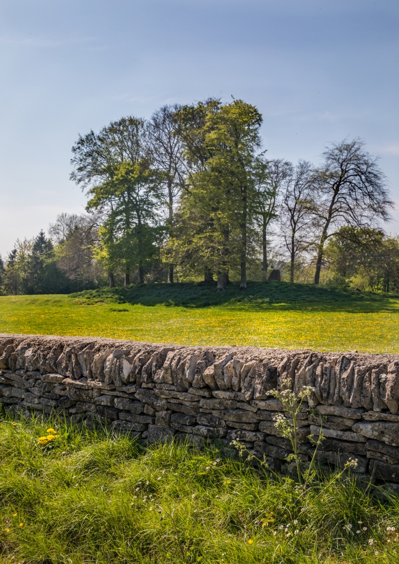
The monument includes a long barrow known as the Tingle Stone situated in the
Cotswold Hills below the crest of a ridge overlooking a valley to the south.
The barrow has a mound composed of small stones orientated north-south with
maximum dimensions of 40m in length, 20m in width and a maximum height of
c.2m. This is flanked on each side by a ditch from which material was quarried
during the construction of the monument. These have become infilled over the
years, but survive as buried features c.5m wide.
The site is named after the standing stone which is situated towards the
northern end of the monument. This stone is a block of oolitic limestone
orientated north-south with a maximum height of 1.5m above ground level and
dimensions of 0.6m by 0.3m.
There are reports of coins having been recovered from the site of the barrow
prior to 1789, although there are no records of an excavation.
The long barrow represents one of at least three long barrows which occur as a
dispersed group in the vicinity.
MAP EXTRACT
The site of the monument is shown on the attached map extract.
It includes a 2 metre boundary around the archaeological features,
considered to be essential for the monument's support and preservation.
Source: Historic England
Long barrows were constructed as earthen or drystone mounds with flanking
ditches and acted as funerary monuments during the Early and Middle Neolithic
periods (3400-2400 BC). They represent the burial places of Britain's early
farming communities and, as such, are amongst the oldest field monuments
surviving visibly in the present landscape. Where investigated, long barrows
appear to have been used for communal burial, often with only parts of the
human remains having been selected for interment. Certain sites provide
evidence for several phases of funerary monument preceding the barrow and,
consequently, it is probable that long barrows acted as important ritual sites
for local communities over a considerable period of time. Some 500 long
barrows are recorded in England. As one of the few types of Neolithic
structure to survive as earthworks, and due to their comparative rarity, their
considerable age and their longevity as a monument type, all long barrows are
considered to be nationally important.
The Tingle Stone long barrow survives well and will contain archaeological and
environmental evidence relating to the monument and the landscape in which it
was constructed. The occurrence of the standing stone on the mound is unusual.
This barrow is a good example representing a group of long barrows commonly
referred to as the Cotswold Severn group, named after the area in which they
occur. It is one of very few examples of this group not to have been
excavated.
Source: Historic England
Other
Mention finds from the site,
Mention the name of the site,
View of site,
Source: Historic England
Other nearby scheduled monuments