Approximate Location Map
Large Map »
This site is entirely user-supported. See how you can help.
Latitude: 54.3271 / 54°19'37"N
Longitude: -2.7443 / 2°44'39"W
OS Eastings: 351688.423231
OS Northings: 492650.583526
OS Grid: SD516926
Mapcode National: GBR 9L8D.NM
Mapcode Global: WH82W.THCL
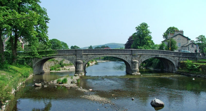
Entry Name: Miller Bridge
Scheduled Date:
Source: Historic England
Source ID: 1007109
English Heritage Legacy ID: CU 443
County: Cumbria
Civil Parish: Kendal
Built-Up Area: Kendal
Traditional County: Westmorland
Lieutenancy Area (Ceremonial County): Cumbria
Church of England Parish: Kendal Holy Trinity
Church of England Diocese: Carlisle
This record has been generated from an "old county number" (OCN) scheduling record. These are monuments that were not reviewed under the Monuments Protection Programme and are some of our oldest designation records. As such they do not yet have the full descriptions of their modernised counterparts available. Please contact us if you would like further information.
Source: Historic England
Other nearby scheduled monuments