Approximate Location Map
Large Map »
This site is entirely user-supported. See how you can help.
Latitude: 54.0934 / 54°5'36"N
Longitude: -0.2036 / 0°12'12"W
OS Eastings: 517586.380335
OS Northings: 467884.642567
OS Grid: TA175678
Mapcode National: GBR WP03.QC
Mapcode Global: WHHF6.VC7R
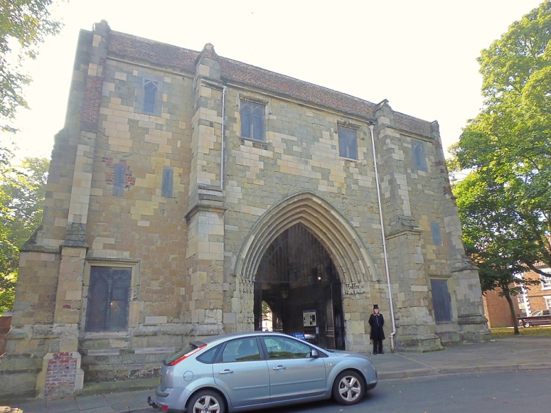
Entry Name: The Bayle Gate, Bridlington
Scheduled Date:
Source: Historic England
Source ID: 1005218
English Heritage Legacy ID: ER 184
County: East Riding of Yorkshire
Civil Parish: Bridlington
Built-Up Area: Bridlington
Traditional County: Yorkshire
Lieutenancy Area (Ceremonial County): East Riding of Yorkshire
Church of England Parish: Bridlington Priory Church (St Mary)
Church of England Diocese: York
This record has been generated from an "old county number" (OCN) scheduling record. These are monuments that were not reviewed under the Monuments Protection Programme and are some of our oldest designation records. As such they do not yet have the full descriptions of their modernised counterparts available. Please contact us if you would like further information.
Source: Historic England
Other nearby scheduled monuments