Approximate Location Map
Large Map »
This site is entirely user-supported. See how you can help.
Latitude: 51.6851 / 51°41'6"N
Longitude: -5.0884 / 5°5'18"W
OS Eastings: 186608
OS Northings: 202995
OS Grid: SM866029
Mapcode National: GBR G4.ZXC0
Mapcode Global: VH1RX.RXB3
Entry Name: The Tower
Scheduled Date:
Source: Cadw
Source ID: 3026
Cadw Legacy ID: PE068
Schedule Class: Defence
Category: Tower
Period: Medieval
County: Pembrokeshire (Sir Benfro)
Community: Angle
Traditional County: Pembrokeshire
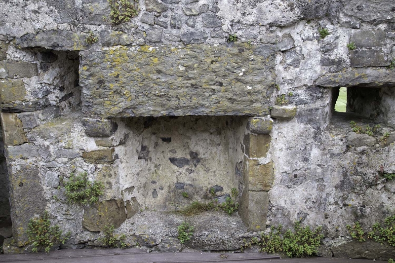
The monument comprises the remains of a well-preserved tower, thought to be part of a medieval moated mansion which is situated facing the medieval parish church above the tidal inlet at Angle. The tower is c 4.5m square and has walls with a battered base rising near to original height at 9.1m. There is a round stair tower on one corner with one square side. There are two slit lights on the south and the three sides without the stair tower have corbels which would have supported wall-top machicolations. There is a vaulted undercroft, a first floor entrance and three upper floors, the stairs survive to all floors though above the first they have fallen. The east side of the first has a garedrobe and there are later insertions of hearths to upper floors. The tower formerly stood within the southwest angle of a rectangular enclosure of c 24-32m across with a second similar tower at the opposite angle. A pond was set against its northern side and the remains of a dovecot (scheduled as PE067 Angle Dovecot) still stand c 50m to the north.
The monument is of national importance for its potential to enhance our knowledge of medieval settlement and construction techniques. The monument is well preserved and is an important relic of the medieval landscape. It retains significant archaeological potential, with a strong probability of the presence of intact archaeological deposits and structural evidence.
The scheduled area comprises an approximately rectangular area of c 10.75m east to west by 8.75m surrounding the tower within which related evidence may be expected to survive.
Source: Cadw
Other nearby scheduled monuments