Approximate Location Map
Large Map »
This site is entirely user-supported. See how you can help.
Latitude: 52.8721 / 52°52'19"N
Longitude: -4.0613 / 4°3'40"W
OS Eastings: 261360
OS Northings: 332508
OS Grid: SH613325
Mapcode National: GBR 5S.R3Y3
Mapcode Global: WH560.L28G
Entry Name: Moel Goedog Camp
Scheduled Date:
Source: Cadw
Source ID: 3213
Cadw Legacy ID: ME059
Schedule Class: Defence
Category: Hillfort
Period: Prehistoric
County: Gwynedd
Community: Harlech
Traditional County: Merionethshire
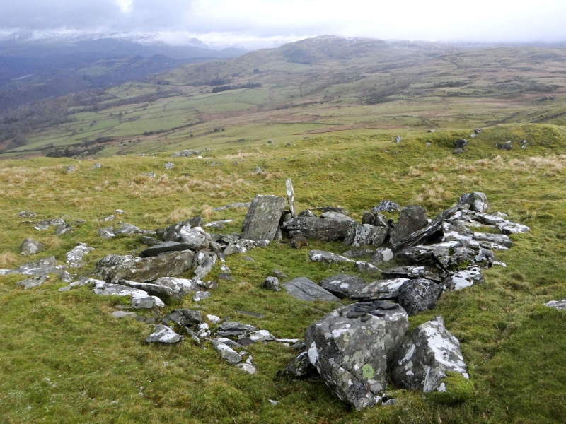
The monument comprises the remains of a hillfort, which probably dates to the Iron Age period (c. 800 BC - AD 74, the Roman conquest of Wales). Hillforts are usually located on hilltops and surrounded by a single or multiple earthworks of massive proportions. Hillforts must have formed symbols of power within the landscape, while their function may have had as much to do with ostentation and display as defence. The hillfort is located on a round grassy hill which rises to 369 m, it falls away on all sides but the E, where the ground forms a saddle before rising again to 378 m. The defences consist of two banks which encircle the hilltop, with traces of an external ditch accompanying each bank. The inner ditch is not very convincing, but the outer ditch is visible on the E side. The inner bank rises less than 0.5 m above the interior of the fort, and is about 3 m wide. The interior of the fort is nearly circular in plan, and reaches a maximum diameter of just over 100 m. There are no early features visible inside the fort, but there are the remains of two sheepfolds, one on the north east and one on the south east.
The monument is of national importance for its potential to enhance our knowledge of later prehistoric defensive organisation and settlement. The site forms an important element within the wider later prehistoric context and within the surrounding landscape. The site is well preserved and retains considerable archaeological potential. There is a strong probability of the presence of evidence relating to chronology, building techniques and functional detail.
The scheduled area comprises the remains described and areas around them within which related evidence may be expected to survive.
Source: Cadw
Other nearby scheduled monuments