Approximate Location Map
Large Map »
This site is entirely user-supported. See how you can help.
Latitude: 52.0089 / 52°0'32"N
Longitude: -5.0604 / 5°3'37"W
OS Eastings: 190056
OS Northings: 238923
OS Grid: SM900389
Mapcode National: GBR CG.HMGC
Mapcode Global: VH1QD.7RMT
Entry Name: Garn Fechan Camp
Scheduled Date:
Source: Cadw
Source ID: 2749
Cadw Legacy ID: PE471
Schedule Class: Defence
Category: Hillfort
Period: Prehistoric
County: Pembrokeshire (Sir Benfro)
Community: Pencaer (Pen-caer)
Traditional County: Pembrokeshire
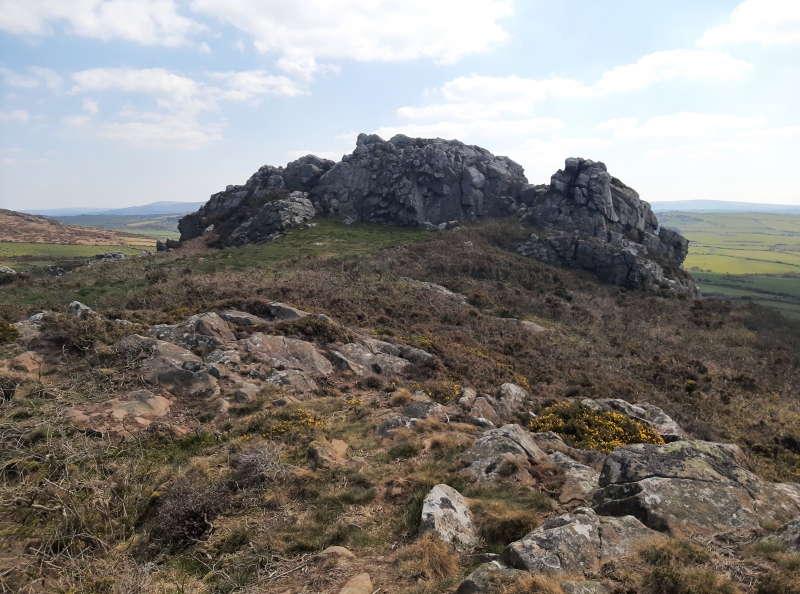
The monument comprises the remains of a hillfort, which probably dates to the Iron Age period (c. 800 BC - AD 74, the Roman conquest of Wales). Hillforts must have formed symbols of power within the landscape, while their function may have had as much to do with ostentation and display as defence. Garn Fechan consists of a complex and multi phase sequence of defences occupying a commanding craggy hill at 200m above sea level. The most of prominent of which is an enclosure defined by collapsed stone rampart surviving to c 0.7m internally and up to 2.6m externally. The enclosure is square in plan, 90m across and incorporates rocky outcrops in its circuit. Down-slope on the east side there are other lines of both earth and stone-built ramparts through which the original entrance passed. Each rampart seems to have had expanded terminals and a slight in turn at the entrance. On the west side a further rampart defines an annexe down-slope of the main enclosure. The interior has evidence of a number of hut circles and there are several rectangular structures built against the ramparts. Some hut circles underlie sections of rampart and are probably associated with an earlier phase of the fort represented by earth built banks within and partly without later defences.
The monument is of national importance for its potential to enhance our knowledge of later prehistoric defensive organisation and settlement. The site forms an important element within the wider later prehistoric context and within the surrounding landscape. The site is well preserved and retains considerable archaeological potential. There is a strong probability of the presence of evidence relating to chronology, building techniques and functional detail.
The scheduled area comprises the remains described and areas around them within which related evidence may be expected to survive.
Source: Cadw
Other nearby scheduled monuments