Approximate Location Map
Large Map »
This site is entirely user-supported. See how you can help.
Latitude: 53.0816 / 53°4'53"N
Longitude: -4.3347 / 4°20'4"W
OS Eastings: 243716
OS Northings: 356369
OS Grid: SH437563
Mapcode National: GBR 5F.9X35
Mapcode Global: WH43L.DS2Y
Entry Name: Dinas Dinlle Camp
Scheduled Date:
Source: Cadw
Source ID: 3169
Cadw Legacy ID: CN048
Schedule Class: Defence
Category: Promontory Fort - coastal
Period: Prehistoric
County: Gwynedd
Community: Llandwrog
Traditional County: Caernarfonshire
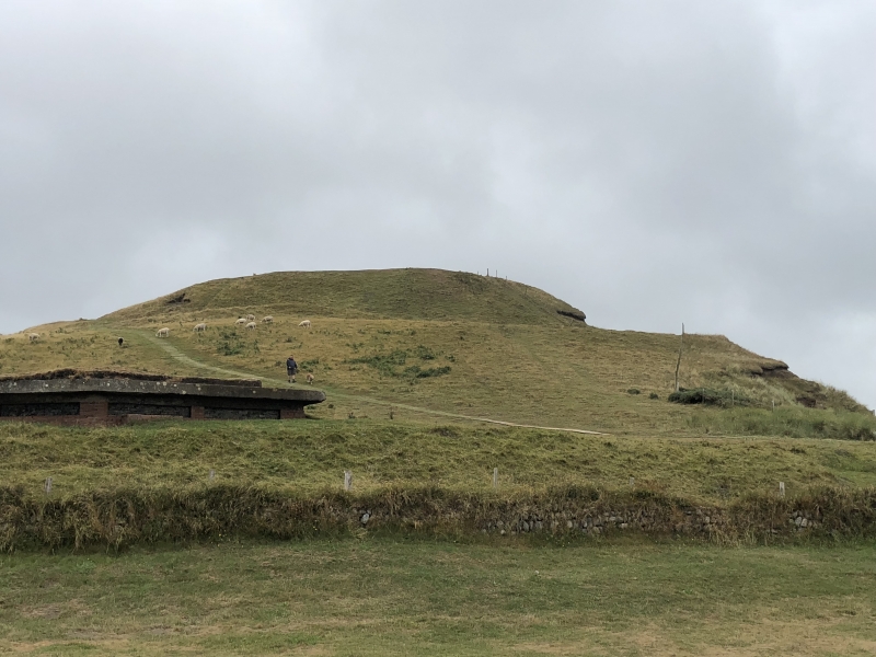
The monument comprises the remains of a hillfort, which probably dates to the Iron Age period (c.800 BC - AD 74, the Roman conquest of Wales). Hillforts are usually located on hilltops and surrounded by a single or multiple earthworks of massive proportions. Hillforts must have formed symbols of power within the landscape, while their function may have had as much to do with ostentation and display as defence.
A hillfort defended by two banks which now run around three sides of the fort. The W side faces the sea, and much of this side of the fort has been eroded away, but it would appear that the defences continued right round the fort and were not supposed to end on the cliff top as they do now.
The outer rampart rises some 8-10 m above the intervening ditch, and is best preserved on the S side; on the N and E sides it has eroded away to form a broad shelf. The inner rampart stands c.2 m above the level of the interior on the S side but rises to 6 m above on the N side, where the bank sits on a natural ridge. The entrance is on the SE, c.22 m wide, and is a simple passage formed by banks running across the ditch, so joining the inner and outer ramparts. The interior is fairly level and on the E side contains the remains of several round huts and enclosure walls, one of which appears to cut into the inner rampart.
A large, open mound of unknown date and function lies in the NE corner. Roman pottery and coins have been found in the interior of the fort. A modern footpath has been constructed up the NW corner of the site for use by the public.
The monument is of national importance for its potential to enhance our knowledge of prehistoric and Romano-British settlement and defence. It retains significant archaeological potential, with a strong probability of the presence of associated archaeological features and deposits. The structures themselves may be expected to contain archaeological information concerning chronology and building techniques.
The scheduled area comprises the remains described and areas around them within which related evidence may be expected to survive.
Source: Cadw
Other nearby scheduled monuments