Approximate Location Map
Large Map »
This site is entirely user-supported. See how you can help.
Latitude: 53.123 / 53°7'22"N
Longitude: -4.3152 / 4°18'54"W
OS Eastings: 245172
OS Northings: 360934
OS Grid: SH451609
Mapcode National: GBR 5G.786Z
Mapcode Global: WH43D.PRBP
Entry Name: Cored Gwyrfai Fish Weir
Scheduled Date: 19 November 2002
Source: Cadw
Source ID: 3905
Cadw Legacy ID: CN334
Schedule Class: Agriculture and Subsistence
Category: Fish weir
Period: Medieval
County: Gwynedd
Community: Bontnewydd
Traditional County: Caernarfonshire
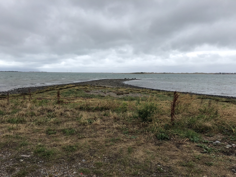
The monument consists of the well preserved remains of a fish weir, dating to the medieval period. A fish weir is usually characterised by a foundation of stone topped with a fence or row of stakes, often with nets attached forming an enclosure within a river or harbour and used for catching, or holding, fish. The monument comprises a rectilinear weir defined by spread banks of stone some 4.0m wide and 0.5m high. The inner wall runs from a promontory at 90 degrees to the shore and is some 120m long. Wooden stakes 10 to 15cm in diameter are clearly visible along much of its length. The outer wall runs to the south at a right angle and is some 150m in length. A substantial spur, 100m in length, turns back to the shore at 45 degrees from the southern end of the outer arm. The weir is referred to in letters patent of Edward IV (1461-1483).
The monument is of national importance for its potential to enhance our knowledge of medieval maritime agricultural practices. It retains significant archaeological potential, with a strong probability of the presence of associated archaeological features and deposits, including preserved wood. The structure itself may be expected to contain archaeological information concerning chronology and building techniques.
The scheduled area comprises the remains described and areas around them within which related evidence may be expected to survive.
Source: Cadw
Other nearby scheduled monuments