Approximate Location Map
Large Map »
This site is entirely user-supported. See how you can help.
Latitude: 56.2422 / 56°14'31"N
Longitude: -3.2212 / 3°13'16"W
OS Eastings: 324410
OS Northings: 706186
OS Grid: NO244061
Mapcode National: GBR 27.BN9G
Mapcode Global: WH6R7.HC9J
Entry Name: East Lomond Hill, fort and cairn
Scheduled Date: 15 June 1936
Last Amended: 16 January 2014
Source: Historic Environment Scotland
Source ID: SM810
Schedule Class: Cultural
Category: Crosses and carved stones: symbol stone; Prehistoric domestic and defensive: fort (includes hill and
Location: Falkland
County: Fife
Electoral Ward: Howe of Fife and Tay Coast
Traditional County: Fife
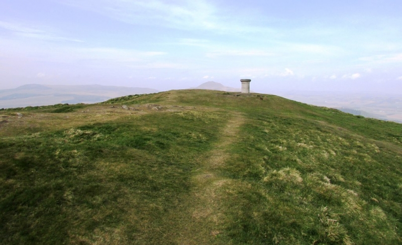
The monument is the remains of a prehistoric fort and burial cairn on the summit of East Lomond Hill. The hill fort is likely to have been in use in the Iron Age (sometime between 500 BC and AD 600), while the burial cairn is earlier and dates probably from the Bronze Age. The remains of the cairn are visible on the summit as a low, circular turf-covered concentration of stones, measuring around 13m across. The remains of the fort extend over an area of some 2.3 hectares, comprising a summit enclosure and a complex series of defences that exploit the contours of the hill. The summit enclosure is pear-shaped and measures around 61m by 30m, with its long axis orientated NW-SE. It is defined by a low bank, presumably a collapsed rampart. Other earth and stone ramparts and artificial terraces extend down the lower slopes on the N, E and S sides of the fort, but are absent on the precipitous W side. A well-defined traverse connects the lower ramparts and terraces on the steep northern slope. Along the more accessible S side of the hill, the defences include a series of walls, a massive rampart of earth and stone and an external ditch. The line of approach is from the SE, where an entrance way up to 15m wide is visible running across the defences. The multi-period nature of the site is demonstrated by several important finds, including a cup-and-ring marked rock of likely Bronze Age date identified in 1978 and a Pictish slab bearing an incised bull of early historic date, both found within the fort. The monument occupies a commanding position on the summit of East Lomond Hill around 448m above OD. It has excellent views in all directions and can be seen from great distances S of the Firth of Forth and N of the Tay Estuary. The monument was first scheduled in 1936, but the documentation did not meet modern standards: the present rescheduling rectifies this.
The scheduled area is irregular on plan to include the remains described above and an area around them within which evidence relating to the monument's construction, use and abandonment is expected to survive, as shown in red on the accompanying map. The scheduling specifically excludes the above-ground elements of a summit viewing plinth and the top 30cm of all modern paths to allow for their maintenance and repair.
Source: Historic Environment Scotland
The monument is of national importance as the upstanding remains of a multi-period site, which includes a prehistoric burial cairn and an Iron Age hill fort with complex defences, which is probably of more than one phase in itself. Limited archaeological investigations have recovered a range of artefacts, including a Pictish carved stone, a mould for casting metal ingots and glass beads, as well as a cup-and-ring marked rock. The monument has considerable potential to make a significant addition to understanding of early prehistoric burial practices and Iron Age and later defensive and domestic settlement and economy. Its importance is enhanced by its highly visible position in the landscape and its relationship with two other Iron Age hill forts, at Maiden Castle and West Lomond, 2km and 4.7km to the W respectively, which occupy similarly commanding positions. Our understanding of the distribution and character of late Iron Age and early medieval settlements would be diminished if this monument was to be lost or damaged.
Source: Historic Environment Scotland
Bibliography
The principal component of the monument, the fort, is recorded by RCAHMS as NO20NW 20. Three other RCAHMS entries (NO20NW 20.1, NO20NW 23 and NO20NW 59) refer to artefacts found on the hill.
Corrie J M 1926 'Notice of (1) certain bronze implements from Dumfriesshire; and (2) a symbol stone from East Lomond Hill, Fife, recently presented to the National Museum', Proc Soc Antiq Scot 60 (1925-6), 27-34.
Feachem, R 1963, A guide to prehistoric Scotland, London: Batsford, 125.
Kenworthy, M 1978 Lomond Hills Survey, Discovery and Excavation in Scotland 1978, 6.
RCAHMS RCAHMS (1933) The Royal Commission on the Ancient and Historical Monuments and Constructions of Scotland. Eleventh report with inventory of monuments and constructions in the counties of Fife, Kinross and Clackmannan, 143-4, no. 244. Edinburgh.
Source: Historic Environment Scotland
Other nearby scheduled monuments