Approximate Location Map
Large Map »
This site is entirely user-supported. See how you can help.
Latitude: 56.5777 / 56°34'39"N
Longitude: -3.1736 / 3°10'24"W
OS Eastings: 327999
OS Northings: 743475
OS Grid: NO279434
Mapcode National: GBR VD.JQQ1
Mapcode Global: WH6PJ.7X0V
Entry Name: Macbeth's Stone, standing stone
Scheduled Date: 16 April 1964
Last Amended: 23 February 1998
Source: Historic Environment Scotland
Source ID: SM2408
Schedule Class: Cultural
Category: Prehistoric ritual and funerary: standing stone
Location: Meigle
County: Perth and Kinross
Electoral Ward: Strathmore
Traditional County: Perthshire
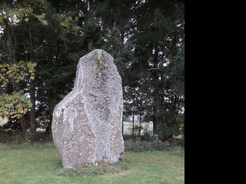
The monument comprises a standing stone of prehistoric date, first scheduled in 1964. It is being rescheduled in order to clarify the extent of the scheduled area and to ensure protection for buried archaeological deposits in the immediate vicinity of the stone.
The monument is located SW of the SW gate-lodge of the Belmont Castle policies at around 60m OD. It comprises a standing stone measuring approximately 1.8m by 1.3m at the base, and some 3.6m in height, tapering to a thickness of about 0.3m at the top. On the broad E face there are approximately forty cupmarks, each measuring up to about 6cm in diameter. On the W face there are approximately twenty similar cupmarks. In addition, there are two cupmarks low down on the S face and a single cupmark on the N face.
Standing stones of this type usually relate to ritual activity of Neolithic or Bronze Age date. Cupmarks are decorative circular depressions, generally of similar date.
The area proposed for scheduling comprises the standing stone and an area around it within which related material may be expected to be found. It is irregular in shape with maximum dimensions of 20m between its N-most and S-most points, and 20m between its E-most and W-most points, as marked in red on the accompanying map extract.
Source: Historic Environment Scotland
Bibliography
No Bibliography entries for this designation
Source: Historic Environment Scotland
Other nearby scheduled monuments