Approximate Location Map
Large Map »
This site is entirely user-supported. See how you can help.
If Google Street View is available, the image is from the best available vantage point looking, if possible, towards the location of the monument. Where it is not available, the satellite view is shown instead.
Latitude: 57.5976 / 57°35'51"N
Longitude: -3.7011 / 3°42'3"W
OS Eastings: 298426
OS Northings: 857667
OS Grid: NH984576
Mapcode National: GBR K87N.1C3
Mapcode Global: WH5H9.39VH
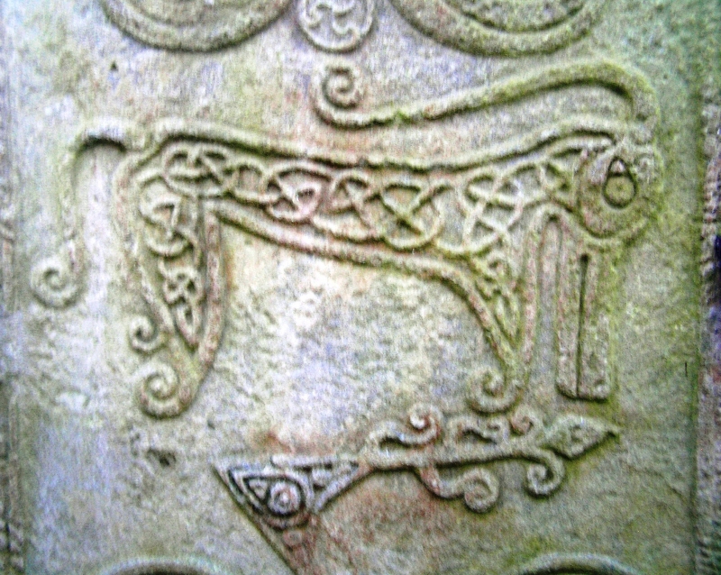
Entry Name: Rodney's Stone,cross slab 450m ESE of Brodie Castle
Scheduled Date: 16 November 1923
Source: Historic Environment Scotland
Source ID: SM1226
Schedule Class: Cultural
Category: Crosses and carved stones: cross slab
Location: Dyke and Moy
County: Moray
Electoral Ward: Forres
Traditional County: Morayshire
Bibliography
No Bibliography entries for this designation
Source: Historic Environment Scotland
Other nearby scheduled monuments