Approximate Location Map
Large Map »
This site is entirely user-supported. See how you can help.
Latitude: 59.1239 / 59°7'25"N
Longitude: -3.0814 / 3°4'52"W
OS Eastings: 338194
OS Northings: 1026836
OS Grid: HY381268
Mapcode National: GBR L4RM.94K
Mapcode Global: WH695.MXWY
Entry Name: Aiker Ness,Broch of Gurness,broch and settlement
Scheduled Date: 4 May 1994
Source: Historic Environment Scotland
Source ID: SM90157
Schedule Class: Cultural
Category: Prehistoric domestic and defensive: broch
Location: Evie and Rendall
County: Orkney Islands
Electoral Ward: West Mainland
Traditional County: Orkney
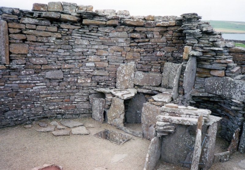
The monument consists of an Iron Age defended settlement centred upon a broch and situated on the promontory of Aikerness.
The site was excavated from 1929 and has been laid out for visitors. It is in the care of the Secretary of State for Scotland. Gurness is a complex monument of many phases, constructed over the last centuries BC and the early centuries AD. The monument takes the form of a large semi-circular platform encircled by a triple line of ditch and rampart. On the seaward, N, side these defences have been truncated by the sea.
On the platform, off-centre towards the W, stands the remaining 4m of a broch, while to the S and E are the
remains of a cluster of small houses and yards. The entrance to the platform is aligned with the entrance to the broch and is from the E. The terminals of the outer ditches have been particularly carefully faced with stone, and there is a clearly ceremonial appearance about
the approach.
There is evidence for several phases of construction,
and in particular the ditches and ramparts appear to have become gradually obsolete as defensive elements over time, being reduced and in places partly infilled. A later group of small buildings, probably of fifth century date AD, has been moved and reconstructed to the W of the main complex.
The area to be scheduled is that contained within the boundary fence, and measures a maximum of 115m E-W by 75m N-S to include the broch, its external and internal buildings, the ramparts and ditches and an area around and between them in which evidence relating to the construction and use of the monument may be expected to survive.
It also includes the group of buildings which has been moved but excludes the visitor centre and the area beneath it as they exist at the date of scheduling. The area to be scheduled is marked in red on the accompanying map.
Source: Historic Environment Scotland
The monument is of national importance as the finest example of a broch and external settlement so far excavated. The length of the sequence of structures and deposits and their inter-relationship afford a quite exceptional opportunity for study of the developing structure of Iron Age society as well as for the development of architectural techniques.
Although subsequently excavated, there are considerable areas as yet undisturbed which can be expected to contain important evidence to supplement and extend that already gathered, with particular potential for an understanding of the agricultural and domestic economy of the period. Gurness is arguably the single most important excavated Iron Age site in northern Scotland.
Source: Historic Environment Scotland
Bibliography
RCAHMS records the monument as HY 32 NE 5.
Reference:
Hedges, J. W. (1987) Bu, Gurness and the Brochs of Orkney, part 2: Gurness, Brit Archaeol Rep, BAR British, vol. 164 Oxford. 81.
Historic Environment Scotland Properties
Broch of Gurness
https://www.historicenvironment.scot/visit-a-place/places/broch-of-gurness
Find out more
Source: Historic Environment Scotland
Other nearby scheduled monuments