Approximate Location Map
Large Map »
This site is entirely user-supported. See how you can help.
Latitude: 56.1643 / 56°9'51"N
Longitude: -3.3724 / 3°22'20"W
OS Eastings: 314870
OS Northings: 697694
OS Grid: NT148976
Mapcode National: GBR 21.HQB2
Mapcode Global: WH6RK.5BC7
Entry Name: Benarty Hill, fort
Scheduled Date: 1 December 2000
Source: Historic Environment Scotland
Source ID: SM7601
Schedule Class: Cultural
Category: Prehistoric domestic and defensive: fort (includes hill and promontory fort)
Location: Cleish
County: Perth and Kinross
Electoral Ward: Kinross-shire
Traditional County: Kinross-shire
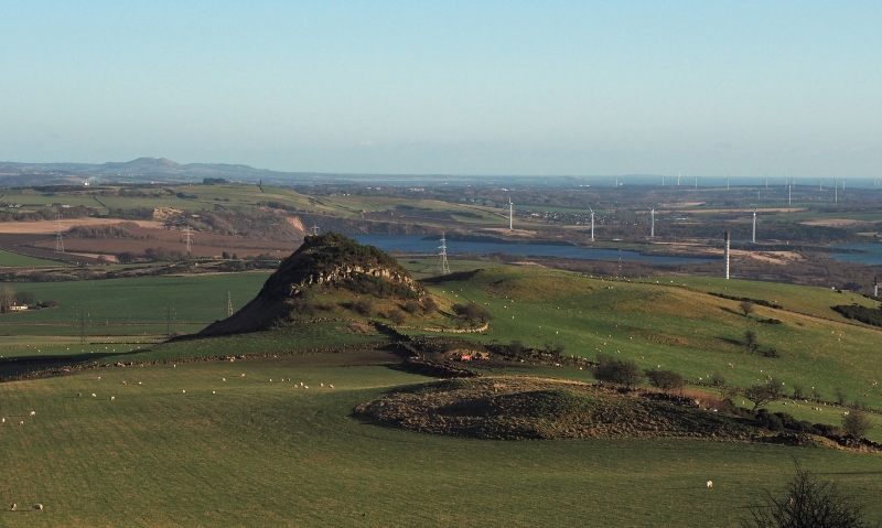
The monument comprises a fort of prehistoric date, visible as upstanding remains.
The monument lies in rough grassland at around 325m OD, on a ridge which runs W from the massif of Benarty Hill towards Castle Craig. It comprises a fort of irregular shape, measuring about 250m E-W by a maximum of about 100m transversely.
On the N, the fort is protected by a natural escarpment, while to the SW steep rock faces and marshy ground provide strong natural protection. The S approach to the fort was protected by a rampart comprising a single stone wall which has been extensively robbed, leaving in situ occasional revetment stones. Two probable entrances, one at either end, are approached by hollow ways.
The area proposed for scheduling comprises the remains described and an area around them within which related material may be expected to be found. It is polygonal, measuring 350m E-W by 290m NNW-SSE, as marked in red on the accompanying map extract.
Source: Historic Environment Scotland
The monument is of national importance because of its potential to contribute to our understanding of prehistoric defended settlement and economy.
Source: Historic Environment Scotland
Bibliography
RCAHMS records the monument as NT 19 NW 7.
Source: Historic Environment Scotland
Other nearby scheduled monuments