Approximate Location Map
Large Map »
This site is entirely user-supported. See how you can help.
Latitude: 56.459 / 56°27'32"N
Longitude: -3.0551 / 3°3'18"W
OS Eastings: 335074
OS Northings: 730148
OS Grid: NO350301
Mapcode National: GBR Z0D.W6
Mapcode Global: WH7R9.1XGB
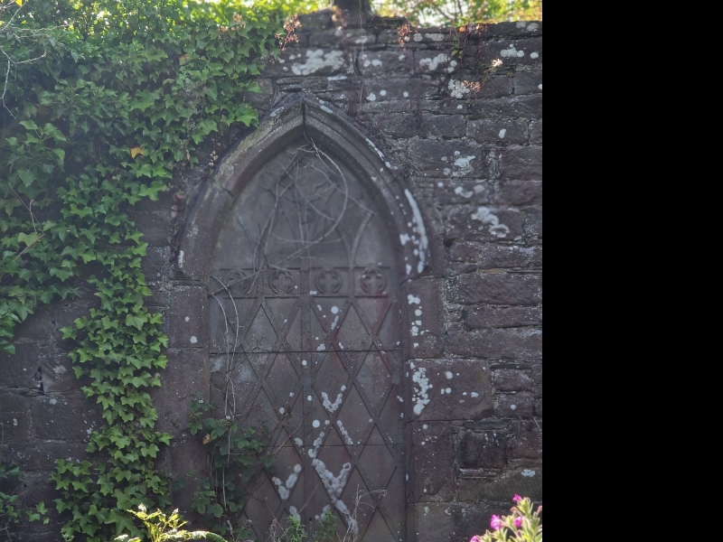
Entry Name: St Peter's Church & graveyard, Invergowrie
Scheduled Date: 12 November 1970
Source: Historic Environment Scotland
Source ID: SM2996
Schedule Class: Cultural
Category: Ecclesiastical: burial ground, cemetery, graveyard
Location: Dundee
County: Perth and Kinross
Electoral Ward: Carse of Gowrie
Traditional County: Perthshire
Dated 1843. Single storey, 6-bay, paired L-plan cottages in estate style with advanced stone gabled bay to penultimate right with shaped hoodmold and infilled slit detail to apex. Timber-bracketed overhanging eaves with cross bracing and delicate timber finials to gable apexes. Finely tooled whinstone rubble with droved sandstone quoins. Later 20th century rendered extension to rear to form U-plan. Townhead Cottage to S and Barjols to N.
12-pane lying-pane glazing in timber sash and case windows to principal elevation, later 20th century glazing patterns to rear. Plain boarded doors. Grey slates. Shouldered diamond-plan shafted ridge stacks. Cast-iron rainwater goods.
Source: Historic Environment Scotland
Bibliography
No Bibliography entries for this designation
Source: Historic Environment Scotland
Other nearby scheduled monuments