Approximate Location Map
Large Map »
This site is entirely user-supported. See how you can help.
Latitude: 58.5632 / 58°33'47"N
Longitude: -4.7199 / 4°43'11"W
OS Eastings: 241881
OS Northings: 967106
OS Grid: NC418671
Mapcode National: GBR G6Q3.2RG
Mapcode Global: WH26R.G1N7
Entry Name: Smoo Cave,prehistoric occupation site
Scheduled Date: 9 December 1992
Source: Historic Environment Scotland
Source ID: SM5482
Schedule Class: Cultural
Category: Prehistoric domestic and defensive: cave
Location: Durness
County: Highland
Electoral Ward: North, West and Central Sutherland
Traditional County: Sutherland
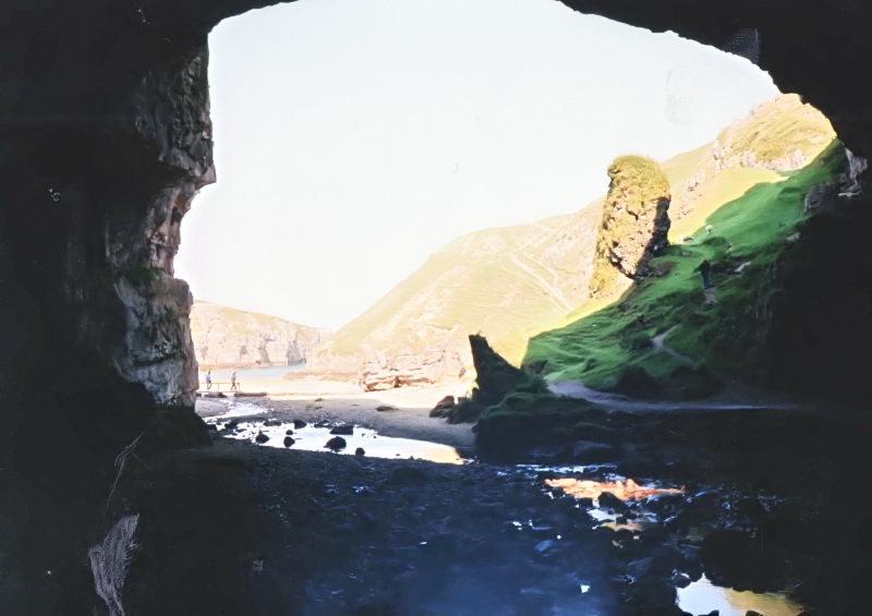
The monument consists of deposits related to human occupation which occur on the floor of Smoo Cave. Smoo Cave is situated at the head of a narrow inlet which runs inland 600m from the N coast of Durness. It consists of a main cave (33m wide and 48m deep) and a series of smaller, subsidiary, caves. Visible archaeological deposits are confined to the main cave and consist of a midden covering much of the E portion of the cave; this is at least 17m long and a maximum of 8m wide.
At its deepest the midden is a minimum of 1.3m deep. It is likely, however, that significant deposits may extend over the whole of the cave floor, beneath the present floor level. Recent excavation of the exposed section of the midden has revealed at least three phases of human activity. The bottom layer was not studied in detail, but could be Mesolithic in date. This was sealed by a layer of sand. On top of this was evidence for 2 successive occupation deposits, containing charcoal, animal bone and possible stone structures.
The final layer was a shell midden of probable Iron Age to Medieval date. The area to be scheduled measures 35m NNE-SSW by a maximum of 30m WNW-ESE, to include the middens and an area to the S and W in which further archaeological deposits may survive below the present floor of the cave, as shown in red on the accompanying map.
Source: Historic Environment Scotland
The monument is of national importance for its potential contribution to an understanding of the way of life and economy of successive human communities in the north of Scotland over a period possibly dating from as early as 10,000 years ago until the present day. The lowest deposit may well be of Mesolithic date and, if so, this is the furthest N that Mesolithic finds have been made in Scotland.
Source: Historic Environment Scotland
Bibliography
RCAHMS records the monument as NC 46 NW 6.
Source: Historic Environment Scotland
Other nearby scheduled monuments