Ancient Monuments

History on the Ground

This site is entirely user-supported. See how you can help.

Hare Cairn,cairn 600m west of Keir

A Scheduled Monument in Mid Formartine, Aberdeenshire

More Photos »
Approximate Location Map
Large Map »

If Google Street View is available, the image is from the best available vantage point looking, if possible, towards the location of the monument. Where it is not available, the satellite view is shown instead.

Coordinates

Latitude: 57.2495 / 57°14'58"N

Longitude: -2.0758 / 2°4'32"W

OS Eastings: 395523

OS Northings: 817652

OS Grid: NJ955176

Mapcode National: GBR XQ.RZLT

Mapcode Global: WH9QC.21SR

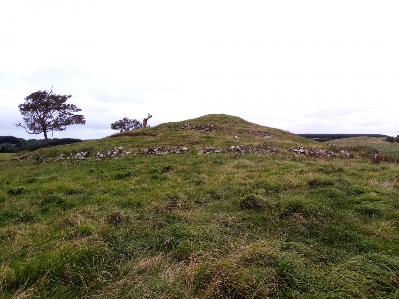
Entry Name: Hare Cairn,cairn 600m W of Keir

Scheduled Date: 6 July 1973

Source: Historic Environment Scotland

Source ID: SM3277

Schedule Class: Cultural

Category: Prehistoric ritual and funerary: cairn (type uncertain)

Location: Belhelvie

County: Aberdeenshire

Electoral Ward: Mid Formartine

Traditional County: Aberdeenshire

Sources

Bibliography
No Bibliography entries for this designation

Source: Historic Environment Scotland

Other nearby scheduled monuments

AncientMonuments.uk is an independent online resource and is not associated with any government department. All government data published here is used under licence. Please do not contact AncientMonuments.uk for any queries related to any individual ancient or schedued monument, planning permission related to scheduled monuments or the scheduling process itself.

AncientMonuments.uk is a Good Stuff website.