Approximate Location Map
Large Map »
This site is entirely user-supported. See how you can help.
Latitude: 54.4975 / 54°29'51"N
Longitude: -0.9425 / 0°56'32"W
OS Eastings: 468589.168603
OS Northings: 511871.086602
OS Grid: NZ685118
Mapcode National: GBR PJVF.RJ
Mapcode Global: WHF8N.H6FY
Entry Name: Bronze Age enclosed urnfield on Moorsholm Moor, 300m west of Dimmingdale Farm
Scheduled Date: 7 June 1974
Last Amended: 19 March 1999
Source: Historic England
Source ID: 1018806
English Heritage Legacy ID: 32004
County: Redcar and Cleveland
Civil Parish: Lockwood
Traditional County: Yorkshire
Lieutenancy Area (Ceremonial County): North Yorkshire
Church of England Parish: Moorsholm
Church of England Diocese: York
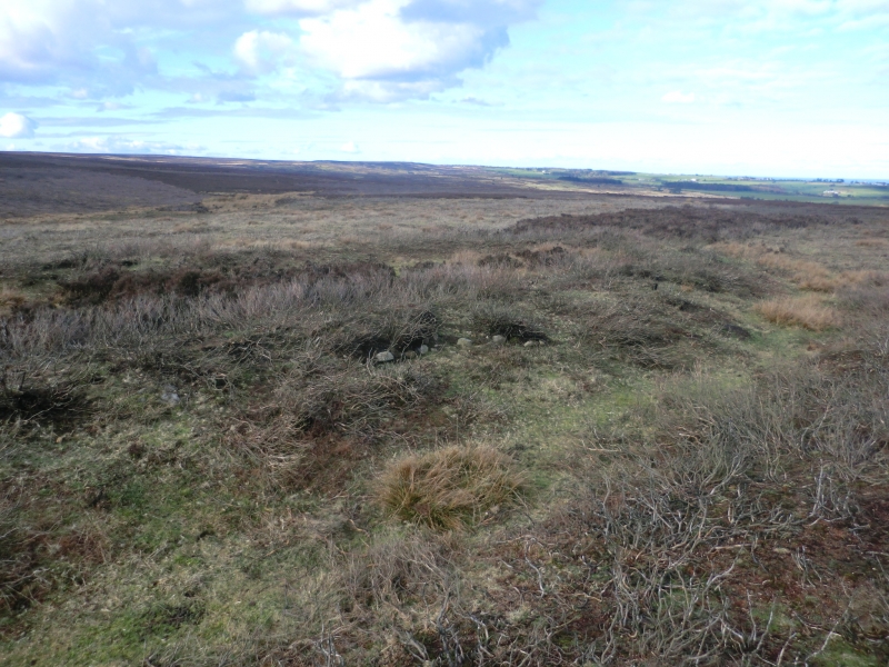
The monument includes an oval earthwork identified as a Bronze Age urnfield
situated in a prominent position on the northern edge of the North York Moors.
It is visible as a well defined oval, enclosed by a continuous earthen bank up
to 2.5m wide and standing up to 0.7m high. It has maximum dimensions of 35m
north to south and 18m east to west. The bank was originally faced with a kerb
of stones around the outer edge and these are visible in two places on the
north west and south east of the perimeter. The bank is surrounded by a ditch
up to 2m wide and 0.3m deep. This is no longer visible on the north west side
of the enclosure, having been filled in over the years by soil slipping from
the bank. The ditch was originally surrounded by an outer bank up to 2m wide
but this has weathered away with time and is no longer visible as an
earthwork, apart from traces which can be seen on the southern and eastern
edges of the enclosure. Partial excavation in 1959 uncovered a pit in the
centre of the southern half and this was interpreted as a cremation pit.
The monument lies in an area rich in prehistoric monuments, including barrows,
field systems and clearance cairns.
MAP EXTRACT
The site of the monument is shown on the attached map extract.
It includes a 2 metre boundary around the archaeological features,
considered to be essential for the monument's support and preservation.
Source: Historic England
An enclosed Bronze Age urnfield is a burial ground in which cremations,
usually placed in cinerary urns, were interred within a circular enclosure up
to 30m in diameter. This was formed by either a ditch, a bank, or a bank
within a stone circle. There was normally an entrance or causeway allowing
access into the enclosure, where a central mound or standing stone is
sometimes found. Excavated examples are known to date to the Middle Bronze Age
between the 16th and 11th centuries BC. Enclosed Bronze Age urnfields are
largely found in the north of England, mainly in Yorkshire, Cumbria and
Northumberland, although their distribution also extends into Scotland. They
are a rare type of Bronze Age burial monument, with fewer than 50 identified
examples and provide an important insight into beliefs and social organisation
during this period. All positively identified examples are considered to be
nationally important
Despite limited disturbance the urnfield on Moorsholm Moor, 300m west of
Dimmingdale Farm is in a good state of preservation. Significant information
about the date and form of its construction will be preserved. Important
evidence for the nature and duration of the rituals involved in its use will
survive in the interior of the enclosure. Evidence for earlier land use and
the contemporary environment will also survive beneath the banks and within
the buried ditch.
This monument is one of only four or five similar embanked oval enclosures on
the North York Moors which are interpreted as a regionally distinct form of
urnfield. They share characteristics in common with funerary and ritual
monuments of both Late Neolithic and Bronze Age date and as such will contain
important information to aid our understanding of the development and
complexity of funerary and ritual practice during these periods. This example
is situated in a group of prehistoric monuments which also includes round
barrows, cup marked rocks, clearance cairns and a stone hut circle. Monument
groupings such as these offer important scope for the study of the
distribution of prehistoric activity across the landscape.
Source: Historic England
Books and journals
Crawford, G M, Bronze Age Burial Mounds in Cleveland, (1980)
Hayes, R H, 'Research report' in The Chambered Cairn and adjacent monuments on Great Ayton Moor, , Vol. 7, (1967), 34-35
Vyner, B, 'Antiquity' in The Territory Of Ritual: Cross-Ridge Boundaries in Cleveland, , Vol. 68, (1994), 27-38
Source: Historic England
Other nearby scheduled monuments