Approximate Location Map
Large Map »
This site is entirely user-supported. See how you can help.
Latitude: 54.3067 / 54°18'24"N
Longitude: -0.9307 / 0°55'50"W
OS Eastings: 469675.413834
OS Northings: 490647.161371
OS Grid: SE696906
Mapcode National: GBR PLYM.9Y
Mapcode Global: WHF9M.P00R
Entry Name: Four round barrows one 400m and three 540m east of Grouse Hall
Scheduled Date: 25 October 1969
Last Amended: 24 October 1997
Source: Historic England
Source ID: 1016023
English Heritage Legacy ID: 30105
County: North Yorkshire
Civil Parish: Hutton-le-Hole
Traditional County: Yorkshire
Lieutenancy Area (Ceremonial County): North Yorkshire
Church of England Parish: Lastingham St Mary
Church of England Diocese: York
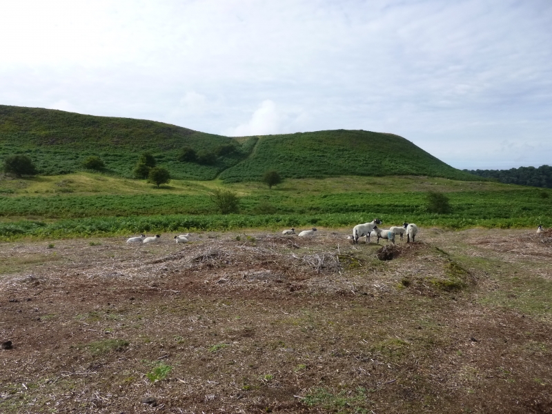
The monument, which is divided into two areas of protection, includes the
remains of four round barrows surviving as upstanding earthworks within open
moorland between Grouse Hall and Barmoor. The eastern area includes three
regularly spaced barrows lying in a roughly east-west line. The fourth barrow
lies in a second area about 150m to the west. All four barrows lie on a slight
ridge between two west draining water courses. A pair of barrows, which are
the subject of a separate scheduling (SM 30104), lie about 450m to the north
east.
A large group of rectangular earthen mounds extends from 150m to the south and
are of a much later date, being the remains of pillow mounds (artificial
rabbit warrens). These are also the subject of a separate scheduling (SM
30106).
The group of three round barrows forming the first area of protection have
been identified as the barrows partly excavated by a group of miners around
1900. A number of Bronze Age cremation urns are reported to have been found,
one of which was given to York Museum. All three barrows survive as roughly
11m diameter mounds standing up to 0.4m high, each with a central depression
considered to be the result of the miners' investigations. There is also
evidence, in the form of slight depressions, that each also had a roughly 2m
wide encircling ditch, now largely infilled.
The fourth barrow to the west survives as a mound about 11m in diameter
standing up to 0.3m high. It does not have a central depression and shows no
signs of any other disturbance beyond natural weathering. The barrow retains
evidence of an encircling ditch about 2m wide shown as a slight depression and
level area around the mound.
Excavation of round barrows in the region has shown that they demonstrate a
very wide range of burial rites from simple scatters of cremated material to
coffin inhumations and cremations contained in urns, typically dating to the
Bronze Age. A common factor is that barrows were normally used for more than
one burial and that the primary burial was frequently on or below the original
ground surface, often with secondary burials located in the body of the mound.
Most of the barrows include a small number of grave goods. These are often
small pottery food vessels, but stone, bone, jet and bronze items have also
occasionally been found. Shallow ditches and/or stone kerbs immediately
encircling the mounds are also quite common.
MAP EXTRACT
The site of the monument is shown on the attached map extract.
It includes a 2 metre boundary around the archaeological features,
considered to be essential for the monument's support and preservation.
Source: Historic England
Bowl barrows, the most numerous form of round barrow, are funerary monuments
dating from the Late Neolithic period to the Late Bronze Age, with most
examples belonging to the period 2400-1500 BC. They were constructed as
earthen or rubble mounds, sometimes ditched, which covered single or multiple
burials. They occur either in isolation or grouped as cemeteries and often
acted as a focus for burials in later periods. Often superficially similar,
although differing widely in size, they exhibit regional variations in form
and a diversity of burial practices. There are over 10,000 surviving bowl
barrows recorded nationally (many more have already been destroyed), occurring
across most of lowland Britain. Often occupying prominent locations, they are
a major historic element in the modern landscape and their considerable
variation of form and longevity as a monument type provide important
information on the diversity of beliefs and social organisations amongst early
prehistoric communities. They are particularly representative of their period
and a substantial proportion of surviving examples are considered worthy of
protection.
The Grouse Hall round barrows are good examples of their type and are well
preserved, especially the outlying barrow to the west. They will retain
important archaeological information. Their importance is heightened by the
survival of a further pair of slightly larger round barrows to the north east.
Source: Historic England
Other nearby scheduled monuments