Approximate Location Map
Large Map »
This site is entirely user-supported. See how you can help.
Latitude: 52.8727 / 52°52'21"N
Longitude: -3.0478 / 3°2'52"W
OS Eastings: 329567.544372
OS Northings: 331089.383413
OS Grid: SJ295310
Mapcode National: GBR 73.R44S
Mapcode Global: WH89X.42X2
Entry Name: Old Oswestry hillfort, and two adjacent sections of Wat's Dyke
Scheduled Date: 15 May 1934
Last Amended: 8 December 1997
Source: Historic England
Source ID: 1014899
English Heritage Legacy ID: 27556
County: Shropshire
Civil Parish: Selattyn and Gobowen
Traditional County: Shropshire
Lieutenancy Area (Ceremonial County): Shropshire
Church of England Parish: Gobowen All Saints
Church of England Diocese: Lichfield
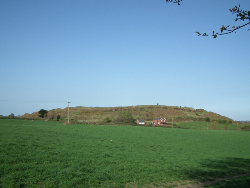
The monument includes the earthwork and buried remains of the hillfort of Old
Oswestry, which is situated on a glacial mound north of the town of Oswestry,
with sweeping views to west, north and east. The site has been known by a
variety of names, including Caer Ogyrfan, after the father of Guinevere, and
Yr hen Ddinas, meaning the old fort or city. Finds of flints and a stone axe
suggest there has been activity at the site since the Neolithic period, and
excavation has revealed occupation from the Late Bronze Age through to the end
of the Iron Age. In the eighth century AD the hillfort was incorporated into
the line of Wat's Dyke, which extends to the north and south, and the two
sections of dyke adjacent to the hillfort are included in the scheduling. Old
Oswestry saw military use during the First World War, when it was used for
training exercises by troops based at nearby Park Hall camp.
Old Oswestry has a roughly diamond-shaped plan, with maximum dimensions of
570m north east to south west by 420m transversely. It is a multivallate
hillfort, having ramparts of five earthen banks and ditches, interrupted by
two complex entrances, one on the east side and one on the west. The inner two
banks and ditches are the earliest of the earthworks visible today, probably
dating to around the sixth century BC, and they enclose a gently domed area of
c.8.4ha. They comprise an earthen bank with a flattish top and steep outer
slope with a ditch some distance outside it, and a second, slighter bank
beyond. Both banks completely surround the hilltop, except where they are
broken by the entrances. A third bank and ditch extend around the west side of
the hillfort, the bank surviving to c.2.4m in places. Downslope of these, to
the north and south of the western entrance, are a series of roughly
rectangular hollows between additional steeply sloping banks. They have been
variously described as cisterns, storage pits, stock enclosures, and quarry
pits, although their regular shape would argue against the latter. The outer
and latest phase of defences are formed by two massive `glacis style' earthen
banks with steep sides rising directly from the bottom of their deep outer
ditches and standing up to 6m high. These banks and ditches again surround the
whole hillfort except where broken by the entrances, and the banks survive in
places up to 6m high. Both entrances were initially created by inturning the
inner bank to form short passages into the hillfort's interior. As the
defences developed, the western entrance in particular became more complex,
and survives today as a sunken approach flanked on both sides by transverse
banks and ditches extending to the outer edge of the rampart. The eastern
entrance is defended by an earthen bank along its south side. In general the
banks and ditches are better preserved on the north and west sides of the
hillfort, as the steeper slope to the south east has caused the ditches
to become more infilled, producing an almost continuous slope in places.
The visible earthworks of Old Oswestry represent the culmination of several
phases of construction, which successively increased the defensive
capabilities and status of the site. Excavations during the 1940s revealed
that the earliest occupation within the rampart was a Late Bronze Age
settlement of round huts. Charcoal from similar settlements elsewhere has been
dated to the ninth century BC. The trench for a surrounding timber palisade
was found, and a pottery bronze working crucible was found in the hearth of
one of the huts, indicating that small-scale industrial activities were taking
place. During the Early Iron Age the palisade was replaced by the hillfort's
innermost earthen bank. This was of `box rampart' construction, with revetment
walls constructed of boulders, some of which can be seen protruding from the
bank. The shallow surrounding ditch was quarried roughly 10m outside the bank,
and a second bank and ditch was constructed beyond it, rather lower than the
first. The box rampart may have had a timber lacing similar to examples
elsewhere, which have been radiocarbon dated to the sixth century BC.
Excavations at Old Oswestry found a number of stone kerbed huts to be
contemporary with this phase of rampart construction, and associated finds of
Early Iron Age pottery supports a sixth century date. The inner bank was later
enhanced by a sloping earthen revetment against the inner stone wall, and the
third bank and ditch were added around the western half of the monument. It is
likely that the inturned entrances were created at this time, while occupation
is represented by circular stone-walled huts which replaced the earlier
stone-kerbed variety. The third, western, bank and ditch were also extensively
rebuilt, with the original bank and ditch buried beneath an enlarged bank
around a boulder core. These impressive glacis-style ramparts probably date
from between the fifth and third centuries BC, and were constructed in a
similar way. The complex western entrance had probably already been created by
this time and was enhanced during the construction of these outer works.
Contemporary with these developments, a large circular hut with stone footings
was found to partly overlay the inturn of the inner bank, to the south of the
western entrance.
Although a Roman presence at the site is indicated by finds of pottery and
tile from the upper fills of the ditches, exactly where their activity was
concentrated remains uncertain. However, some centuries later the hillfort was
again utilised for defence as a strong point in the earthwork known as Wat's
Dyke, which stretches for roughly 38 miles from Morda Brook in Shropshire
northwards to Basingwerk-on-Dee. Wat's Dyke lies to the east of Offa's Dyke,
and its northern section, beyond the end of Offa's Dyke, stands alone as the
early border with Wales. The remains of the dyke's earthen bank and flanking
ditch extend north and south from Old Oswestry. The southern section stands as
an earthwork for roughly 140m, starting from the south west quarter of the
hillfort and ending at a recreation ground whose landscaping has modified the
archaeological remains. Mid-way along this stretch the bank has been reduced
and the ditch utilised as a pond, although it will survive as a buried feature
in this area. From the northernmost quarter of the hillfort the dyke extends
for over 700m NNE, its first 400m marked by a low earthen bank which has been
incorporated into the post-medieval field boundary and is planted with a
hedge. Along this line the ditch had become infilled but will survive as a
buried feature. Further north the ditch survives as an earthwork and the broad
bank remains up to 1m high. After roughly 140m the western side of the bank
spreads and its line continues north as a clear scarp which peters out just
south of the track to Pentre-Clawdd. The ditch is again buried along the line
of the scarp, but a pond indicates its alignment. At the north end of this
stretch of dyke the construction of Pentre-Clawdd Farm and its approach roads
will have modified the remains, but further sections survive to the north and
are the subject of separate schedulings.
All fences and gates around and across the monument, information boards and
stiles, metalled road surfaces, electricity pylons, the outbuildings of
Oldport Cottages, and the wooden shed on the line of the northern stretch of
Wat's Dyke, are all excluded from the scheduling, although the ground beneath
these features is included.
MAP EXTRACT
The site of the monument is shown on the attached map extract.
It includes a 5 metre boundary around the archaeological features,
considered to be essential for the monument's support and preservation.
Source: Historic England
Large multivallate hillforts are defined as fortified enclosures of between
5ha and 85ha in area, located on hills and defined by two or more lines of
concentric earthworks set at intervals of up to 15m. They date to the Iron
Age period, most having been constructed and used between the sixth century BC
and the mid-first century AD. They are generally regarded as centres of
permanent occupation, defended in response to increasing warfare, a reflection
of the power struggle between competing elites.
Earthworks usually consist of a rampart and ditch, although some only have
ramparts. Access to the interior is generally provided by two entrances
although examples with one and more than two have been noted. These may
comprise a single gap in the rampart, inturned or offset ramparts,
oblique approaches, guardrooms or outworks. Internal features generally
include evidence for intensive occupation, often in the form of oval or
circular houses. These display variations in size and are often clustered,
for example, along streets. Four- and six-post structures, interpreted as
raised granaries, also occur widely while a few sites appear to contain
evidence for temples. Other features associated with settlement include
platforms, paved areas, pits, gullies, fencelines, hearths and ovens.
Additional evidence, in the form of artefacts, suggests that industrial
activity such as bronze- and iron-working as well as pottery manufacture
occurred on many sites.
Large multivallate hillforts are rare with around 50 examples recorded
nationally. These occur mostly in two concentrations, in Wessex and the Welsh
Marches, although scattered examples occur elsewhere.
In view of the rarity of large multivallate hillforts and their importance in
understanding the nature of social organisation within the Iron Age period,
all examples with surviving archaeological potential are believed to be of
national importance.
Old Oswestry hillfort is a fine example of this class of monument, which has
two complex entrances and illustrates several phases of development and
occupation. The interior of the hillfort will retain evidence for occupation
including post holes, foundation trenches, and storage and refuse pits, as
well as environmental and artefactual evidence for the domestic and industrial
activities which took place there. The surrounding banks will retain details
of their method of construction and subsequent modifications, and will have
sealed beneath them environmental evidence for land use immediately prior to
each phase of construction. The enigmatic sunken features on the west side of
the hillfort will also preserve evidence for their construction and function,
and their stratigraphic relationship with other elements of the site. The
entrances will retain evidence for the sequence of their development, and for
the revetments and palisades with which they will have been strengthened. The
adjacent stretches of Wat's Dyke will similarly preserve evidence for their
date and method of construction and the stretches of earthen bank will protect
evidence for medieval land use prior to the dyke's construction. The reuse of
the hillfort within the Wat's Dyke system illustrates the continuity of
defensive structures in the vicinity from the prehistoric through to the
medieval period.
Old Oswestry is a prominent local landmark, is open all year to the public and
is in the care of the Secretary of State. A public footpath follows the
northern stretch of Wat's Dyke, allowing the relationship of the two
earthworks to be appreciated.
Source: Historic England
Books and journals
Hughes, E G, Old Oswestry Hillfort, site narrative and archive assessment, (1991)
Source: Historic England
Other nearby scheduled monuments