Approximate Location Map
Large Map »
This site is entirely user-supported. See how you can help.
Latitude: 50.3363 / 50°20'10"N
Longitude: -4.6761 / 4°40'33"W
OS Eastings: 209657.192845
OS Northings: 51912.596271
OS Grid: SX096519
Mapcode National: GBR N4.XBNV
Mapcode Global: FRA 1834.S3W
Entry Name: Wayside cross in Tregaminion chapel yard, 3m north west of the chapel
Scheduled Date: 5 October 1959
Last Amended: 5 January 1996
Source: Historic England
Source ID: 1014226
English Heritage Legacy ID: 28441
County: Cornwall
Civil Parish: Fowey
Traditional County: Cornwall
Lieutenancy Area (Ceremonial County): Cornwall
Church of England Parish: Tywardreath
Church of England Diocese: Truro
The monument includes a medieval wayside cross situated in Tregaminion chapel
yard on the south coast of central Cornwall.
The wayside cross survives as an upright granite shaft with a round, `wheel'
head set on a millstone base. The overall height of the monument is 0.75m. The
granite head measures 0.31m high by 0.5m wide and is 0.19m thick. Each
principal face bears four triangular sinkings defining an equal limbed cross
with a bead around the outer edge of the head, linking the limbs. The
rectangular section shaft measures 0.38m high by 0.3m wide at the base
tapering slightly to 0.3m at the top, and is 0.18m thick at the base widening
slightly to 0.2m at the top. The millstone used as a base for the cross, is
completely covered by a layer of soil and vegetation.
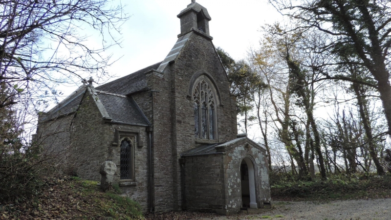
The cross is located in the chapel yard at Tregaminion close to the north west
corner of the chapel. This chapel was built by William Rashleigh of Menabilly
in 1815. Sometime during the 19th century the cross was `removed from the
roadside' and re-erected on the millstone in its present position, where the
historian Langdon illustrated it in 1896. It has been suggested that the cross
was possibly moved from the road which runs past Tregaminion chapel, a minor
road which links Menabilly and Gribben Head to the route between Fowey, an
important medieval port on the south coast of Cornwall, and Tywardreath, a
medieval settlement with a priory.
The gravel surface of the footpath passing to the south and west of the cross,
where it lies within its protective margin, is excluded from the scheduling
although the ground beneath is included.
This cross is Listed Grade II.
MAP EXTRACT
The site of the monument is shown on the attached map extract.
It includes a 2 metre boundary around the archaeological features,
considered to be essential for the monument's support and preservation.
Source: Historic England
Wayside crosses are one of several types of Christian cross erected during the
medieval period, mostly from the 9th to 15th centuries AD. In addition to
serving the function of reiterating and reinforcing the Christian faith
amongst those who passed the cross and of reassuring the traveller, wayside
crosses often fulfilled a role as waymarkers, especially in difficult and
otherwise unmarked terrain. The crosses might be on regularly used routes
linking ordinary settlements or on routes having a more specifically religious
function, including those providing access to religious sites for parishioners
and funeral processions, or marking long-distance routes frequented on
pilgrimages.
Over 350 wayside crosses are known nationally, concentrated in south west
England throughout Cornwall and on Dartmoor where they form the commonest type
of stone cross. A small group also occurs on the North York Moors. Relatively
few examples have been recorded elsewhere and these are generally confined to
remote moorland locations.
Outside Cornwall almost all wayside crosses take the form of a `Latin' cross,
in which the cross-head itself is shaped within the projecting arms of an
unenclosed cross. In Cornwall wayside crosses vary considerably in form and
decoration. The commonest type includes a round, or `wheel', head on the faces
of which various forms of cross or related designs were carved in relief or
incised, the spaces between the cross arms possibly pierced. The design was
sometimes supplemented with a relief figure of Christ and the shaft might bear
decorative panels and motifs. Less common forms in Cornwall include the
`Latin' cross and, much rarer, the simple slab with a low relief cross on both
faces. Rare examples of wheel-head and slab-form crosses also occur within the
North York Moors group. Most wayside crosses have either a simple socketed
base or show no evidence for a separate base at all.
Wayside crosses contribute significantly to our understanding of medieval
religious customs and sculptural traditions and to our knowledge of medieval
routeways and settlement patterns. All wayside crosses which survive as earth-
fast monuments, except those which are extremely damaged and removed from
their original locations, are considered worthy of protection.
This wayside cross in Tregaminion chapel yard has survived reasonably well,
and is a good example of a wheel-headed cross despite the loss of part of its
lower shaft. The use only of sinkings to form the cross motif is uncommon. Its
removal from the roadside in the 19th century and subsequent re-erection in
the chapel yard demonstrate well the changing attitudes to religion and
changes in the local landscape since the medieval period.
Source: Historic England
Books and journals
Langdon, A G, Old Cornish Crosses, (1896)
Langdon, A, Stone Crosses in Mid Cornwall, (1994)
Other
Title: 1:25000 Ordnance Survey Map; SX 05/15; St Austell and Fowey
Source Date: 1980
Author:
Publisher:
Surveyor:
Source: Historic England
Other nearby scheduled monuments