Approximate Location Map
Large Map »
This site is entirely user-supported. See how you can help.
Latitude: 54.6767 / 54°40'36"N
Longitude: -2.8057 / 2°48'20"W
OS Eastings: 348143.430947
OS Northings: 531589.978032
OS Grid: NY481315
Mapcode National: GBR 8GVC.C9
Mapcode Global: WH813.WQ44
Entry Name: Moated site east of Newton Reigny
Scheduled Date: 30 December 1952
Last Amended: 22 June 1995
Source: Historic England
Source ID: 1012816
English Heritage Legacy ID: 23778
County: Cumbria
Civil Parish: Catterlen
Traditional County: Cumberland
Lieutenancy Area (Ceremonial County): Cumbria
Church of England Parish: Newton Reigny St John
Church of England Diocese: Carlisle
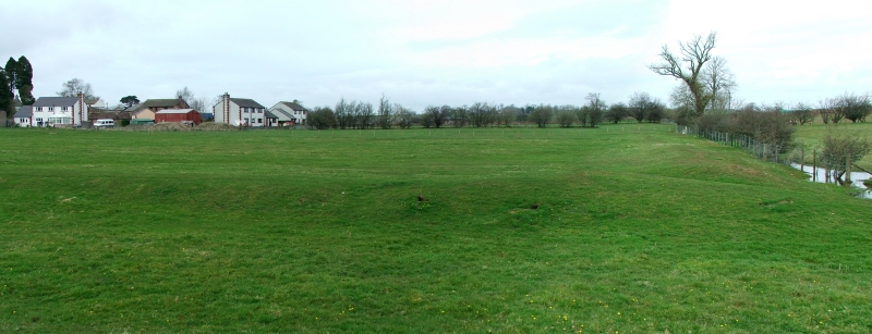
The monument includes a medieval moated site located in fields a short
distance to the east of Newton Reigny. It includes an island or enclosure
surrounded by a shallow moat which is now largely dry apart from one side
where a small stream forms its eastern arm. The island is trapezoidal in shape
and measures between 150m-170m north-south by 74m-90m east-west. On the
southern and much of its eastern edge there is an inner bank measuring up to
6m wide and 1m high. The surrounding moat varies in size, measuring between
1.5m wide and 0.2m deep on the south and much of the west sides to 7m wide and
0.3m deep on the north side. Access onto the island is through an entrance on
the western side where there are faint traces of a causeway across the moat.
Limited excavation by Anderson during the 1960's located a flagged floor and a
cobble-lined posthole which the excavator interpreted as evidence of the
`hall' which would have occupied the island.
All gateposts, walls and fences are excluded from the scheduling but the
ground beneath them is included.
MAP EXTRACT
The site of the monument is shown on the attached map extract.
Source: Historic England
Around 6,000 moated sites are known in England. They consist of wide ditches,
often or seasonally water-filled, partly or completely enclosing one or more
islands of dry ground on which stood domestic or religious buildings. In some
cases the islands were used for horticulture. The majority of moated sites
served as prestigious aristocratic and seigneurial residences with the
provision of a moat intended as a status symbol rather than a practical
military defence. The peak period during which moated sites were built was
between about 1250 and 1350 and by far the greatest concentration lies in
central and eastern parts of England. However, moated sites were built
throughout the medieval period, are widely scattered throughout England and
exhibit a high level of diversity in their forms and sizes. They form a
significant class of medieval monument and are important for the understanding
of the distribution of wealth and status in the countryside. Many examples
provide conditions favourable to the survival of organic remains.
Despite infilling of part of the moat's northern arm, the moated site east of
Newton Reigny survives reasonably well and remains largely unencumbered by
modern development. Limited excavation by Anderson during the 1960's located
structural remains, and the monument will retain further evidence for the
building which originally occupied the island.
Source: Historic England
Other
AP Ref No. MU CS 97,20, AP Ref No. MU CS 97,20,
Darvill, T., MPP Single Monument Class Description - Moats, (1988)
FMW Report, Crow, J, Earthwork E of Newton Reigny, (1991)
Ref No SMR 2924, Cumbria SMR, Monument Evaluation Form Single Monument Discrimination - Moats, (1991)
Source: Historic England
Other nearby scheduled monuments