Approximate Location Map
Large Map »
This site is entirely user-supported. See how you can help.
Latitude: 54.2966 / 54°17'47"N
Longitude: -1.1913 / 1°11'28"W
OS Eastings: 452729.84361
OS Northings: 489303.198555
OS Grid: SE527893
Mapcode National: GBR NL3R.WJ
Mapcode Global: WHD8C.N8XG
Entry Name: Group of round barrows and cross ridge dyke at Sunny Bank
Scheduled Date: 8 February 1968
Last Amended: 28 February 1995
Source: Historic England
Source ID: 1010528
English Heritage Legacy ID: 25588
County: North Yorkshire
Civil Parish: Hawnby
Traditional County: Yorkshire
Lieutenancy Area (Ceremonial County): North Yorkshire
Church of England Parish: Upper Ryedale
Church of England Diocese: York
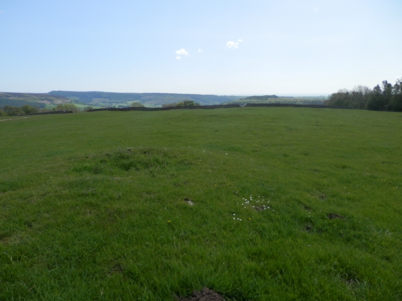
The monument includes a group of nine round barrows located on a prominent
east to west orientated spur overlooking Gowerdale. The eastern end of the
monument is defined by a cross ridge dyke which runs across the spur from
north to south.
Most of the barrows have roughly circular earth and stone mounds with an
average diameter of c.6m. They stand between 0.3m and 0.5m high. There is
one larger example which is 11m in diameter, 0.5m high with a large excavation
hole in the centre. Each mound was surrounded by a ditch up to 3m wide which
has been infilled over time and is no longer visible as an earthwork. The
archaeologically sensitive area between the barrows is included as it will
contain further information about the form and function of the group. By
analogy with other sites further burials between the barrows may also be
expected here. The majority of the mounds have been disturbed in the past
leaving each with a hollow top. Excavations of the mounds in the 19th century
produced a number of Anglo-Saxon burials which are secondary insertions into
earlier Bronze Age mounds.
The cross ridge dyke lies to the east of the barrow group and stands as a
prominent earthwork extending for 180m across the spur. It consists of a ditch
5m wide and 1m deep with a bank to the east 4m wide and 0.5m high which
is capped by a large dry stone wall for most of its length. There is a slight
counterscarp bank to the east standing about 0.2m high which has been eroded
in several places by pre-enclosure trackways. The dyke is part of a wider
system of prehistoric boundaries dividing land into units given over mostly to
pastoralism.
There are similar, albeit smaller, groups of barrows on this part of the
Hambleton Hills which offer important scope for the study of burial practice.
Together with associated later prehistoric boundaries, they provide evidence
of territorial organisation marking the division of land; divisions which
still remain as some parish or township boundaries.
The stone wall is excluded from the sceduling although the ground beneath is
included.
MAP EXTRACT
The site of the monument is shown on the attached map extract.
It includes a 2 metre boundary around the archaeological features,
considered to be essential for the monument's support and preservation.
Source: Historic England
Round barrow cemeteries date to the Bronze Age (c.2000-700 BC). They comprise
closely-spaced groups of up to 30 round barrows - rubble or earthen mounds
covering single or multiple burials. Most cemeteries developed over a
considerable period of time, often many centuries, and in some cases acted as
a focus for burials as late as the early medieval period. They exhibit
considerable diversity of burial rite, plan and form, frequently including
several different types of round barrow, occasionally associated with earlier
long barrows. Where large scale investigation has been undertaken around them,
contemporary or later "flat" burials between the barrow mounds have often been
revealed. Round barrow cemeteries occur across most of lowland Britain, with a
marked concentration in Wessex. In some cases, they are clustered around other
important contemporary monuments such as henges. Often occupying prominent
locations, they are a major historic element in the modern landscape, whilst
their diversity and their longevity as a monument type provide important
information on the variety of beliefs and social organisation amongst early
prehistoric communities. They are particularly representative of their period
and a substantial proportion of surviving or partly-surviving examples are
considered worthy of protection.
These barrows have survived well and significant information about the
original form, burials placed within them and evidence of earlier land use
beneath the mound will be preserved. The reuse of the barrows in the Anglo-
Saxon period is unusual and as there are few other Anglo-Saxon burials in this
area. This reuse illustrates changing burial practice over time and indicates
that the prehistoric barrows were recognisable and functioning in the later
landscape.
The cross ridge dyke is part of a wider system of prehistoric linear
earthworks stretching accross the western Hambleton Hills. The system was
constructed between the Bronze Age and the Iron Age to augment the natural
division of the terrain by river valleys and watersheds. The system formed a
prehistoric territorial boundary in an area largely given over to pastoralism
and the impressive scale of the works also displayed the corporate prestige of
its builders.
The barrows themselves are also considered to be territorial markers and
together with the dyke provide evidence of the continuity of function. Such
groupings of monuments offer important scope for the study of the division of
land for social, ritual and agricultural purposes in different geographical
areas during the prehistoric period.
Source: Historic England
Books and journals
Meaney, A L S, Gazetteer of Early Anglo-Saxon Burial Sites, (1964), 290-1
Spratt, D A , 'The Archaeological Journal' in The Cleave Dyke System, , Vol. VOL 54, (1982), 33-52
Spratt, D A , 'Prehistoric and Roman Archaeology in North East Yorkshire' in Prehistoric and Roman Archaeology of North East Yorkshire, , Vol. BAR 104, (1993), 116-123
Spratt, D A , 'Prehistoric and Roman Archaeology in North East Yorkshire' in Prehistoric and Roman Archaeology of North East Yorkshire, , Vol. BAR 104, (1993), 116-123
Spratt, D A , 'Prehistoric and Roman Archaeology in North East Yorkshire' in Prehistoric and Roman Archaeology of North East Yorkshire, , Vol. BAR 104, (1993), 116-123
Spratt, D A , 'Prehistoric and Roman Archaeology in North East Yorkshire' in Prehistoric and Roman Archaeology of North East Yorkshire, , Vol. BAR 104, (1993), 116-123
Spratt, D A , 'Prehistoric and Roman Archaeology in North East Yorkshire' in Prehistoric and Roman Archaeology of North East Yorkshire, , Vol. BAR 104, (1993), 116-123
Spratt, D A , 'Prehistoric and Roman Archaeology in North East Yorkshire' in Prehistoric and Roman Archaeology of North East Yorkshire, , Vol. BAR 104, (1993), 116-123
Spratt, D A , 'Prehistoric and Roman Archaeology in North East Yorkshire' in Prehistoric and Roman Archaeology of North East Yorkshire, , Vol. BAR 104, (1993), 116-123
Source: Historic England
Other nearby scheduled monuments