Approximate Location Map
Large Map »
This site is entirely user-supported. See how you can help.
Latitude: 52.3138 / 52°18'49"N
Longitude: -2.5451 / 2°32'42"W
OS Eastings: 362935.968113
OS Northings: 268550.907663
OS Grid: SO629685
Mapcode National: GBR BT.W645
Mapcode Global: VH84L.T3WK
Entry Name: Motte castle 50m north east of Rochford church
Scheduled Date: 27 February 1974
Last Amended: 15 November 1994
Source: Historic England
Source ID: 1008393
English Heritage Legacy ID: 19143
County: Worcestershire
Civil Parish: Rochford
Traditional County: Worcestershire
Lieutenancy Area (Ceremonial County): Worcestershire
Church of England Parish: Teme Valley South
Church of England Diocese: Worcester
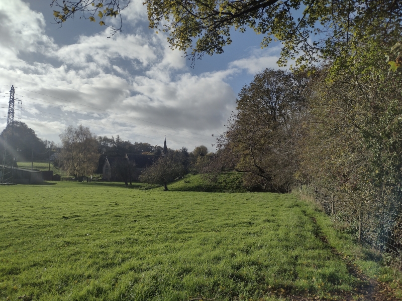
The monument includes the remains of a small motte castle situated on the
south bank of the River Teme and 50m north east of Rochford church. It
includes an earthen mound 40m in diameter at the base rising 2.7m to a
flattened summit 22m in diameter. The whole northern quarter of the mound has
been eroded away by the action of the River Teme exposing a complete section
through it. A shallow ditch averaging 7m wide and 0.4m deep, from which
material would have been quarried for the construction of the mound remains
visible around the surviving portion on the south west, south and east sides.
There is a lowering of the ditch edge in the north west segment and a slight
scoop in the castle mound directly opposite. There is no visible evidence of a
bailey associated with the motte. However, cultivation lynchets can be
recognised on the valley slopes to the south west of the motte, although these
are not included in the scheduling. The parish church and the now derelict
Court House Farm stand close by the motte, indicating that the area was a
focus for the medieval agricultural community around Rochford. This area,
largely through the church, continues to serve this function today.
A post and wire fence crossing the south eastern quadrant of the monument is
excluded from the scheduling, although the ground beneath is ncluded.
MAP EXTRACT
The site of the monument is shown on the attached map extract.
It includes a 2 metre boundary around the archaeological features,
considered to be essential for the monument's support and preservation.
Source: Historic England
Motte castles are medieval fortifications introduced into Britain by the
Normans. They comprised a large conical mound of earth or rubble, the motte,
surmounted by a palisade and a stone or timber tower. In a majority of
examples an embanked enclosure containing additional buildings, the bailey,
adjoined the motte. Motte castles and motte-and-bai1ey castles acted as
garrison forts during offensive military operations, as strongholds, and, in
many cases, as aristocratic residences and as centres of local or royal
administration. Built in towns, villages and open countryside, motte castles
generally occupied strategic positions dominating their immediate locality
and, as a result, are the most visually impressive monuments of the early
post-Conquest period surviving in the modern landscape. Over 600 motte castles
and motte-and-bailey castles are recorded nationally, with examples known from
most regions. Some 100-150 examples do not have baileys and are classified as
motte castles. As one of a restricted range of recognised early post-Conquest
monuments, they are particularly important for the study of Norman Britain and
the development of the feudal system. Although many were occupied for only a
short period of time, motte castles continued to be built and occupied from
the 11th to the 13th centuries, after which they were superseded by other
types of castle.
Despite being damaged by natural erosion caused by the adjacent river, the
motte castle on the south bank of the River Teme at Rochford survives well and
is a good example of its class. It will preserve archaeological information
relating to its construction and occupation. Environmental evidence relating
to the landscape in which the monument was constructed will survive sealed
beneath the mound and in the ditch fill. The motte is one of a group of such
monuments which lie along the valley of the River Teme, possibly positioned to
guard crossing places. As such it offers important information relating to the
political and strategic management of this valley during the medieval period.
Source: Historic England
Other nearby scheduled monuments