Approximate Location Map
Large Map »
This site is entirely user-supported. See how you can help.
Latitude: 52.6306 / 52°37'50"N
Longitude: 1.2997 / 1°17'58"E
OS Eastings: 623399.206308
OS Northings: 308761.572929
OS Grid: TG233087
Mapcode National: GBR W9Z.65
Mapcode Global: WHMTM.Y42N
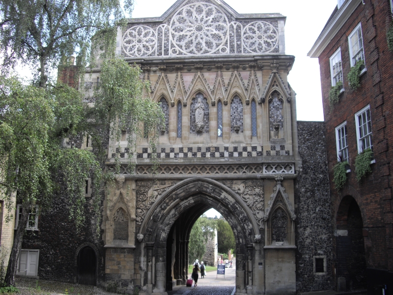
Entry Name: St Ethelbert Gate
Scheduled Date:
Source: Historic England
Source ID: 1004028
English Heritage Legacy ID: NF 28
County: Norfolk
Electoral Ward/Division: Thorpe Hamlet
Built-Up Area: Norwich
Traditional County: Norfolk
Lieutenancy Area (Ceremonial County): Norfolk
This record has been generated from an "old county number" (OCN) scheduling record. These are monuments that were not reviewed under the Monuments Protection Programme and are some of our oldest designation records. As such they do not yet have the full descriptions of their modernised counterparts available. Please contact us if you would like further information.
Source: Historic England
Other nearby scheduled monuments