Approximate Location Map
Large Map »
This site is entirely user-supported. See how you can help.
Latitude: 50.7493 / 50°44'57"N
Longitude: -2.6437 / 2°38'37"W
OS Eastings: 354681.540022
OS Northings: 94607.7
OS Grid: SY546946
Mapcode National: GBR PS.G618
Mapcode Global: FRA 57B3.CWC
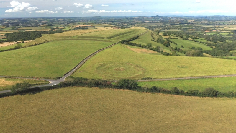
Entry Name: Eggardon Hill disc barrow
Scheduled Date:
Source: Historic England
Source ID: 1003060
English Heritage Legacy ID: DO 31
County: Dorset
Civil Parish: Toller Porcorum
Traditional County: Dorset
Lieutenancy Area (Ceremonial County): Dorset
Church of England Parish: Powerstock with West Milton Witherstone and North Porton St Mary The Virgin
Church of England Diocese: Salisbury
This record has been generated from an "old county number" (OCN) scheduling record. These are monuments that were not reviewed under the Monuments Protection Programme and are some of our oldest designation records. As such they do not yet have the full descriptions of their modernised counterparts available. Please contact us if you would like further information.
Source: Historic England
Other nearby scheduled monuments