Approximate Location Map
Large Map »
This site is entirely user-supported. See how you can help.
Latitude: 50.7502 / 50°45'0"N
Longitude: -2.652 / 2°39'7"W
OS Eastings: 354099.16027
OS Northings: 94717.477304
OS Grid: SY540947
Mapcode National: GBR PR.W3T1
Mapcode Global: FRA 57B3.8NC
Entry Name: Large multivallate hillfort containing two bowl barrows 855m north east of North Eggardon Farm
Scheduled Date: 15 October 1924
Source: Historic England
Source ID: 1002684
English Heritage Legacy ID: DO 32
County: Dorset
Civil Parish: Askerswell
Traditional County: Dorset
Lieutenancy Area (Ceremonial County): Dorset
Church of England Parish: Askerswell St Michael
Church of England Diocese: Salisbury
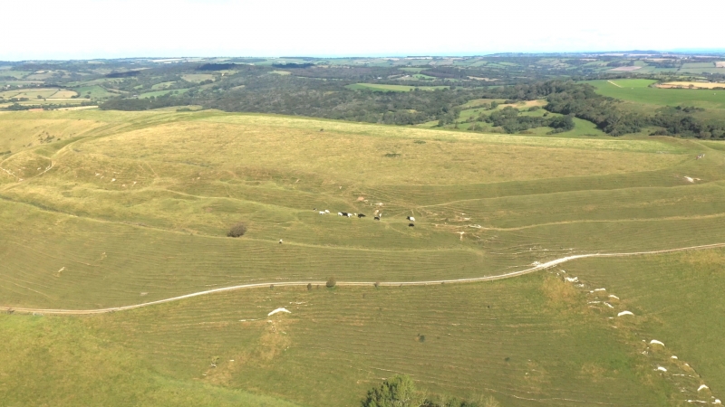
The monument includes a large multivallate hillfort containing two bowl barrows, situated on the summit of the prominent Eggardon Hill. The hillfort survives as a large enclosure of approximately 21ha in total defined by three ramparts with two medial ditches except to the north west and east where additional outer banks, ditches and counterscarp banks afford additional protection at the staggered entrances and to the south west where there is an additional outwork. It is thought that the complex nature of the defences represent different phases of construction and also responses to landslips, particularly in the south. The interior of the hillfort is covered with circular depressions measuring 3m up to 5m in diameter and up to 0.5m deep which are the visible remains of contemporary buildings. Further mounds and probable enclosures have also been identified. In 1900 five of the circular hollows were excavated and found to contain a flint knife, saw, scrapers and numerous flakes and a broken quern. The hillfort was pre-dated by linear earthworks which cross the interior and partial excavations from 1963-6 revealed these features to have been associated with Bronze Age pottery. At the same time some of the excavated pits produced Middle to Late Iron Age pottery. An octagonal enclosure, defined by a bank, within the interior of the hillfort was the boundary of a coppice planted to serve as a sea-mark. Also within the hillfort are two bowl barrows which survive as circular mounds surrounded by buried quarry ditches, from which the construction material was derived. One survives as a circular mound measuring up to 14m in diameter and 1.5m high. It was excavated in 1965 and was found to contain a small flinty cairn covered with soil. At least 3kg of pottery from the Middle Bronze Age were recovered. The second barrow mound is 13m in diameter and 0.4m high with a flattened top. A track crosses the hillfort on its north eastern side, the surface is excluded from the scheduling but the ground beneath is included.
Further archaeological remains survive within the vicinity which are scheduled separately.
Sources: HER:-
PastScape Monument No:-451411, 451401 and 451425
Source: Historic England
Large multivallate hillforts are defined as fortified enclosures of between 5ha and 85ha in area, located on hills and defined by two or more lines of concentric earthworks set at intervals of up to 15m. They date to the Iron Age period, most having been constructed and used between the sixth century BC and the mid-first century AD. They are generally regarded as centres of permanent occupation, defended in response to increasing warfare, a reflection of the power struggle between competing elites. Earthworks usually consist of a rampart and ditch, although some only have ramparts. Access to the interior is generally provided by two entrances although examples with one and more than two have been noted. These may comprise a single gap in the rampart, inturned or offset ramparts, oblique approaches, guardrooms or outworks. Internal features generally include evidence for intensive occupation, often in the form of oval or circular houses. These display variations in size and are often clustered, for example, along streets. Four- and six-post structures, interpreted as raised granaries, also occur widely while a few sites appear to contain evidence for temples. Other features associated with settlement include platforms, paved areas, pits, gullies, fence-lines, hearths and ovens. Additional evidence, in the form of artefacts, suggests that industrial activity such as bronze- and iron-working as well as pottery manufacture occurred on many sites. Large multivallate hillforts are rare with around 50 examples recorded nationally. These occur mostly in two concentrations, in Wessex and the Welsh Marches, although scattered examples occur elsewhere. They are a rare monument class and are important for understanding the nature of social organisation within the Iron Age period. Bowl barrows, the most numerous form of round barrow, are funerary monuments dating from the Late Neolithic period to the Late Bronze Age, with most examples belonging to the period 2400-1500 BC. They were constructed as earthen or rubble mounds, sometimes ditched, which covered single or multiple burials. They occur either in isolation or grouped as cemeteries and often acted as a focus for burials in later periods. Often superficially similar, although differing widely in size, they exhibit regional variations in form and a diversity of burial practices. Often occupying prominent locations, they are a major historic element in the modern landscape and their considerable variation of form and longevity as a monument type provide important information on the diversity of beliefs and social organisations amongst early prehistoric communities. They are particularly representative of their period. Despite some partial excavations, quarrying and past agricultural activity, the large multivallate hillfort containing two bowl barrows 855m north east of North Eggardon Farm survives well and will contain archaeological and environmental evidence relating to its construction, development, longevity, relationship with earlier monument classes and their territorial, ritual and funerary significance and practices, trade, agricultural practices, social organisation, territorial significance, domestic arrangements and overall landscape context.
Source: Historic England
Other nearby scheduled monuments